Bates County, Missouri
Bates County is a county located in the west central part of the U.S. state of Missouri , two counties south of the Missouri River and is part of the Kansas City metropolitan area. As of the 2010 census, the population was 17,049.[2] Its county seat is Butler.[3] The county was organized in 1841 and named after Frederick Bates, the second Governor of Missouri.[4]
Bates County | |
|---|---|
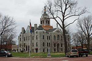 Bates County Courthouse in Butler | |
 Location within the U.S. state of Missouri | |
 Missouri's location within the U.S. | |
| Coordinates: 38°16′N 94°20′W | |
| Country | |
| State | |
| Founded | January 29, 1841[1] |
| Named for | Frederick Bates |
| Seat | Butler |
| Largest city | Butler |
| Area | |
| • Total | 851 sq mi (2,200 km2) |
| • Land | 837 sq mi (2,170 km2) |
| • Water | 15 sq mi (40 km2) 1.7% |
| Population (2010) | |
| • Total | 17,049 |
| • Estimate (2018) | 16,320 |
| • Density | 20/sq mi (7.7/km2) |
| Time zone | UTC−6 (Central) |
| • Summer (DST) | UTC−5 (CDT) |
| Congressional district | 4th |
| Website | www |
This mostly rural county has an overwhelmingly ethnic European-American population, which has declined in number since the early 20th century as people have moved to cities.
History
The borderlands of Kansas and Missouri were battlegrounds for insurgents during the American Civil War, with raids going back and forth across the border. Bates County is noted as the site for the first combat engagement during the war of African-American soldiers serving with the Union and against Confederate forces, which occurred on October 28–29, 1862. The First Kansas Colored Division (part of the state militia) fought Confederate guerrillas at the Battle of Island Mound four miles north of present-day Rich Hill, Missouri, and the Union forces won.
The Kansas soldiers were badly outnumbered but stood their ground, fighting valiantly. The skirmish was covered by The New York Times, which noted the men's bravery at a time when many people questioned whether former slaves could make good soldiers.[5] Their heroic action preceded President Abraham Lincoln's announcement of the Emancipation Proclamation in January 1863 and establishment of the United States Colored Troops.
Following a massacre of men and boys and the burning of Lawrence, Kansas, by Confederate bushwhackers in the summer of 1863, the United States General Ewing ordered the evacuation of the civilian population from rural areas of Bates and nearby counties except for within a mile of certain Union-controlled cities, in order to cut off sources of support for Confederate insurgents. This was done under Order No. 11. The county had been a base of Confederate guerrillas. But, Ewing's order generated outrage and added to support of guerrillas in some areas.
This mostly rural county continued to support agriculture in the decades after the Civil War. Since the late 20th century, population has declined as people have moved to cities for work.
Legacy and honors
- A statue commemorating the Battle of Island Mound was installed on the north lawn of the county courthouse in Butler, seven miles from the skirmish site.
- The skirmish area has been preserved since 2012 as the Battle of Island Mound State Historic Site, and its historic prairie is being restored.[6]
- The Battle of Island Mound (2014) is a short documentary film made in cooperation with the Missouri Department of Natural Resources; it won two Emmy Awards in 2015 for historic documentary and cinematography.[7]
Geography
According to the U.S. Census Bureau, the county has a total area of 851 square miles (2,200 km2), of which 837 square miles (2,170 km2) is land and 15 square miles (39 km2) (1.7%) is water.[8]
Adjacent counties
- Cass County (north)
- Henry County (northeast)
- St. Clair County (southeast)
- Vernon County (south)
- Linn County, Kansas (west)
- Miami County, Kansas (northwest)
Major highways
.svg.png)


Demographics
| Historical population | |||
|---|---|---|---|
| Census | Pop. | %± | |
| 1850 | 3,669 | — | |
| 1860 | 7,215 | 96.6% | |
| 1870 | 15,960 | 121.2% | |
| 1880 | 25,381 | 59.0% | |
| 1890 | 32,223 | 27.0% | |
| 1900 | 30,141 | −6.5% | |
| 1910 | 25,869 | −14.2% | |
| 1920 | 23,933 | −7.5% | |
| 1930 | 22,068 | −7.8% | |
| 1940 | 19,531 | −11.5% | |
| 1950 | 17,534 | −10.2% | |
| 1960 | 15,905 | −9.3% | |
| 1970 | 15,468 | −2.7% | |
| 1980 | 15,873 | 2.6% | |
| 1990 | 15,025 | −5.3% | |
| 2000 | 16,653 | 10.8% | |
| 2010 | 17,049 | 2.4% | |
| Est. 2018 | 16,320 | [9] | −4.3% |
| U.S. Decennial Census[10] 1790-1960[11] 1900-1990[12] 1990-2000[13] 2010-2015[2] | |||
As of the census[14] of 2000, there were 16,653 people, 6,511 households, and 4,557 families residing in the county. The population density was 20 people per square mile (8/km²). There were 7,247 housing units at an average density of 8 per square mile (3/km²). The racial makeup of the county was 97.33% White, 0.61% Black or African American, 0.59% Native American, 0.15% Asian, 0.01% Pacific Islander, 0.39% from other races, and 0.92% from two or more races. Approximately 1.07% of the population were Hispanic or Latino of any race.
There were 6,511 households out of which 32.30% had children under the age of 18 living with them, 58.80% were married couples living together, 7.60% had a female householder with no husband present, and 30.00% were non-families. 26.10% of all households were made up of individuals and 13.90% had someone living alone who was 65 years of age or older. The average household size was 2.51 and the average family size was 3.02.
In the county, the population was spread out with 26.50% under the age of 18, 7.50% from 18 to 24, 26.00% from 25 to 44, 22.60% from 45 to 64, and 17.40% who were 65 years of age or older. The median age was 38 years. For every 100 females there were 95.20 males. For every 100 females age 18 and over, there were 91.50 males.
The median income for a household in the county was $30,731, and the median income for a family was $36,470. Males had a median income of $30,298 versus $19,772 for females. The per capita income for the county was $15,477. About 11.50% of families and 14.50% of the population were below the poverty line, including 18.30% of those under age 18 and 14.10% of those age 65 or over.
Education
Public schools
- Adrian R-III School District – Adrian
- Adrian Elementary School (PK-05)
- Adrian High School (06-12)
- Ballard R-II School District – Butler
- Ballard Elementary School (PK-06)
- Ballard High School (07-12)
- Butler R-V School District – Butler
- Butler Elementary School (K-06)
- Butler High School (07-12)
- Hume R-VIII School District – Hume
- Hume Elementary School (PK-05)
- Hume High School (06-12)
- Miami R-I School District – Amoret
- Miami Elementary School (K-06)
- Miami High School (07-12)
- Rich Hill R-IV School District – Rich Hill
- Rich Hill Elementary School (K-05)
- Rich Hill High School (06-12)
Politics
Local
| Bates County, Missouri | ||||
|---|---|---|---|---|
| Elected countywide officials | ||||
| Assessor | Roger Pruden | Democratic | ||
| Circuit Clerk | Shelli White | Republican | ||
| County Clerk | Marlene Wainscott | Democratic | ||
| Collector | Jimmy Platt | Democratic | ||
| Commissioner (Presiding) |
Jim Wheatley | Republican | ||
| Commissioner (District 1) |
Alvin O. Griffin | Democratic | ||
| Commissioner (District 2) |
Larry J. Hacker | Democratic | ||
| Coroner | Greg Mullinax | Republican | ||
| Prosecuting Attorney | Hugh C. Jenkins | Democratic | ||
| Public Administrator | Sharon Cumpton | Democratic | ||
| Recorder | Danyelle Baker | Republican | ||
| Sheriff | Chad Anderson | Democratic | ||
| Surveyor | W.C. “Bill” Lethcho | Democratic | ||
| Treasurer | Jimmy Platt | Democratic | ||
State
| Year | Republican | Democratic | Third Parties |
|---|---|---|---|
| 2016 | 59.64% 4,772 | 37.36% 2,989 | 3.00% 240 |
| 2012 | 45.46% 3,513 | 51.40% 3,972 | 3.14% 243 |
| 2008 | 41.75% 3,431 | 55.43% 4,555 | 2.82% 232 |
| 2004 | 53.22% 4,479 | 45.09% 3,795 | 1.69% 142 |
| 2000 | 48.88% 3,783 | 49.02% 3,794 | 2.10% 162 |
| 1996 | 34.70% 2,483 | 63.33% 4,531 | 1.97% 141 |
| 1992 | 42.06% 3,204 | 57.94% 4,414 | 0.00% 0 |
Bates County is divided into three legislative districts in the Missouri House of Representatives, all of which are held by Republicans.
- District 56 — Jack Bondon (R-Belton). Consists of unincorporated areas in the northwestern quadrant of the county south of Drexel.
| Party | Candidate | Votes | % | ± | |
|---|---|---|---|---|---|
| Republican | Jack Bondon | 224 | 74.67% | +10.51 | |
| Democratic | DJ Rash | 76 | 25.33% | -10.51 | |
| Party | Candidate | Votes | % | ± | |
|---|---|---|---|---|---|
| Republican | Jack Bondon | 111 | 64.16% | +4.94 | |
| Democratic | Patty Johnson | 62 | 35.84% | -4.94 | |
| Party | Candidate | Votes | % | ± | |
|---|---|---|---|---|---|
| Republican | Chris Molendrop | 183 | 59.22% | ||
| Democratic | Patty Johnson | 126 | 40.78% | ||
- District 57 — Wanda Brown (R-Lincoln). Consists of unincorporated areas in the northern part of the county south of Archie and Creighton.
| Party | Candidate | Votes | % | ± | |
|---|---|---|---|---|---|
| Republican | Wanda Brown | 303 | 71.97% | +15.17 | |
| Democratic | William A. Grimes | 118 | 28.03% | -5.70 | |
| Party | Candidate | Votes | % | ± | |
|---|---|---|---|---|---|
| Republican | Wanda Brown | 96 | 56.80% | -4.33 | |
| Democratic | William A. Grimes | 57 | 33.73% | -5.14 | |
| Constitution | Butch Page | 16 | 9.47% | +9.47 | |
| Party | Candidate | Votes | % | ± | |
|---|---|---|---|---|---|
| Republican | Wanda Brown | 162 | 61.13% | ||
| Democratic | Don Bullock | 103 | 38.87% | ||
- District 126 — Patricia Pike (R-Adrian). Consists of most of the entire county.
| Party | Candidate | Votes | % | ± | |
|---|---|---|---|---|---|
| Republican | Patricia Pike | 6,188 | 100.00% | +36.97 | |
| Party | Candidate | Votes | % | ± | |
|---|---|---|---|---|---|
| Republican | Patricia Pike | 2,534 | 63.03% | ||
| Democratic | Sam Foursha | 1,119 | 27.84% | +27.84 | |
| Constitution | William M. Gilmore | 367 | 9.13% | +9.13 | |
| Party | Candidate | Votes | % | ± | |
|---|---|---|---|---|---|
| Republican | Randy Pike | 5,897 | 100.00% | ||
All of Bates County is a part of Missouri's 31st Senatorial District in the Missouri Senate and is currently represented by Ed Emery (R-Lamar).
| Party | Candidate | Votes | % | ± | |
|---|---|---|---|---|---|
| Republican | Ed Emery | 5,373 | 71.02% | +9.57 | |
| Independent | Tim Wells | 1,459 | 19.29% | +19.29 | |
| Libertarian | Lora Young | 733 | 9.69% | +9.69 | |
| Party | Candidate | Votes | % | ± | |
|---|---|---|---|---|---|
| Republican | Ed Emery | 4,618 | 61.45% | ||
| Democratic | Charles A. Burton | 2,897 | 38.55% | ||
Federal
| Party | Candidate | Votes | % | ± | |
|---|---|---|---|---|---|
| Republican | Roy Blunt | 4,630 | 58.06% | +14.61 | |
| Democratic | Jason Kander | 2,866 | 35.94% | -12.33 | |
| Libertarian | Jonathan Dine | 259 | 3.25% | -5.02 | |
| Green | Johnathan McFarland | 126 | 1.58% | +1.58 | |
| Constitution | Fred Ryman | 94 | 1.18% | +1.18 | |
| Party | Candidate | Votes | % | ± | |
|---|---|---|---|---|---|
| Republican | Todd Akin | 3,345 | 43.45% | ||
| Democratic | Claire McCaskill | 3,716 | 48.27% | ||
| Libertarian | Jonathan Dine | 637 | 8.27% | ||
All of Bates County is included in Missouri's 4th Congressional District and is currently represented by Vicky Hartzler (R-Harrisonville) in the U.S. House of Representatives.
| Party | Candidate | Votes | % | ± | |
|---|---|---|---|---|---|
| Republican | Vicky Hartzler | '5,814 | 73.69% | +5.26 | |
| Democratic | Gordon Christensen | 1,470 | 22.05% | -3.25 | |
| Libertarian | Mark Bliss | 336 | 4.26% | -2.02 | |
| Party | Candidate | Votes | % | ± | |
|---|---|---|---|---|---|
| Republican | Vicky J. Hartzler | 2,943 | 68.43% | +8.29 | |
| Democratic | Nate Irvin | 1,088 | 25.30% | -11.17 | |
| Libertarian | Herschel L. Young | 270 | 6.28% | +3.78 | |
| Party | Candidate | Votes | % | ± | |
|---|---|---|---|---|---|
| Republican | Vicky Hartzler | 4,599 | 60.14% | ||
| Democratic | Teresa Hensley | 2,789 | 36.47% | ||
| Libertarian | Thomas Holbrook | 191 | 2.50% | ||
| Constitution | Greg Cowan | 68 | 0.89% | ||
Presidential Elections
Bates County has become increasingly Republican over the past few presidential elections. Since the 2000 election, the county has become more Republican with each election cycle. The last time a democratic candidate has carried this county was in 1996 by Bill Clinton.
| Year | Republican | Democratic | Third parties |
|---|---|---|---|
| 2016 | 74.2% 6,001 | 20.0% 1,618 | 5.7% 464 |
| 2012 | 64.6% 5,020 | 32.9% 2,557 | 2.5% 194 |
| 2008 | 58.4% 4,833 | 39.5% 3,271 | 2.2% 179 |
| 2004 | 59.1% 5,004 | 40.1% 3,398 | 0.8% 64 |
| 2000 | 54.5% 4,245 | 43.5% 3,386 | 2.1% 161 |
| 1996 | 40.7% 2,904 | 45.2% 3,224 | 14.1% 1,009 |
| 1992 | 32.3% 2,499 | 38.7% 2,993 | 29.0% 2,238 |
| 1988 | 51.6% 3,574 | 48.1% 3,332 | 0.4% 24 |
| 1984 | 59.4% 4,223 | 40.6% 2,889 | |
| 1980 | 54.0% 4,061 | 43.8% 3,297 | 2.2% 163 |
| 1976 | 43.6% 3,350 | 55.8% 4,288 | 0.6% 46 |
| 1972 | 63.8% 5,314 | 36.2% 3,020 | |
| 1968 | 49.5% 4,087 | 40.8% 3,370 | 9.7% 801 |
| 1964 | 40.5% 3,514 | 59.5% 5,162 | |
| 1960 | 58.2% 5,429 | 41.8% 3,906 | |
| 1956 | 56.0% 5,467 | 44.0% 4,300 | |
| 1952 | 60.0% 6,002 | 40.0% 3,995 | 0.0% 2 |
| 1948 | 48.7% 4,156 | 51.2% 4,371 | 0.1% 6 |
| 1944 | 55.5% 5,122 | 44.4% 4,096 | 0.2% 18 |
| 1940 | 53.3% 5,727 | 46.4% 4,978 | 0.3% 33 |
| 1936 | 46.6% 5,022 | 52.7% 5,681 | 0.7% 74 |
| 1932 | 35.0% 3,395 | 64.2% 6,220 | 0.8% 79 |
| 1928 | 62.7% 6,133 | 36.7% 3,594 | 0.6% 54 |
| 1924 | 47.1% 4,552 | 48.9% 4,722 | 4.0% 389 |
| 1920 | 51.9% 5,039 | 45.7% 4,433 | 2.4% 236 |
| 1916 | 42.9% 2,597 | 53.8% 3,255 | 3.4% 204 |
| 1912 | 23.0% 1,383 | 50.7% 3,057 | 26.3% 1,587 |
| 1908 | 44.1% 2,754 | 52.0% 3,248 | 4.0% 247 |
| 1904 | 47.1% 2,956 | 47.3% 2,967 | 5.6% 352 |
| 1900 | 39.3% 2,731 | 51.6% 3,591 | 9.1% 634 |
| 1896 | 32.6% 2,522 | 65.6% 5,073 | 1.7% 133 |
| 1892 | 27.7% 1,928 | 43.1% 3,007 | 29.2% 2,039 |
| 1888 | 38.1% 2,674 | 50.6% 3,556 | 11.3% 794 |
Missouri Presidential Preference Primary (2008)
- Former U.S. Senator Hillary Clinton (D-New York) received more votes, a total of 1,427, than any candidate from either party in Bates County during the 2008 presidential primary.
| Bates County, Missouri | |
|---|---|
| 2008 Republican primary in Missouri | |
| John McCain | 594 (37.71%) |
| Mike Huckabee | 503 (31.94%) |
| Mitt Romney | 368 (23.37%) |
| Ron Paul | 71 (4.51%) |
| Bates County, Missouri | |
|---|---|
| 2008 Democratic primary in Missouri | |
| Hillary Clinton | 1,427 (63.51%) |
| Barack Obama | 676 (30.08%) |
| John Edwards (withdrawn) | 106 (4.72%) |
See also
- National Register of Historic Places listings in Bates County, Missouri
References
- "Bates County History". Bates County. Retrieved November 23, 2014.
- "State & County QuickFacts". United States Census Bureau. Retrieved September 7, 2013.
- "Find a County". National Association of Counties. Archived from the original on 2012-07-12. Retrieved 2011-06-07.
- Eaton, David Wolfe (1916). How Missouri Counties, Towns and Streams Were Named. The State Historical Society of Missouri. pp. 208.
- "AFFAIRS IN THE WEST.; A Negro Regiment in Action--The Battle of Island Mounds--Desperate Bravery of the Negros--Defeat of the Guerrillas--An Attempted Fraud", The New York Times, 19 November 1862, accessed 22 February 2016
- "Battle of Island Mound State Historic Site". Missouri State Parks. Missouri Department of Natural Resources. Retrieved 15 July 2013.
- " 'The Battle of Island Mound' wins two Emmy Awards from NATAS Mid-American Chapter", 7 October 2015 Press Release, Missouri Department of Natural Resources, accessed 29 February 2016
- "2010 Census Gazetteer Files". United States Census Bureau. August 22, 2012. Archived from the original on October 21, 2013. Retrieved November 13, 2014.
- "Population and Housing Unit Estimates". Retrieved November 29, 2019.
- "U.S. Decennial Census". United States Census Bureau. Retrieved November 13, 2014.
- "Historical Census Browser". University of Virginia Library. Retrieved November 13, 2014.
- "Population of Counties by Decennial Census: 1900 to 1990". United States Census Bureau. Retrieved November 13, 2014.
- "Census 2000 PHC-T-4. Ranking Tables for Counties: 1990 and 2000" (PDF). United States Census Bureau. Retrieved November 13, 2014.
- "U.S. Census website". United States Census Bureau. Retrieved 2011-05-14.
- Breeding, Marshall. "Butler Public Library". Libraries.org. Retrieved May 8, 2017.
- Breeding, Marshall. "Rich Hill Memorial Library". Libraries.org. Retrieved May 8, 2017.
- Leip, David. "Dave Leip's Atlas of U.S. Presidential Elections". uselectionatlas.org. Retrieved 2018-03-24.
External links
- Bates County website
- Digitized 1930 Plat Book of Bates County from University of Missouri Division of Special Collections, Archives, and Rare Books
- "Battle of Island Mound State Historic Site", Missouri State Parks
- " 'The Battle of Island Mound' wins two Emmy Awards from NATAS Mid-American Chapter", 7 October 2015 Press Release, Missouri Department of Natural Resources
Places adjacent to Bates County, Missouri | ||||||||||
|---|---|---|---|---|---|---|---|---|---|---|
| ||||||||||
Kansas City metropolitan area's cities and counties | ||
|---|---|---|
| Central city | 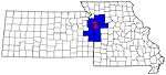 | |
| Largest cities (over 100,000 in 2000) | ||
| Medium-sized cities (10,000 to 100,000 in 2000) | ||
| Smaller Cities (between 5,000 and 9,900 in 2010) | ||
| Counties | ||
Municipalities and communities of Bates County, Missouri, United States | ||
|---|---|---|
| Cities | Map of Missouri highlighting Bates County | |
| Villages | ||
| Townships | ||
| Unincorporated communities | ||
| Ghost towns | ||
| Footnotes | ‡This populated place also has portions in an adjacent county or counties | |

| Authority control |
|
|---|