Dunklin County, Missouri
Dunklin County is a county located in the Bootheel of the U.S. state of Missouri. As of the 2010 census, the population was 31,953.[1] The largest city and county seat is Kennett.[2] The county was officially organized on February 14, 1845,[3] and is named in honor of Daniel Dunklin,[4] a Governor of Missouri who died the year before the county was organized.
Dunklin County | |
|---|---|
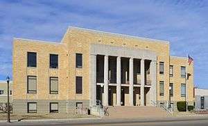 Dunklin County Courthouse in Kennett | |
 Location within the U.S. state of Missouri | |
 Missouri's location within the U.S. | |
| Coordinates: 36°16′N 90°05′W | |
| Country | |
| State | |
| Founded | February 14, 1845 |
| Named for | Daniel Dunklin |
| Seat | Kennett |
| Largest city | Kennett |
| Area | |
| • Total | 547 sq mi (1,420 km2) |
| • Land | 541 sq mi (1,400 km2) |
| • Water | 6.1 sq mi (16 km2) 1.1% |
| Population (2010) | |
| • Total | 31,953 |
| • Estimate (2018) | 29,423 |
| • Density | 58/sq mi (23/km2) |
| Time zone | UTC−6 (Central) |
| • Summer (DST) | UTC−5 (CDT) |
| Congressional district | 8th |
| Website | dunklincounty |
Dunklin County comprises the Kennett, MO Micropolitan Statistical Area.
Geography
According to the U.S. Census Bureau, the county has a total area of 547 square miles (1,420 km2), of which 541 square miles (1,400 km2) is land and 6.1 square miles (16 km2) (1.1%) is water.[5] The lowest point in the state of Missouri is located on the St. Francis River in Buffalo Township in Dunklin County, where it flows out of Missouri and into Arkansas.
Adjacent counties
- Stoddard County (north)
- New Madrid County (northeast)
- Pemiscot County (east)
- Mississippi County, Arkansas (southeast)
- Craighead County, Arkansas (south)
- Greene County, Arkansas (southwest)
- Clay County, Arkansas (west)
- Butler County (northwest)
Demographics
| Historical population | |||
|---|---|---|---|
| Census | Pop. | %± | |
| 1850 | 1,229 | — | |
| 1860 | 5,026 | 309.0% | |
| 1870 | 5,982 | 19.0% | |
| 1880 | 9,604 | 60.5% | |
| 1890 | 15,085 | 57.1% | |
| 1900 | 21,706 | 43.9% | |
| 1910 | 30,328 | 39.7% | |
| 1920 | 32,773 | 8.1% | |
| 1930 | 35,799 | 9.2% | |
| 1940 | 44,957 | 25.6% | |
| 1950 | 45,329 | 0.8% | |
| 1960 | 39,139 | −13.7% | |
| 1970 | 33,742 | −13.8% | |
| 1980 | 36,324 | 7.7% | |
| 1990 | 33,112 | −8.8% | |
| 2000 | 33,155 | 0.1% | |
| 2010 | 31,953 | −3.6% | |
| Est. 2018 | 29,423 | [6] | −7.9% |
| U.S. Decennial Census[7] 1790-1960[8] 1900-1990[9] 1990-2000[10] 2010-2015[1] | |||
As of the census[11] of 2000, there were 33,155 people, 13,411 households, and 9,159 families residing in the county. The population density was 61 people per square mile (23/km²). There were 14,682 housing units at an average density of 27 per square mile (10/km²). The racial makeup of the county was 88.64% White, 8.68% Black or African American, 0.31% Native American, 0.27% Asian, 0.01% Pacific Islander, 1.03% from other races, and 1.06% from two or more races. Approximately 2.49% of the population were Hispanic or Latino of any race. Among the major first ancestries reported in Dunklin County were 38.8% American, 10.6% Irish, 8.2% German, and 7.5% English ancestry.
There were 13,411 households, of which 31.30% had children under the age of 18 living with them, 51.60% were married couples living together, 13.20% had a female householder with no husband present, and 31.70% were "non-families." Of all households, 28.10% consisted of individuals and 14.00% had someone living alone who was 65 years of age or older. The average household size was 2.42 and the average family size was 2.94.
Of the county's population, 26.00% were under the age of 18, 8.10% were from 18 to 24, 26.00% were from 25 to 44, 23.50% were from 45 to 64, and 16.50% were 65 years of age or older. The median age was 38 years. For every 100 females there were 89.60 males. For every 100 women age 18 and over, there were 85.10 men.
The median income for a household in the county was $30,927, and the median income for a family was $38,439. Males had a median income of $27,288 versus $18,142 for females. The per capita income for the county was $16,737. About 19.40% of families and 24.50% of the population were below the poverty line, including 33.90% of those under age 18 and 21.30% of those age 65 or over. Of the state's 115 counties, in 2010 Dunklin ranked 105th in terms of poverty.[12][13]
Religion
According to the Association of Religion Data Archives County Membership Report (2000), Dunklin County is a part of the Bible Belt with evangelical Protestantism being the majority religion. The most predominant denominations among residents in Dunklin County who adhere to a religion are Southern Baptists (64.11%), Methodists (8.66%), and Churches of Christ (6.74%).
Education
Of adults 25 years of age and older in Dunklin County, 63.7% possesses a high school diploma or higher while 9.1% hold a bachelor's degree or higher as their highest educational attainment.
Public schools
- Campbell R-II School District - Campbell
- Campbell Elementary School (PK-06)
- Campbell High School (07-12)
- Clarkton C-4 School District - Clarkton
- Clarkton Elementary School (PK-06)
- Clarkton High School (07-12)
- Holcomb R-III School District - Holcomb
- Holcomb Elementary School (PK-06)
- Holcomb High School (07-12)
- Kennett School District 39 - Kennett
- Early Childhood Center - (PK) - Primary School
- H. Byron Masterson Elementary School (K-02)
- South Elementary School (03-05)
- Kennett Middle School (06-08)
- Kennett High School (09-12)
- Malden R-I School District - Malden
- Malden Elementary School (PK-06)
- Malden High School (07-12)
- Senath-Hornersville C-8 School District - Senath
- Senath Elementary School (PK-04)
- Hornersville Middle School (05-08)
- Senath-Hornersville High School (09-12)
- Southland C-9 School District - Cardwell
- Southland Elementary School (K-06)
- Southland High School (07-12)
Private schools
- Kennett Christian Academy - Kennett - (K-12) - Assemblies of God/Pentecostal
- St. Teresa School - Campbell - (PK-08) - Roman Catholic
Alternative and vocational schools
Public libraries
- Dunklin County Library
- Arbyrd Community Library[14]
Transportation
Airports
Kennett Memorial Airport is a public-use airport in Dunklin County. It is located one nautical mile (1.85 km) southeast of the central business district of Kennett, which owns the airport.[15]
Health care
The county no longer has a hospital as the Twin Rivers Regional Medical Center closed on June 11, 2018. The nearest hospital is now Pemiscot County Hospital in Hayti. The region suffers from high infant and maternal mortality rates.[16]
Media
Radio
FM
- FM 89.9 KAUF Kennett
- FM 92.9 KLSC Malden
- LPFM 102.5 KCJS Kennett
- FM 104.3 KXOQ Kennett
- FM 105.5 KBOA-FM Piggott, AR-Kennett
- FM 106.5 KTMO New Madrid-Kennett
- FM 107.5 KFEB Campbell
AM
Print
- Campbell Courier, Campbell, Missouri
- Delta Dunklin Democrat, Kennett, Missouri[17]
Television
There are no television stations in Dunklin County, Missouri. Dunklin County, Missouri is placed in the Paducah, KY, Cape Girardeau, MO, & Harrisburg, Illinois Television Market. Those stations include:
However some residents in the south end of the county watch stations from the Memphis, TN and Jonesboro, AR Television Markets.
Politics
Local
A slim majority of elected officials in the county are Democrats, with six Republicans holding office.
| Dunklin County, Missouri | ||||
|---|---|---|---|---|
| Elected countywide officials | ||||
| Assessor | Karen Vandiver | Democratic | ||
| Circuit Clerk | Paula Gargus | Democratic | ||
| County Clerk | Kent Hampton | Republican | ||
| Collector | Kathy Rasberry | Democratic | ||
| Commissioner (Presiding) |
Don Collins | Republican | ||
| Commissioner (District 1) |
Ron Huber | Republican | ||
| Commissioner (District 2) |
Patrick McHaney | Democratic | ||
| Coroner | James Powell | Democratic | ||
| Prosecuting Attorney | Nicholas Jain | Republican | ||
| Public Administrator | Matt Jackson | Democratic | ||
| Recorder | Connie Green | Republican | ||
| Sheriff | Bob Holder | Republican | ||
| Surveyor | Metz Skelton | Democratic | ||
| Treasurer | Kathy Rasberry | Democratic | ||
State
| Year | Republican | Democratic | Third Parties |
|---|---|---|---|
| 2012 | 43.55% 4,560 | 54.03% 5,657 | 2.43% 254 |
| 2008 | 41.65% 4,792 | 56.13% 6,458 | 2.22% 255 |
| 2004 | 52.46% 6,015 | 46.25% 5,302 | 1.29% 148 |
| 2000 | 42.70% 4,471 | 56.11% 5,875 | 1.19% 125 |
| 1996 | 31.51% 3,232 | 66.86% 6,858 | 1.63% 167 |
| 1992 | 39.36% 4,309 | 60.64% 6,640 | 0.00% 0 |
| 1988 | 58.16% 5,822 | 41.74% 4,178 | 0.10% 10 |
| 1984 | 51.01% 5,407 | 48.99% 5,193 | 0.00% 0 |
| 1980 | 46.29% 5,203 | 53.62% 6,026 | 0.09% 10 |
| 1976 | 40.86% 4,131 | 59.08% 5,974 | 0.06% 6 |
| 1972 | 49.07% 4,239 | 50.85% 4,393 | 0.09% 7 |
| 1968 | 25.16% 2,879 | 74.84% 8,566 | 0.00% 0 |
| 1964 | 24.32% 2,804 | 75.68% 8,724 | 0.00% 0 |
| 1960 | 30.71% 3,938 | 69.29% 8,884 | 0.00% 0 |
In the Missouri House of Representatives, Dunklin County is divided into two legislative districts, both of which are represented by Republicans.
- District 150 – Consists of most of the county (the central and southern portions). The district includes the entire city of Kennett as well as the communities of Campbell, Clarkton, Holcomb, Senath, Hornersville, Rives, Arbyrd, and Cardwell. Kent Hampton, a Republican from Malden, was reelected in 2012 to his second term in the Missouri House in the newly redrawn district.
- District 152 – Consists of the northern portion of the county and takes in the entire city of Malden. Todd Richardson, a Republican from Poplar Bluff, was reelected in 2012 to his second term in the Missouri House in the newly redrawn district.
In the Missouri Senate, all of Dunklin County is a part of Missouri’s 25th District and is currently represented by Republican Doug Libla of Dexter. Libla defeated former Democratic State Representative Terry Swinger of Caruthersville in 2012 to be elected to his first term in the Missouri Senate to succeed fellow Republican Rob Mayer of Dexter. Mayer successfully served two terms/eight years in the Missouri Senate and was ineligible to seek a third term due to term limits.
Federal
Missouri's two U.S. Senators are Republican Josh Hawley of Columbia and Republican Roy Blunt of Strafford.
McCaskill was reelected to her second term in 2012 with 54.81 percent of the statewide vote over former Republican U.S. Representative W. Todd Akin of Town & Country and Libertarian Jonathan Dine of Riverside; Dunklin County gave McCaskill just over 50 and a half percent of the vote.
| Party | Candidate | Votes | % | ± | |
|---|---|---|---|---|---|
| Democratic | Claire McCaskill | 5,347 | 50.69 | ||
| Republican | W. Todd Akin | 4,806 | 45.56 | ||
| Libertarian | Jonathan Dine | 395 | 3.74 | ||
Blunt was elected to his first term in 2010 with 54.23 percent of the statewide vote over former Democratic Missouri Secretary of State Robin Carnahan, Libertarian Jonathan Dine of Riverside, and Constitutionalist Jerry Beck of Novelty; Dunklin County voters backed Blunt with just under 62 and a half percent of the vote.
| Party | Candidate | Votes | % | ± | |
|---|---|---|---|---|---|
| Republican | Roy Blunt | 4,306 | 62.48 | ||
| Democratic | Robin Carnahan | 2,363 | 34.29 | ||
| Libertarian | Jonathan Dine | 121 | 1.76 | ||
| Constitution | Jerry Beck | 102 | 1.48 | ||
All of Dunklin County is included in Missouri's 8th Congressional District and is currently represented by Republican Jason T. Smith of Salem in the U.S. House of Representatives. Smith won a special election on Tuesday, June 4, 2013, to complete the remaining term of former Republican U.S. Representative Jo Ann Emerson of Cape Girardeau. Emerson announced her resignation a month after being reelected with over 70 percent of the vote in the district. She resigned to become CEO of the National Rural Electric Cooperative.
| Party | Candidate | Votes | % | ± | |
|---|---|---|---|---|---|
| Republican | Jo Ann Emerson | 7,416 | 70.66 | +4.06 | |
| Democratic | Jack Rushin | 2,884 | 27.48 | -3.34 | |
| Libertarian | Rick Vandeven | 196 | 1.87 | +0.87 | |
| Party | Candidate | Votes | % | ± | |
|---|---|---|---|---|---|
| Republican | Jason T. Smith | 1,407 | 67.22 | ||
| Democratic | Steve Hodges | 618 | 29.53 | ||
| Constitution | Doug Enyart | 37 | 1.77 | ||
| Libertarian | Bill Slantz | 30 | 1.43 | ||
| Write-in | Thomas Brown | 1 | 0.05 | ||
Political culture
| Year | Republican | Democratic | Third parties |
|---|---|---|---|
| 2016 | 75.9% 8,026 | 22.3% 2,360 | 1.8% 192 |
| 2012 | 64.3% 6,850 | 34.1% 3,636 | 1.6% 165 |
| 2008 | 59.9% 7,044 | 38.6% 4,540 | 1.5% 180 |
| 2004 | 57.6% 6,720 | 42.0% 4,901 | 0.5% 56 |
| 2000 | 51.6% 5,426 | 47.0% 4,947 | 1.4% 152 |
| 1996 | 37.0% 3,766 | 53.4% 5,428 | 9.6% 979 |
| 1992 | 35.1% 4,024 | 54.7% 6,277 | 10.3% 1,178 |
| 1988 | 48.7% 5,026 | 51.2% 5,281 | 0.1% 13 |
| 1984 | 55.1% 6,092 | 44.9% 4,967 | |
| 1980 | 45.6% 5,253 | 53.1% 6,120 | 1.4% 157 |
| 1976 | 31.7% 3,314 | 68.1% 7,107 | 0.2% 22 |
| 1972 | 68.1% 5,926 | 31.9% 2,776 | |
| 1968 | 35.4% 4,366 | 41.1% 5,063 | 23.5% 2,903 |
| 1964 | 29.0% 3,465 | 71.0% 8,467 | |
| 1960 | 50.5% 6,708 | 49.5% 6,568 | |
| 1956 | 36.2% 4,943 | 63.8% 8,698 | |
| 1952 | 36.2% 5,400 | 63.8% 9,515 | 0.1% 9 |
| 1948 | 18.3% 2,466 | 81.6% 10,979 | 0.1% 16 |
| 1944 | 33.6% 4,274 | 66.2% 8,431 | 0.2% 27 |
| 1940 | 33.1% 5,516 | 66.7% 11,132 | 0.2% 32 |
| 1936 | 26.8% 3,775 | 72.8% 10,233 | 0.4% 58 |
| 1932 | 17.6% 1,977 | 81.5% 9,141 | 0.8% 93 |
| 1928 | 42.4% 3,602 | 57.4% 4,879 | 0.2% 20 |
| 1924 | 42.7% 3,436 | 54.1% 4,357 | 3.2% 259 |
| 1920 | 44.7% 4,455 | 52.2% 5,199 | 3.1% 309 |
| 1916 | 31.9% 1,924 | 61.7% 3,723 | 6.4% 386 |
| 1912 | 18.8% 987 | 51.9% 2,723 | 29.3% 1,538 |
| 1908 | 35.2% 1,638 | 58.7% 2,734 | 6.1% 286 |
| 1904 | 38.5% 1,461 | 58.7% 2,229 | 2.8% 108 |
| 1900 | 31.4% 1,276 | 66.8% 2,711 | 1.8% 73 |
| 1896 | 24.4% 961 | 75.5% 2,975 | 0.2% 6 |
| 1892 | 22.0% 659 | 72.3% 2,167 | 5.7% 170 |
| 1888 | 28.1% 719 | 71.9% 1,838 |
Historically, Dunklin County has tended to support Democrats at the presidential level. A predominantly rural county in the heavily impoverished Bootheel with a fairly substantial African American population, Democrats at all levels have historically performed quite well in Dunklin County. Bill Clinton of neighboring Arkansas was the last Democratic presidential nominee to carry the county in 1996; since then, Dunklin County has, like virtually all counties throughout the state, experienced a rapid trend rightward, as Republicans have been surging at the presidential level. Voters in Dunklin County still maintain their historically Democratic roots as Democrats hold all the local elected offices in the county, and statewide elections are much more competitive and still have a tendency to lean Democratic. Case in point: Incumbent U.S. Senator Claire McCaskill, a Democrat, carried Dunklin County by approximately five percentage points in her reelection bid for U.S. Senate in 2012 at the same time as former Governor of Massachusetts Mitt Romney, a Republican, trounced incumbent President Barack Obama by 30 points in the county.
Like most rural areas throughout Missouri, voters in Dunklin County generally adhere to socially and culturally conservative principles but are more moderate or populist on economic issues, typical of the Dixiecrat philosophy. In 2004, Missourians voted on a constitutional amendment to define marriage as the union between a man and a woman—it overwhelmingly passed Dunklin County with 87.57 percent of the vote. The initiative passed the state with 71 percent of support from voters as Missouri became the first state to ban same-sex marriage. In 2006, Missourians voted on a constitutional amendment to fund and legalize embryonic stem cell research in the state—it failed in Dunklin County with 53.70 percent voting against the measure. The initiative narrowly passed the state with 51 percent of support from voters as Missouri became one of the first states in the nation to approve embryonic stem cell research. Despite Dunklin County’s longstanding tradition of supporting socially conservative platforms, voters in the county have a penchant for advancing populist causes like increasing the minimum wage. In 2006, Missourians voted on a proposition (Proposition B) to increase the minimum wage in the state to $6.50 an hour—it passed Dunklin County with 79.42 percent of the vote. The proposition strongly passed every single county in Missouri with 78.99 percent voting in favor as the minimum wage was increased to $6.50 an hour in the state. During the same election, voters in five other states also strongly approved increases in the minimum wage.
Missouri presidential preference primary (2008)
In the 2008 Missouri Presidential Preference Primary, voters in Dunklin County from both political parties supported candidates who finished in second place in the state at large and nationally.
- Former U.S. Senator Hillary Clinton (D-New York) received more votes in Dunklin County, 2,587, than any candidate from either party during the 2008 Missouri Democratic presidential preference primary. The 2,587 is more votes than the total number cast in the entire Republican primary in Dunklin County.
| Dunklin County, Missouri | |
|---|---|
| 2008 Republican primary in Missouri | |
| John McCain | 480 (21.46%) |
| Mike Huckabee | 1,309 (58.52%) |
| Mitt Romney | 381 (17.03%) |
| Ron Paul | 36 (1.61%) |
| Dunklin County, Missouri | |
|---|---|
| 2008 Democratic primary in Missouri | |
| Hillary Clinton | 2,587 (78.44%) |
| Barack Obama | 604 (18.31%) |
| John Edwards (withdrawn) | 69 (2.09%) |
| Uncommitted | 24 (1.90%) |
Communities
Notable people
- Sheryl Crow, Grammy-winning singer/songwriter, was born in Kennett and grew up there.
- Trent Tomlinson, country music singer/songwriter, was born and raised in Kennett
- David Nail, country music singer, was born and raised in Kennett.
- Limmie Pulliam, classical and opera singer, was born and raised in Kennett.
- Catina O'Leary, health literacy, public health, and social work professional was born and raised in Kennett.
References
- "State & County QuickFacts". United States Census Bureau. Archived from the original on June 7, 2011. Retrieved September 8, 2013.
- "Find a County". National Association of Counties. Archived from the original on 2012-07-12. Retrieved 2011-06-07.
- Eaton, David Wolfe (1916). How Missouri Counties, Towns and Streams Were Named. The State Historical Society of Missouri. p. 165.
- Gannett, Henry (1905). The Origin of Certain Place Names in the United States. Govt. Print. Off. p. 110.
- "2010 Census Gazetteer Files". United States Census Bureau. August 22, 2012. Archived from the original on October 21, 2013. Retrieved November 15, 2014.
- "Population and Housing Unit Estimates". Retrieved November 25, 2019.
- "U.S. Decennial Census". United States Census Bureau. Retrieved November 15, 2014.
- "Historical Census Browser". University of Virginia Library. Retrieved November 15, 2014.
- "Population of Counties by Decennial Census: 1900 to 1990". United States Census Bureau. Retrieved November 15, 2014.
- "Census 2000 PHC-T-4. Ranking Tables for Counties: 1990 and 2000" (PDF). United States Census Bureau. Retrieved November 15, 2014.
- "U.S. Census website". United States Census Bureau. Retrieved 2008-01-31.
- "SELECTED ECONOMIC CHARACTERISTICS 2006-2010 American Community Survey 5-Year Estimates". U.S. Census Bureau. Archived from the original on 2020-02-12. Retrieved 2012-11-25.
- "Profile of General Population and Housing Characteristics: 2010 Demographic Profile Data". U.S. Census Bureau. Archived from the original on 2019-05-21. Retrieved 2012-11-25.
- Breeding, Marshall. "Dunklin County Library". Libraries.org. Retrieved May 8, 2017.
- FAA Airport Master Record for TKX (Form 5010 PDF). Federal Aviation Administration. Effective 11 February 2010.
- Healy, Jack (17 July 2018). "It's 4 a.m. The Baby's Coming. But the Hospital Is 100 Miles Away". New York Times. Retrieved 17 July 2018.
- "Delta Dunklin Democrat | Newspaper serving Kennett, Missouri". Delta Dunklin Democrat. Retrieved 2019-01-12.
- Leip, David. "Dave Leip's Atlas of U.S. Presidential Elections". uselectionatlas.org. Retrieved 2018-03-25.
- http://www.dddnews.com/story/1991176.html
External links
- Digitized 1930 Plat Book of Dunklin County from University of Missouri Division of Special Collections, Archives, and Rare Books
Places adjacent to Dunklin County, Missouri | ||||||||||
|---|---|---|---|---|---|---|---|---|---|---|
| ||||||||||
Municipalities and communities of Dunklin County, Missouri, United States | ||
|---|---|---|
| Cities | Map of Missouri highlighting Dunklin County | |
| Village | ||
| Townships | ||
| Unincorporated communities | ||
| Ghost towns | ||
| Footnotes | ‡This populated place also has portions in an adjacent county or counties | |

| Authority control |
|
|---|