Greenville, Texas
Greenville is a city in Hunt County, Texas, United States, approximately 50 miles (80 km) northeast of Dallas. It is the county seat and largest city of Hunt County.[10] As of the 2010 census, the city population was 25,557,[6] and in 2019 the estimated population was 28,827.[11]
Greenville, Texas | |
|---|---|
.jpg) Lee Street in downtown Greenville | |
 Flag | |
| Motto(s): "Rich Heritage, Vibrant Future"[1] | |
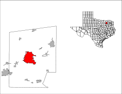
 Location of Greenville, Texas | |
 | |
| Coordinates: 33°7′34″N 96°6′35″W | |
| Country | |
| State | |
| County | Hunt |
| Incorporated | April 13, 1852[2] |
| Named for | Thomas J. Green[3] |
| Government | |
| • Type | Council-Manager |
| • City Council | Mayor David Dreiling Place 1 Jerry Ransom Place 2 Al Atkins Place 3 John Turner Place 4 Holly Gotcher Place 5 Brent Money Place 6 Cedric Dean[4] |
| • City Manager | Summer Spurlock[5] |
| Area | |
| • Total | 33.4 sq mi (86.6 km2) |
| • Land | 32.6 sq mi (84.5 km2) |
| • Water | 0.8 sq mi (2.1 km2) |
| Elevation | 541 ft (165 m) |
| Population | |
| • Total | 25,557 |
| • Estimate (2019)[7] | 28,827 |
| • Density | 833/sq mi (321.5/km2) |
| Time zone | UTC-6 (Central (CST)) |
| • Summer (DST) | UTC-5 (CDT) |
| ZIP codes | 75401–75404 |
| Area code(s) | 903, 430 |
| FIPS code | 48-30920[8] |
| GNIS feature ID | 1377755[9] |
| Website | ci |
Greenville was named for Thomas J. Green,[3] a significant contributor to the founding of the Texas Republic.[12]
Geography

Greenville is located in North Texas at 33°7′34″N 96°6′35″W (33.126004, −96.109703),[13] in central Hunt County. Greenville is situated in the heart of the Texas blackland prairies, 50 miles (80 km) northeast of Dallas and about 45 miles (72 km) south of the Texas/Oklahoma border, on the eastern edge of the Dallas/Fort Worth Metroplex.
According to the U.S. Census Bureau, Greenville has a total area of 33.4 square miles (86.6 km2), of which 32.6 square miles (84.5 km2) are land and 0.1 square miles (0.2 km2), or 2.46%, are water.[6] The Cowleech Fork of the Sabine River flows through the northeast part of the city.
Climate
Greenville is considered to be a part of the humid subtropical region. Due to its location on the north Texas prairies the climate is typically humid with mild precipitation.
History

Greenville was founded in 1846. The city was named after Thomas J. Green, a significant contributor to the establishment of the Texas Republic. He later became a member of the Congress of the Texas Republic.
As the Civil War loomed, Greenville was divided over the issue of secession, as were several area towns and counties. Greenville attorney and State Senator Martin D. Hart was a prominent Unionist. He formed a company of men who fought for the Union in Arkansas, even as other Greenville residents fought for the Confederacy. The divided nature of Greenville and Hunt County is noted by a historical marker in "The SPOT" Park at 2800 Lee Street in downtown Greenville. In the post-Civil War era, Greenville's economy became partly dependent on cotton as the local economy entered a period of transition.[14]
With a population of 12,384 in the 1920 census, the city was the 20th largest in Texas at the time.
In World War II, the Mexican Escuadrón 201 was stationed in Greenville while training at nearby Majors Field.
Greenville was notorious for a large sign, installed on July 7, 1921, over Lee Street, the main street in the downtown district, between the train station and the bus station in the 1920s to 1960s. The sign read: "Welcome to Greenville, The Blackest Land, The Whitest People."[15][16] According to history teacher Paul E. Sturdevant of Greenville, the original intent behind "the whitest people" was to define "the citizens of Greenville as friendly, trustworthy and helpful was sincere, and it was meant to include all citizens, regardless of race."[16] In pre-civil rights America, the phrase "That's mighty white of you" meant that you were honest, not like suspect blacks. The sign thus acquired racial overtones, and the original sign was taken down and placed into storage on April 13, 1965, possibly at the urging of Texas Governor John Connally, who had made a visit to the town weeks before.[16] In 1968, Greenville's Sybil Maddux had the sign reinstalled, with the wording modified to read "The Greatest People"; the original sign is in the collection of the Audie Murphy American Cotton Museum.[16]
In 1957, Greenville annexed the small town of Peniel, which had been founded in 1899 as a Pentecostal Church of the Nazarene community centered around Texas Holiness University. The annexation was approved by the citizens of Peniel, which at the time had a population of about 157.[17]
On May 12, 2011, a white buffalo was born near Greenville during a thunderstorm on the ranch of Arby Littlesoldier, who identified himself as a great-great grandson of Sitting Bull. A public naming ceremony and dedication was held on June 29, 2011, during which the male calf was officially given the title "Lightning Medicine Cloud".[18] However, on August 21, 2012, Lightning Medicine Cloud died. The Sheriff's department declared it had died from a bacterial infection,[19] but the owners disagree, claiming that the buffalo was allegedly skinned by an unknown party.[20]
Demographics
| Historical population | |||
|---|---|---|---|
| Census | Pop. | %± | |
| 1890 | 4,330 | — | |
| 1900 | 6,860 | 58.4% | |
| 1910 | 8,850 | 29.0% | |
| 1920 | 12,384 | 39.9% | |
| 1930 | 12,407 | 0.2% | |
| 1940 | 13,995 | 12.8% | |
| 1950 | 14,727 | 5.2% | |
| 1960 | 19,087 | 29.6% | |
| 1970 | 22,043 | 15.5% | |
| 1980 | 22,161 | 0.5% | |
| 1990 | 23,071 | 4.1% | |
| 2000 | 23,960 | 3.9% | |
| 2010 | 25,557 | 6.7% | |
| Est. 2019 | 28,827 | [7] | 12.8% |
| U.S. Decennial Census | |||
As of the census[8] of 2000, there were 23,960 people, 9,156 households, and 6,171 families residing in the city. The population density was 706.5 people per square mile (272.8/km²). There were 9,977 housing units at an average density of 294.2 per square mile (113.6/km²). The racial makeup of the city was 69.7% White, 18.9% African American, 0.5% Native American, 0.6% Asian, <0.1% Pacific Islander, 8.2% from other races, and 2.1% from two or more races. Hispanic or Latino of any race were 14.65% of the population.
There were 9,156 households out of which 31.7% had children under the age of 18 living with them, 49.4% were married couples living together, 13.9% had a female householder with no husband present, and 32.6% were non-families. 28.6% of all households were made up of individuals and 11.8% had someone living alone who was 65 years of age or older. The average household size was 2.56 and the average family size was 3.13.
In the city, the population was spread out with 27.0% under the age of 18, 9.9% from 18 to 24, 28.2% from 25 to 44, 20.2% from 45 to 64, and 14.7% who were 65 years of age or older. The median age was 35 years. For every 100 females, there were 94.2 males. For every 100 females age 18 and over, there were 90.5 males.
The median income for a household in the city was $34,606, and the median income for a family was $41,808. Males had a median income of $31,556 versus $22,373 for females. The per capita income for the city was $17,231. About 11.3% of families and 16.3% of the population were below the poverty line, including 23.8% of those under age 18 and 14.4% of those age 65 or over.
Media

Greenville is served by Dallas/Fort Worth television stations on local cable and also regular programming.
KGVL is a radio station that serves the city of Greenville. KETR in Commerce also serves the city of Greenville due to the proximity of the two cities.
In addition to The Dallas Morning News, which serves the entire Dallas/Fort Worth area, Greenville is served by a local daily newspaper, the Herald-Banner.
Education

Primary and secondary education of Greenville is provided by Greenville ISD along with private institutions such as Greenville Christian School.
Postsecondary education is offered through Paris Junior College-Greenville Center. Texas A&M University-Commerce, a major university of over 12,000 students, is located 15 miles (24 km) northeast in the neighboring city of Commerce.
Government
Local government
.jpg)
According to the city's most recent Comprehensive Annual Financial Report Fund Financial Statements, the city's various funds had $19.9 million in revenues, $21.7 million in expenditures, $10.1 million in total assets, $1.8 million in total liabilities, and $1.4 million in investments.[21]
The structure of the management and coordination of city services is:[22]
| Department | Director |
|---|---|
| City Manager | Summer Spurlock |
| City Attorney | Daniel Ray |
| City Secretary | Carole Kuykendall |
| Police Chief | Scott Smith |
| Fire Chief | Jeremy Powell |
| Community Development Director | Steve Methven |
| Main Street Coordinator | Doyle Dick |
| Finance Director | Talia Willner |
| Human Resources Director | Sheri W. Wells |
| Public Works Director | Press Tompkins |
| Library Director | Olivia Griggs |
| Parks & Recreation Director | Brett Quarles |
Greenville is a voluntary member of the North Central Texas Council of Governments association, the purpose of which is to coordinate individual and collective local governments and facilitate regional solutions, eliminate unnecessary duplication, and enable joint decisions.
State government
Greenville is represented in the Texas Senate by Republican Bob Hall, District 2,[23] and in the Texas House of Representatives by Republican Dan Flynn, District 2.[24]
The Texas Department of Criminal Justice (TDCJ) operates the Greenville District Parole Office in Greenville.[25]
Federal government
At the federal level, the two senators from Texas are Republicans John Cornyn and Ted Cruz. Greenville is part of Texas' 4th Congressional District, which is currently represented by Republican John Ratcliffe.
The United States Postal Service operates the Greenville,[26] Greenville Finance,[27] and Rolling Hills post offices.[28]
Economy
.jpg)
.jpg)
In early years, Hunt County was known as the cotton capital of the world. The world's largest inland cotton compress was located in Greenville until it was destroyed by fire in the mid-1900s.
Currently, the largest industry is L3 Mission Integration Division (MID, formerly E-Systems, then Raytheon Intelligence and Information Systems (RIIS, IIS)) a major U.S. Defense contractor located at Majors Airport. This airport, created in 1942 and initially financed by the local Rotary club, was used as a training base for P-47 Thunderbolt fighter pilots in World War II, and since then has served as a focal point for economic growth in Greenville.
Tourism is playing an increasing role in the local economy, with attractions such as Collin Street Bakery and Splash Kingdom Water Park located on Interstate 30, and the redeveloping historic downtown featuring Landon Winery and the restored vintage Texan Theater, which opened in 2014. Tourism promotion has been under the wing of the Greenville Chamber of Commerce / Convention and Visitors Bureau and the City of Greenville, which took over CVB duties in 2014. Greenville is also known for its saddle making industry.
.jpg)
According to the city's 2017-2018 Comprehensive Annual Financial Report,[29] the top employers in the city are:
| # | Employer | # of Employees |
|---|---|---|
| 1 | L3 Mission Integration Division | 6,500 |
| 2 | Hunt Regional Medical Center | 1,100 |
| 3 | Greenville Independent School District | 800 |
| 4 | McKesson | 500 |
| 4 | Hunt County | 500 |
| 6 | Cytec Engineered Materials | 350 |
| 6 | Wal-Mart Supercenter | 350 |
| 8 | Masonite International | 300 |
| 8 | Weatherford International | 300 |
| 10 | Raytheon | 200 |
.jpg)
Entertainment includes the Kenneth Threadgill Concert series, which brings well-known Texas performers to the Municipal Auditorium stage in three concerts per year; the Greenville Entertainment Series, a subscription concert series featuring artists from a variety of musical genres; the Symphony Festival Series, which brings the world-famous Dallas Symphony Orchestra to Greenville for three concerts and an additional children's concert per year; and the Greenville Follies, a musical review showcasing local talent every other year. Local clubs with musical entertainment, live theater in nearby Commerce, local art shows, a movie theater and a bowling alley offer year-round entertainment.
Tourism draws include the Audie Murphy/American Cotton Museum, Collin Street Bakery and the historic downtown area which includes wineries, antique malls, public gardens, boutique shopping, and regular events at the 1,700 seat Greenville Municipal Auditorium. The vintage Texan Theater was slated for a grand re-opening in 2014. The Rally 'Round Greenville festival is held the third weekend each September and includes the Cotton Patch Challenge Bicycle Ride, an Art Show, Barbecue and Chili Cook-Off, Texas Music Weekend, Kids Alley, and more. Backstreet Bash is held in March to celebrate the revitalization of the historic Main Street Area.
Greenville is also home to the Hunt Regional Medical Center.
Transportation
Roads
Interstate 30

Commercial and residential developments line the interstate from Monty Stratton Parkway through Lamar Street. The frontage roads have recently been converted to one-way for safety due to increased traffic.
U.S. highways


State highways


Farm-to-Market roads


Airports
The nearest airports with passenger air service are Dallas Love Field (55.4 miles)[30] and Dallas/Fort Worth International Airport (70.0 miles).[31]
Majors Airport is a municipal airport located in Greenville.[32]
Public transportation

The Connection serves Greenville and all of Hunt County. The transit system operates Monday through Friday from 7 am to 7 pm. Reservations have to be made one day in advance. The charge is $2 ($4 round trip) if the passenger is traveling to a place within the same community or city, and $3 ($6 round trip) if the passenger is traveling from one city or community to another within Hunt County. The Connection will take Hunt County residents to Dallas, on a round-trip only basis: passengers are charged $34, and a minimum of three passengers is required.[33]
Notable people
- Byron Bell, player for NFL's Green Bay Packers and Dallas Cowboys
- Yusuf Bey, Black Muslim activist, founder of Your Black Muslim Bakery in Oakland, California
- John Boles, movie and stage actor of the early 20th century
- Maud Crawford, first woman to practice law in Camden, Arkansas; disappeared in 1957 amid international attention; born in Greenville in 1891[34]
- Brandon Couts, athlete, Baylor University Hall of Famer who ran professionally and specialized in 400 meter dash
- Dean E. Hallmark, pilot in the Doolittle Raid of April 18, 1942, on Tokyo; captured and executed by Japanese; member of first Greenville High School football team to reach state playoffs in 1931
- Mack Harrell, operatic baritone; father of cellist Lynn Harrell
- Stanley Hauerwas, Gilbert T. Rowe Professor of Theological Ethics at Duke Divinity School; named "America's Best Theologian" by Time magazine;
- Burt Hooton, Major League Baseball pitcher who won 151 games with the Chicago Cubs, Los Angeles Dodgers and Texas Rangers (1971–1985); pitched no-hitter in 1972; member of 1981 World Series champion Dodgers
- V. E. Howard, minister of Church of Christ who founded radio's International Gospel Hour; formerly a clergyman in Greenville[35]
- Ben Kweller, rock musician
- Haldor Lillenas, prolific hymn writer and Gospel Music Hall of Fame inductee, pastor of the Church of the Nazarene from 1920 to 1923
- George Maddox, former NFL player
- Kimberly McCarthy, convicted murderer, 500th person executed in Texas since return of
- Bart Millard, lead singer and founder of contemporary Christian band MercyMe
- Robert Neyland, Hall of Fame football coach at Tennessee and decorated officer in U.S. Army
- Collin Raye, country music singer
- Monty Stratton, Major League Baseball pitcher from the 1930s; portrayed by Jimmy Stewart in The Stratton Story
- Earl Thomas, former wide receiver of NFL's Chicago Bears, St. Louis Cardinals, and Houston Oilers
- Jimmy Thomas, former running back of NFL's San Francisco 49ers
- Mike Thomas, NFL running back for the Washington Redskins and San Diego Chargers; won Offensive Rookie of the Year in 1975 and went to Pro Bowl after 1976 NFL season
- Francia White, opera singer, radio and television personality during 1930s and 1940s
- Buzz Williams, head coach of men's basketball team at Texas A&M University
- Kay Granger, a Republican politician representing Texas' 12th congressional district in the U.S. House of Representatives
See also
References
- "City of Greenville Texas". City of Greenville Texas. Retrieved October 19, 2012.
- "Demographics | Greenville, TX - Official Website". www.ci.greenville.tx.us. Retrieved 2018-12-30.
- "GREEN, THOMAS JEFFERSON | The Handbook of Texas Online| Texas State Historical Association (TSHA)". Tshaonline.org. Retrieved 2014-01-10.
- "Mayor and City Council | Greenville, TX - Official Website". www.ci.greenville.tx.us. Retrieved 2020-02-16.
- "City Manager | Greenville, TX - Official Website". www.ci.greenville.tx.us. Retrieved 2018-12-30.
- "Geographic Identifiers: 2010 Census Summary File 1 (G001): Greenville city, Texas". American Factfinder. U.S. Census Bureau. Archived from the original on February 13, 2020. Retrieved March 20, 2018.
- "Population and Housing Unit Estimates". Retrieved May 21, 2020.
- "U.S. Census website". United States Census Bureau. Retrieved 2008-01-31.
- "US Board on Geographic Names". United States Geological Survey. 2007-10-25. Retrieved 2008-01-31.
- "Find a County". National Association of Counties. Archived from the original on 2011-05-31. Retrieved 2011-06-07.
- "State and County Quick Facts". United States Census Bureau. Archived from the original on 2020-02-13. Retrieved 2018-12-30.
- "GREENVILLE, TX (HUNT COUNTY) | The Handbook of Texas Online| Texas State Historical Association (TSHA)". Tshaonline.org. 1984-01-09. Retrieved 2014-01-10.
- "US Gazetteer files: 2010, 2000, and 1990". United States Census Bureau. 2011-02-12. Retrieved 2011-04-23.
- "Greenville, Texas" Archived 2012-06-16 at the Wayback Machine, found in the Encyclopedia of Southern Jewish Communities
- Peter Carlson, "In a Bethesda Bookstore, the Prints of Propaganda", Washington Post (May 16, 2004), D01.
- Paul E. Sturdevant, "Black and White With Shades of Gray: The Greenville Sign", East Texas Historical Journal, Vol. 42, Iss. 1, pp. 25–33.
- Brian Hart, Peniel, TX, in Handbook of Texas Online (uploaded June 2010).
- Heinz, Frank (2012-08-21). "New Details in the Death of Rare White Buffalo | NBC 5 Dallas-Fort Worth". Nbcdfw.com. Retrieved 2014-01-10.
- Davies, Maura (2012-08-21). "Authorities say white buffalo died of natural causes | wfaa.com Dallas – Fort Worth". Wfaa.com. Archived from the original on 2013-12-15. Retrieved 2014-01-10.
- "Welcome to Lakota Ranch, Home of Lightning Medicine Cloud". Lightningmedicinecloud.com. 2012-08-24. Retrieved 2014-01-10.
- City of Greenville 2009 CAFR Retrieved 2010-11-16
- City of Greenville website Retrieved 2010-11-16
- "Senator Bob Hall: District 2". Retrieved April 24, 2015.
- "Texas House Member". Retrieved April 24, 2015.
- "Parole Division Region I Archived 2011-09-28 at the Wayback Machine." Texas Department of Criminal Justice. Retrieved on May 15, 2010.
- "Post Office Location – GREENVILLE Archived 2012-06-09 at the Wayback Machine." United States Postal Service. Retrieved on May 15, 2010.
- "Post Office Location – GREENVILLE FINANCE." United States Postal Service. Retrieved on May 15, 2010.
- "Post Office Location – ROLLING HILLS Archived 2012-06-09 at the Wayback Machine." United States Postal Service. Retrieved on May 15, 2010.
- "COMPREHENSIVE ANNUAL FINANCIAL REPORT". City of Greenville. 2019-03-29. Retrieved 2020-02-16.
- "Greenville to Dallas Love Field Airport". Greenville to Dallas Love Field Airport.
- "Greenville to DFW International Airport". Greenville to DFW International Airport.
- "Greenville Municipal Airport - Majors Field | Greenville, TX - Official Website". www.ci.greenville.tx.us.
- "SCRPT - Transportation". www.connectioninfo.org. Retrieved 2016-05-28.
- "Maud Robinson Crawford (1891–1957)". encyclopediaofarkansas.net. Retrieved January 14, 2011.
- "Verna Elisha Howard (1911–2000)". therestorationmovement.com. Archived from the original on December 25, 2013. Retrieved July 12, 2013.
- Romero, Simon. "A Texas Town Nervously Awaits a New Neighbor", New York Times, August 21, 2005.
Further reading
- Babb, Milton. (2010). "Hunt County, An Illustrated History." Historical Publishing Network. ISBN 978-1-935377-16-0
- Huey, Brenda. (2006). The Blackest Land The Whitest People. Bloomington: AuthorHouse. ISBN 978-1-4259-4424-7
- Mathews, Paul. (2001). I Remember... Personal Reflections on Greenville and Hunt County, Texas. Henington Publishing. ISBN 0-9709068-0-3
External links
- City of Greenville official website
- Greenville Chamber of Commerce
- Friends of Main Street
- The Herald-Banner
Municipalities and communities of Hunt County, Texas, United States | ||
|---|---|---|
| Cities |  Hunt County map | |
| Town | ||
| Unincorporated communities | ||
| Footnotes | ‡This populated place also has portions in an adjacent county or counties | |

| Authority control |
|
|---|