Fairfield, Texas
Fairfield is a city in Freestone County, Texas, United States. The population was 2,951 at the 2010 census,[3] down from 3,094 at the 2000 census. It is the county seat of Freestone County[4] and was founded as such in 1851.[5]
Fairfield, Texas | |
|---|---|
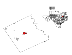
 Location of Fairfield, Texas | |
 | |
| Coordinates: 31°43′19″N 96°9′29″W | |
| Country | United States |
| State | Texas |
| County | Freestone |
| Area | |
| • Total | 5.46 sq mi (14.15 km2) |
| • Land | 5.46 sq mi (14.14 km2) |
| • Water | 0.004 sq mi (0.01 km2) |
| Elevation | 463 ft (141 m) |
| Population (2010) | |
| • Total | 2,951 |
| • Density | 541/sq mi (208.7/km2) |
| Time zone | UTC-6 (Central (CST)) |
| • Summer (DST) | UTC-5 (CDT) |
| ZIP code | 75840 |
| Area code(s) | 903/430 |
| FIPS code | 48-25104[1] |
| GNIS feature ID | 1357165[2] |
| Website | www |
Geography
_Fischer_Home_--_Fairfield%2C_Texas.jpg)


Fairfield is located in the center of Freestone County at 31°43′19″N 96°9′29″W (31.721940, −96.158011).[6] Interstate 45 passes through the west side of the city, leading north 88 miles (142 km) to Dallas and south 152 miles (245 km) to Houston. Access is from Exits 197 and 198. U.S. Route 84 runs directly through the city, leading east 35 miles (56 km) to Palestine and west 63 miles (101 km) to Waco. Texas State Highway 75 (Fairway) crosses US 84 at the west end of downtown, and leads northwest 14 miles (23 km) to Streetman and south 9 miles (14 km) to Dew.
According to the United States Census Bureau, the city has a total area of 5.4 square miles (14.1 km2), of which 0.004 square miles (0.01 km2), or 0.07%, is water.[3]
Demographics
| Historical population | |||
|---|---|---|---|
| Census | Pop. | %± | |
| 1860 | 609 | — | |
| 1870 | 800 | 31.4% | |
| 1880 | 358 | −55.2% | |
| 1890 | 499 | 39.4% | |
| 1940 | 1,047 | — | |
| 1950 | 1,742 | 66.4% | |
| 1960 | 1,781 | 2.2% | |
| 1970 | 2,074 | 16.5% | |
| 1980 | 3,505 | 69.0% | |
| 1990 | 3,234 | −7.7% | |
| 2000 | 3,094 | −4.3% | |
| 2010 | 2,951 | −4.6% | |
| Est. 2018 | 2,937 | [7] | −0.5% |
| U.S. Decennial Census[8] | |||
As of the census[1] of 2000, there were 3,094 people, 1,235 households, and 791 families living in the city. The population density was 685.6 people per square mile (264.9/km²). There were 1,431 housing units at an average density of 317.1 per square mile (122.5/km²). The racial makeup of the city was 71.46% White, 21.43% African American, 0.26% Native American, 0.68% Asian, 4.65% from other races, and 1.52% from two or more races. Hispanic or Latino of any race were 10.50% of the population.
There were 1,235 households out of which 30.7% had children under the age of 18 living with them, 46.2% were married couples living together, 13.5% had a female householder with no husband present, and 35.9% were non-families. 32.7% of all households were made up of individuals and 17.2% had someone living alone who was 65 years of age or older. The average household size was 2.41 and the average family size was 3.06.
In the city, the population was spread out with 26.3% under the age of 18, 8.8% from 18 to 24, 25.9% from 25 to 44, 20.5% from 45 to 64, and 18.6% who were 65 years of age or older. The median age was 37 years. For every 100 females, there were 92.3 males. For every 100 females age 18 and over, there were 87.6 males.
The median income for a household in the city was $28,636, and the median income for a family was $40,871. Males had a median income of $29,643 versus $15,887 for females. The per capita income for the city was $16,308. About 14.1% of families and 18.2% of the population were below the poverty line, including 20.4% of those under age 18 and 22.8% of those age 65 or over.
Notable people
- Tony Brackens, played college football for the Texas Longhorns and played in the NFL for the Jacksonville Jaguars
- Louis Ray Cheek Jr. (born October 6, 1964 in Galveston, Texas), offensive lineman in the National Football League for the Miami Dolphins, Dallas Cowboys, Philadelphia Eagles, and the Green Bay Packers. He played college football at Texas A&M University and was drafted in the eighth round of the 1988 NFL draft.
- Kenny Dorham, jazz trumpeter
- Nanceen Perry, USA Track Team member for 2000 Sydney Olympics
- Winfred Tubbs, played college football for the Texas Longhorns and played in the NFL for the New Orleans Saints and San Francisco 49ers
- Larry Rose III, running back who played college football for New Mexico State University, and professionally for the Tennessee Titans and Los Angeles Rams of the National Football League, the Arizona Hotshots of the Alliance of American Football, and the Winnipeg Blue Bombers of the Canadian Football League.
- Madison Fuller, Miss Texas 2018.
Education
The city is served by the Fairfield Independent School District. Navarro College offers year-round classes at their Navarro College Career & Technical Center at Fairfield campus for undergraduate and graduate students.[9]
Climate
The climate in this area is characterized by hot, humid summers and generally mild to cool winters. According to the Köppen Climate Classification system, Fairfield has a humid subtropical climate, abbreviated "Cfa" on climate maps.[10]
References
- "U.S. Census website". United States Census Bureau. Retrieved 2008-01-31.
- "US Board on Geographic Names". United States Geological Survey. 2007-10-25. Retrieved 2008-01-31.
- "Geographic Identifiers: 2010 Demographic Profile Data (G001): Fairfield city, Texas". U.S. Census Bureau, American Factfinder. Retrieved September 6, 2016.
- "Find a County". National Association of Counties. Archived from the original on 2011-05-31. Retrieved 2011-06-07.
- A Memorial and Biographical History of Navarro, Henderson, Anderson, Limestone, Freestone and Leon Counties, Texas. Chicago: Lewis Publishing Company. 1893. p. 420. Retrieved 28 September 2014.
- "US Gazetteer files: 2010, 2000, and 1990". United States Census Bureau. 2011-02-12. Retrieved 2011-04-23.
- "Population and Housing Unit Estimates". Retrieved November 24, 2019.
- "Census of Population and Housing". Census.gov. Retrieved June 4, 2015.
- Navarro College Career & Technical Center at Fairfield
- Climate Summary for Fairfield, Texas
External links
| Wikivoyage has a travel guide for Fairfield, Texas. |
- City of Fairfield official website
- Fairfield, Texas from the Handbook of Texas Online
Municipalities and communities of Freestone County, Texas, United States | ||
|---|---|---|
| Cities |  Freestone County map | |
| Towns | ||
| Unincorporated communities | ||
| Ghost town | ||
| Footnotes | ‡This populated place also has portions in an adjacent county or counties | |

| Authority control |
|
|---|