Seymour, Texas
Seymour is a city in and the county seat of Baylor County, Texas, United States.[3] The population was 2,740 as of the 2010 Census.[4]
Seymour, Texas | |
|---|---|
City | |
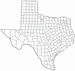 Location of Seymour, Texas | |
| Coordinates: 33°35′39″N 99°15′37″W[1] | |
| Country | United States |
| State | Texas |
| County | Baylor |
| Incorporated (town) | 1890 (dissolved 1892) |
| Incorporated (city) | 1906 |
| Government | |
| • Type | Mayor-Council |
| • Mayor | Jon Hrncirik |
| • City Council | Brian Broome Lan Winn Paula Vaden Mary Kay Fair Monty Glass |
| • City Administrator | Steve Beidermann |
| • Chamber of Commerce Director | Samantha Castilleja |
| Area | |
| • Total | 2.9 sq mi (7.6 km2) |
| • Land | 2.9 sq mi (7.6 km2) |
| • Water | 0.004 sq mi (0.01 km2) |
| Elevation | 1,289 ft (393 m) |
| Population (2010) | |
| • Total | 2,740 |
| • Density | 930/sq mi (360/km2) |
| Time zone | UTC-6 (Central (CST)) |
| • Summer (DST) | UTC-5 (CDT) |
| ZIP code | 76380 |
| Area code(s) | 940 |
| FIPS code | 48-66968[2] |
| Website | www |
Geography
Seymour is located on the Brazos River.[5] It is 52 miles (84 km) southwest of Wichita Falls and 102 miles (164 km) north-northeast of Abilene.
According to the United States Census Bureau, the city has a total area of 2.9 square miles (7.6 km2), of which 0.004 square miles (0.01 km2), or 0.20%, is water.[4]
Climate
The climate is humid subtropical (Köppen: Cfa) with an extreme temperature deviation, however much of the time the variation is always more and the warm weather prevails over the cold as the averages and the records show. Its subtropical location and south of the center of a large land mass bring occasional outbreaks even to a latitude and not very high altitude. The climate in this area is characterized by hot, humid summers and generally mild to cool winters, sometimes cold.[6] On August 12, 1936, Seymour witnessed the record highest temperature in Texas (120 °F), a record that was tied by the city of Monahans on June 28, 1994.[7]
| Climate data for Seymour, TX | |||||||||||||
|---|---|---|---|---|---|---|---|---|---|---|---|---|---|
| Month | Jan | Feb | Mar | Apr | May | Jun | Jul | Aug | Sep | Oct | Nov | Dec | Year |
| Record high °F (°C) | 89 (32) |
93 (34) |
100 (38) |
103 (39) |
107 (42) |
115 (46) |
114 (46) |
120 (49) |
112 (44) |
106 (41) |
92 (33) |
90 (32) |
120 (49) |
| Average high °F (°C) | 54.1 (12.3) |
58.5 (14.7) |
67.2 (19.6) |
77.3 (25.2) |
84.5 (29.2) |
92.6 (33.7) |
97.6 (36.4) |
97.7 (36.5) |
89.3 (31.8) |
78.8 (26.0) |
65.4 (18.6) |
55.5 (13.1) |
76.5 (24.8) |
| Average low °F (°C) | 27.1 (−2.7) |
31.4 (−0.3) |
38.8 (3.8) |
48.9 (9.4) |
58.4 (14.7) |
67.3 (19.6) |
71.2 (21.8) |
70.2 (21.2) |
62.4 (16.9) |
50.9 (10.5) |
38.1 (3.4) |
29.7 (−1.3) |
49.5 (9.8) |
| Record low °F (°C) | −14 (−26) |
−9 (−23) |
5 (−15) |
22 (−6) |
30 (−1) |
47 (8) |
54 (12) |
50 (10) |
34 (1) |
20 (−7) |
7 (−14) |
−8 (−22) |
−14 (−26) |
| Average precipitation inches (mm) | 0.99 (25) |
1.41 (36) |
1.57 (40) |
2.18 (55) |
3.79 (96) |
3.20 (81) |
2.21 (56) |
2.30 (58) |
3.09 (78) |
2.61 (66) |
1.55 (39) |
1.36 (35) |
26.26 (665) |
| Average snowfall inches (cm) | 0.8 (2.0) |
0.6 (1.5) |
0.2 (0.51) |
0 (0) |
0 (0) |
0 (0) |
0 (0) |
0 (0) |
0 (0) |
0 (0) |
0.3 (0.76) |
0.4 (1.0) |
2.3 (5.77) |
| Source: WRCC | |||||||||||||
Geology
Seymour is within the area underlain by Texas Red Beds, which are a strata of red-colored sedimentary rock from the Early Permian. The fossils of Permian period vertebrates in the Texas Red Beds were first discovered by Edward Drinker Cope in 1877.[8][9] Subsequent research has revealed rare fossils of Permian-era amphibians like Trimerorhachis,[10] as well as rich deposits of other Permian tetrapods such as Dimetrodon and Diadectes.[11] The order Seymouriamorpha and genus Seymouria, which were first discovered in the Seymour area, are named after the city.[12]
Demographics
| Historical population | |||
|---|---|---|---|
| Census | Pop. | %± | |
| 1880 | 183 | — | |
| 1890 | 1,125 | 514.8% | |
| 1910 | 2,029 | — | |
| 1920 | 2,121 | 4.5% | |
| 1930 | 2,626 | 23.8% | |
| 1940 | 3,328 | 26.7% | |
| 1950 | 3,779 | 13.6% | |
| 1960 | 3,789 | 0.3% | |
| 1970 | 3,469 | −8.4% | |
| 1980 | 3,657 | 5.4% | |
| 1990 | 3,185 | −12.9% | |
| 2000 | 2,908 | −8.7% | |
| 2010 | 2,740 | −5.8% | |
| Est. 2018 | 2,613 | [13] | −4.6% |
| U.S. Decennial Census[14] | |||
2010 census
As of the census of 2010, there were 2,740 people, a decrease of 5.78% since 2000 (168 people). The racial makeup of the town was 91.28% White (2,501 people), 3.61% Hispanic or Latino of any race (373 people), 2.45% African American (67 people), 0.22% Native American (6 people), 0.11% Asian (3 people), 0.11% Pacific Islander (3 people), 4.11% from other races (104 people), and 3.80% from two or more races (56 people).
There were 1,451 housing units, 249 of which were vacant.
2000 census
As of the census[2] of 2000, 2,908 people, 1,273 households, and 790 families resided in the city. The population density was 1,067.5 people per square mile (412.8/km²). The 1,534 housing units averaged 563.1 per square mile (217.8/km²). The racial makeup of the city was 89.24% White (2,595 people), 10.45% Hispanic or Latino of any race (304 people), 4.57% African American (133 people), 0.48% Native American (14 people), 0.72% Asian (21 people), 0.10% Pacific Islander (3 people), 3.44% from other races (100 people), and 1.44% from two or more races (42 people).
Of the 1,273 households, 26.0% had children under the age of 18 living with them, 49.1% were married couples living together, 10.0% had a female householder with no husband present, and 37.9% were not families; 35.7% of all households were made up of individuals and 21.9% had someone living alone who was 65 years of age or older. The average household size was 2.25 and the average family size was 2.90.
In the city, the population was distributed as 24.3% under the age of 18, 6.1% from 18 to 24, 20.9% from 25 to 44, 23.9% from 45 to 64, and 24.8% who were 65 years of age or older. The median age was 44 years. For every 100 females, there were 83.2 males. For every 100 females age 18 and over, there were 79.6 males.
The median income for a household in the city was $23,662, and for a family was $32,917. Males had a median income of $21,891 versus $19,292 for females. The per capita income for the city was $16,062. About 15.6% of families and 19.5% of the population were below the poverty line, including 31.8% of those under age 18 and 10.7% of those age 65 or over.
Education
Seymour is served by the Seymour Independent School District.
History
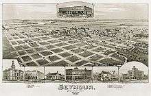
Seymour was founded by settlers from Oregon, who called the town Oregon City; it was originally located where the Western Trail crossed the Brazos River, which flows just south of the townsite. A post office was established in 1879, when the town's name was changed to honor local cowboy Seymour Munday, after whom nearby Munday was also named. The census of 1880 shows 78 people living in the 901 square mile county.[15] The first settlers were ranchers. During those years, the Millett Brothers established a large ranch with the headquarters some 10 miles south of Seymour on Miller Creek. There were about 50 men in the Millett outfit and some of these were reported to be outlaws. It was not unusual for some of the cowboys to ride into town and proceed to "shoot it up". The Milletts realized that law had come to Baylor County in 1884 and sold the ranch. It was the largest transaction ever made in northwest Texas at that time. The purchasers used the Hashknife Ranch brand, which is still in use in the county.[16]
Commerce, a newspaper, a hotel, and the county courthouse all followed soon after, as did violence between cowboys and settlers. The town experienced two distinct economic booms: the first, short-lived, was with the construction of the Wichita Valley rail line in 1880, and the second was due to the discovery of oil in 1906. The population grew from 500 in 1884 to almost 3800 in 1950; it remained at about that level for more than 30 years, but has declined since to 2,740 in the 2010 census. Agribusiness, as well as some tourism from nearby Lake Kemp, has overtaken oil as the driving factor of the local economy. The Old Settlers Reunion and Rodeo has been held each July since 1896.[17]
The town calls itself "the crossroads of North Texas" because it is located at the junction of five highways: U.S. highways 82, 277, 183, and 283, and State Highway 114.[18]
On August 12, 1936, the temperature at Seymour reached 120 °F (49 °C), the highest temperature ever recorded in the state of Texas.[19]
References
- "U.S. Census website". United States Census Bureau. Retrieved January 31, 2008.
- "Find a County". National Association of Counties. Retrieved June 7, 2011.
- "Geographic Identifiers: 2010 Demographic Profile Data (G001): Seymour city, Texas". U.S. Census Bureau, American Factfinder. Archived from the original on February 12, 2020. Retrieved April 9, 2014.
- Seymour West, TX, 7.5 Minute Topographic Quadrangle, USGS, 1966
- Climate Summary for Seymour, Texas
- Enloe. "State Climate Extremes Committee (SCEC) | Extremes | National Centers for Environmental Information (NCEI)". www.ncdc.noaa.gov. Retrieved April 12, 2017.
- Cope, E. D. Descriptions of extinct vertebrata from the Permian and Triassic formations of the United States. Proceedings of the American Philosophical Society, 1877. Volume 17:182–195. JSTOR. Accessed on August 28, 2017.
- Case, E.C.The Red Beds between Wichita Falls, Texas, and Las Vegas, New Mexico, in Relation to Their Vertebrate Fauna. The Journal of Geology, vol. 22, no. 3, 1914, pp. 243–259. JSTOR. Accessed on August 28, 2017.
- Henry, Randy. NRCS and Landowner Team Up With Houston Museum after Rare Species Discovery. Natural Resources Conservation Service. Accessed on August 28, 2017.
- Caulfield, Dave. Prehistoric Predators: Fossil Findings in Seymour 'Redefining'. Newschannel 6: October 25, 2015. Accessed on August 28, 2017.
- Williston, S. W. Restoration of Seymouria Baylorensis Broili, an American Cotylosaur. The Journal of Geology: 1911, vol. 19, no. 3, pp. 232–237. JSTOR. Accessed on August 28, 2017.
- "Population and Housing Unit Estimates". Retrieved December 7, 2019.
- "Census of Population and Housing". Census.gov. Retrieved June 4, 2015.
- "Baylor County, Texas", Wikipedia, May 26, 2019, retrieved May 29, 2019
- ANDERSON, H. ALLEN (June 15, 2010). "HASHKNIFE RANCH". tshaonline.org. Retrieved May 29, 2019.
- "Handbook of Texas Online – Seymour, TX". Retrieved January 15, 2009.
- "City of Seymour, Texas website". Retrieved November 7, 2007.
- Hodge, Larry; Syers, Ed (2000). Backroads of Texas (4th ed.). Lanham, MD: Lone Star Books.
External links
| Wikimedia Commons has media related to Seymour, Texas. |
- City of Seymour official website
- Seymour Independent School District
- Whiteside Museum of Natural History
Municipalities and communities of Baylor County, Texas, United States | ||
|---|---|---|
| City | 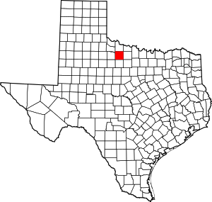 Baylor County map | |
| Unincorporated communities | ||

| Authority control |
|
|---|