Celeste, Texas
Celeste (Light Blue, in Spanish) is a city in Hunt County, in the U.S. state of Texas. The population was 814 at the 2010 census.[3]
Celeste, Texas | |
|---|---|
.jpg) U.S. Route 69 in Celeste | |
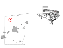
 Location of Celeste, Texas | |
 | |
| Coordinates: 33°17′37″N 96°11′44″W | |
| Country | United States |
| State | Texas |
| County | Hunt |
| Area | |
| • Total | 1.10 sq mi (2.86 km2) |
| • Land | 1.10 sq mi (2.86 km2) |
| • Water | 0.0 sq mi (0.0 km2) |
| Elevation | 669 ft (204 m) |
| Population (2010) | |
| • Total | 814 |
| • Density | 738/sq mi (285.0/km2) |
| Time zone | UTC-6 (Central (CST)) |
| • Summer (DST) | UTC-5 (CDT) |
| ZIP code | 75423 |
| Area code(s) | 903 |
| FIPS code | 48-13672[1] |
| GNIS feature ID | 1354174[2] |
History
Like many towns in Hunt County, Celeste[4] was a product of railroad development. The townsite was platted in 1886 by the Gulf, Colorado and Santa Fe Railway 3 miles (5 km) north of Kingston, on open prairie already crossed by the Missouri, Kansas and Texas line. This location was chosen in order to ensure that Kingston, whose elected officials had refused to offer incentives to attract the Gulf, Colorado and Santa Fe to build through their community, would be bypassed by the line as it put down tracks from Paris through Farmersville to Dallas.
.jpg)
Celeste was named for the wife of a Santa Fe official. The two rail lines stimulated rapid growth. A post office opened in Celeste in 1886, and a number of merchants moved their businesses from Kingston to Celeste. By 1888 three churches were holding services in the settlement. The population by the mid-1890s stood at 600, and the community maintained three gristmills and cotton gins, a bank, a weekly newspaper, and a graded public school. Celeste was incorporated in 1900, and its population increased from 671 that year to 850 on the eve of World War I.
By 1914 the community had two banks, three cotton gins, a water works, an ice factory, and a weekly newspaper, as well as some thirty-five other businesses. It reported a population of 1,022 by 1926. Its high school and two elementary schools registered 500 students. Some fifty business establishments, including two banks and a newspaper, were in operation. After the 1920s, however, the population of Celeste fell from 803 in 1933 to 518 in the mid-1960s; businesses correspondingly declined, from thirty to sixteen. After the 1960s the town revived; in 1976 its population was 745. In 1982 the community, where World War II hero Audie Murphy once lived, had a bank, four churches, ten stores, and a school that enrolled 300 students. The population was 733 in 1990 and 817 in 2010.
Geography
Celeste is in northwestern Hunt County along U.S. Route 69, which leads northwest 40 miles (64 km) to Denison and southeast 12 miles (19 km) to Greenville the Hunt county seat. According to the United States Census Bureau, Celeste has a total area of 1.1 square miles (2.9 km2), all of it land.[3]
Demographics
| Historical population | |||
|---|---|---|---|
| Census | Pop. | %± | |
| 1890 | 250 | — | |
| 1900 | 671 | 168.4% | |
| 1910 | 821 | 22.4% | |
| 1920 | 1,022 | 24.5% | |
| 1930 | 803 | −21.4% | |
| 1940 | 730 | −9.1% | |
| 1950 | 729 | −0.1% | |
| 1960 | 588 | −19.3% | |
| 1970 | 736 | 25.2% | |
| 1980 | 716 | −2.7% | |
| 1990 | 733 | 2.4% | |
| 2000 | 817 | 11.5% | |
| 2010 | 814 | −0.4% | |
| Est. 2018 | 902 | [5] | 10.8% |
| U.S. Decennial Census[6] | |||
As of the census[1] of 2000, there were 817 people, 302 households, and 221 families residing in the city. The population density was 1,005.1 people per square mile (389.4/km2). There were 347 housing units at an average density of 426.9 per square mile (165.4/km2). The racial makeup of the city was 93.27% White, 3.79% African American, 1.10% Native American, 0.12% Asian, 0.86% from other races, and 0.86% from two or more races. Hispanic or Latino of any race were 2.20% of the population.
There were 302 households, out of which 38.7% had children under the age of 18 living with them, 55.3% were married couples living together, 13.6% had a female householder with no husband present, and 26.8% were non-families. 24.2% of all households were made up of individuals, and 14.6% had someone living alone who was 65 years of age or older. The average household size was 2.71 and the average family size was 3.20.
In the city, the population was spread out, with 31.5% under the age of 18, 8.4% from 18 to 24, 30.1% from 25 to 44, 18.7% from 45 to 64, and 11.3% who were 65 years of age or older. The median age was 33 years. For every 100 females, there were 89.6 males. For every 100 females age 18 and over, there were 81.2 males.
The median income for a household in the city was $34,853, and the median income for a family was $39,286. Males had a median income of $34,875 versus $23,250 for females. The per capita income for the city was $14,017. About 12.9% of families and 15.6% of the population were below the poverty line, including 15.4% of those under age 18 and 34.1% of those age 65 or over.
Education
The city is served by the Celeste Independent School District and is home to the Celeste High School Blue Devils.
Notable residents
- Clint Lorance (born 1984), Army officer convicted of second-degree murder for battlefield deaths; pardoned
References
- "U.S. Census website". United States Census Bureau. Retrieved 2008-01-31.
- "US Board on Geographic Names". United States Geological Survey. 2007-10-25. Retrieved 2008-01-31.
- "Geographic Identifiers: 2010 Census Summary File 1 (G001): Celeste city, Texas". American Factfinder. U.S. Census Bureau. Archived from the original on February 13, 2020. Retrieved March 19, 2018.
- Texas State Historical Association, CELESTE, TX The Handbook of Texas Online
- "Population and Housing Unit Estimates". Retrieved May 30, 2019.
- "Census of Population and Housing". Census.gov. Retrieved June 4, 2015.
Municipalities and communities of Hunt County, Texas, United States | ||
|---|---|---|
| Cities | 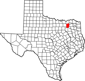 Hunt County map | |
| Town | ||
| Unincorporated communities | ||
| Footnotes | ‡This populated place also has portions in an adjacent county or counties | |
| Authority control |
|
|---|