Flower Mound, Texas
Flower Mound is an incorporated town[Note 1] located in Denton and Tarrant counties in the U.S. state of Texas.[3] [4] Located northwest of Dallas and northeast of Fort Worth adjacent to Grapevine Lake, the town derives its name from a prominent 12.5-acre (5.1 ha) mound located in the center of town.
Flower Mound, Texas | |
|---|---|
 | |
| Nickname(s): FloMo, The Mound | |
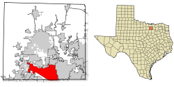 Location of Flower Mound in Denton County, Texas | |
| Coordinates: 33°1′54″N 97°4′44″W | |
| Country | United States |
| State | Texas |
| Counties | Denton, Tarrant |
| Incorporated | February 25, 1961 |
| Government | |
| • Type | Council–manager |
| • Town Council | Mayor Steve Dixon Jim Pierson, Place 1 Mayor Pro Tem Sandeep Sharma, Place 2 Ben Bumgarner, Place 3 Jim Engel, Place 4 Deputy Mayor Pro Tem, Claudio Forest, Place 5 |
| • Town Manager | Jimmy Stathatos |
| Area | |
| • Town | 43.4 sq mi (112 km2) |
| • Land | 41.39 sq mi (107.2 km2) |
| • Water | 2.5 sq mi (6 km2) |
| Elevation | 604 ft (184 m) |
| Population (2010) | |
| • Town | 64,669 |
| • Density | 1,562.5/sq mi (603.3/km2) |
| • Metro | 6,447,615 |
| Time zone | UTC-6 (Central) |
| • Summer (DST) | UTC-5 (Central) |
| ZIP codes | 75022, 75028, 75027 |
| Area code(s) | 214, 469, 972, 682, 817 |
| FIPS code | 48-26232[1] |
| GNIS feature ID | 1335983[2] |
| Website | www |
After settlers used the site for religious camps during the 1840s, the area around Flower Mound was first permanently inhabited in the 1850s; however, residents did not incorporate until 1961. Although an effort to create a planned community failed in the early 1970s, Flower Mound's population increased substantially when Dallas/Fort Worth International Airport opened to the south in 1974. As of the 2010 United States Census, the population was 64,699,[1] reflecting a 28% increase over the 50,702 counted in the 2000 Census.[5]
Flower Mound's municipal government, operating under a council–manager system, has invested in a public park system highlighted by an extensive network of trails. The town's public schools comprise part of the Lewisville Independent School District. With its moderately affluent population and proximity to the Dallas–Fort Worth metroplex, Flower Mound has used a smart growth system for urban planning, and has recently experienced more rapid light industrial growth to match the growing needs of the primarily residential community. In 2012, Flower Mound was ranked at #8 as one of the Best Dallas Suburbs according to D Magazine.[6]
History
Settlement in the area around Flower Mound began when the Presbyterians established a camp in the area in the 1840s.[7] A log cabin, dated around 1850, was discovered preserved within the walls of a home near Liberty Elementary in 2016, providing further proof of settlement. At first, the group held religious camps for two to three weeks at a time.[8] By 1854, residents had established the Flower Mound Presbyterian Church southwest of Lewisville in an area commonly referred to as "Long Prairie".[9][10] By 1920, the church had 126 members,[11] and the pine-framed building was expanded in 1937.[12] Early settlers such as Andrew Morriss and David Kirkpatrick are memorialized with street names in the town. The area remained sparsely populated for many decades after its initial settlement.
On February 25, 1961, the town voted to incorporate to avoid annexation by the City of Irving.[13] William Wilkerson, who became the town's second mayor, led the incorporation effort and helped improve the town's phone service and water supply.[14] In 1970, when Flower Mound had 1,685 residents, Edward S. Marcus and Raymond Nasher began a planned community project with $18 million in loan guarantees from the United States Department of Housing and Urban Development through their New Community program.[15] Called "Flower Mound New Town", the project included elements of the new towns movement, including collaboration with North Texas State University (now the University of North Texas) to move the school's administrative offices to Flower Mound and conduct all research for the project.[16] The project was featured in advertisements as late as 1974,[17] but it was abandoned after residents threatened to disannex a portion of the town to thwart the development.[18][19] The disannexation effort sharply divided the town, and led to a number of strongly contested elections between 1971 and 1976.[20] In 1976, Texas Monthly awarded the project its "Bum Steer Award" after the project lost its federal loan guarantees.[21]
The construction of Dallas-Fort Worth International Airport 4 miles (6.4 km) south of the town in 1974 sparked a period of rapid growth. Between 1980 and 1990, Flower Mound's population increased from 4,402 to 15,896. It reached 50,702 in 2000, an average annual increase of nearly 13 percent per year during the 1990s, making it the nation's tenth fastest-growing community.[22] Between 2000 and 2002, Flower Mound was the ninth fastest-growing municipality in the United States with a population of more than 50,000, and its population continued to increase by approximately five percent each year between 2000 and 2005. Controlled growth continues in central and western Flower Mound.
Geography
Flower Mound is located approximately 20 miles (32 km) northwest of Dallas and 25 miles (40 km) northeast of Fort Worth on the border between Denton and Tarrant counties. The town is located almost entirely in Denton County, however it has areas that extend into Tarrant County.[3] It is situated on the basin of the Trinity River in the Eastern Cross Timbers subregion in Texas.[23] The town borders Lewisville to the east and a number of cities and towns to the north, including Highland Village, Double Oak, and Bartonville. According to the United States Census Bureau, the town has a total area of 43.4 square miles (112 km2).[1] Land comprises 41.39 square miles (107.2 km2) (95.37%) of the total area; Denton County soils include the Silawa, Nawo, Gasil series.[24] Water comprises 2.5 square miles (6.5 km2) (5.76%) of the total area; Grapevine Lake and Marshall Creek form much of the town's southern boundary. Flower Mound's climate is classified as humid subtropical; the city averages 233 sunny days per year and 79 days of precipitation.[25]
The town encourages conservation development projects to protect and preserve existing open space, vistas, and natural habitats while allowing for controlled growth. Much of the town is located on the Barnett Shale, and drilling for shale gas in close proximity to residential neighborhoods has sharply divided parts of the community.[26][27][28] In 1994, amateur fossil collector Gary Byrd discovered a fossilized example of a Hadrosaurid dinosaur among black shale rock formations in the southwest edge of the town near Grapevine Lake.[29] The fossilized creature from the Cenomanian age was named "Protohadros byrdi" in Byrd's honor.[30]
The Mound
Flower Mound was named for a 12.5-acre (5.1 ha) hill approximately 50 feet (15 m) in height located close to the intersection of FM 3040 and FM 2499. The formation attracted the attention of early settlers to the area, and is often simply referred to as "The Mound". Part of the Texas blackland prairies, The Mound is typically covered by big bluestem, little bluestem, and Indian grasses.[31] During blooming seasons, dozens of varieties of flowers can grow on its slopes, often aided by the water retained by gilgai formations.[32] Though surrounded by commercial and residential development, The Mound is owned and maintained by The Mound Foundation, a non-profit private–public partnership. The group has advocated for a controlled burn on The Mound for many years,[33] and it expressed relief when an accidental New Year's Eve fire in late 2011 spurred the growth of wildflowers for the first time in years.[34]
Surrounding municipalities
Places adjacent to Flower Mound, Texas | |
|---|---|
Government
The Town of Flower Mound has been a home rule municipality since 1981, and it has operated under a council–manager type of municipal government since 1989.[35] Residents elect five at-large members to the Flower Mound Town Council and one mayor. Members serve two-year terms.[36] In 1999, the town adopted a Strategically Managed And Responsible Town (SMART) Growth Program to manage both the rate and character of development in the community, and in 2000, the town officially adopted its SMARTGrowth management plan.[37] The program's goal was to create environmentally sensitive development and to mitigate the effects of urban sprawl.[Note 2] Political scientist Allan Saxe and attorney Terrence S. Welch have used Flower Mound's program as an example of a municipality attempting to slow growth.[39][40] In 2013, the town amended the portion of the plan pertaining to public schools; the changes spurred public debate between candidates for town council.[41]
According to the city's 2013–2014 Comprehensive Annual Financial Report, the city's various funds had $114.6 million in revenues, $101.8 million in expenditures, $513.3 million in total assets, $155.9 million in total liabilities, and $68.1 million in cash and investments.[42]
The structure of the management and coordination of city services is as follows:[43]
| City Department | Director |
|---|---|
| Town Manager | Jimmy Stathatos |
| Deputy Town Manager/Chief Financial Officer | Debra Wallace |
| Town Secretary | Theresa Scott |
| Fire Chief | Eric Greaser |
| Police Chief | Andy Kancel |
| Director of Community Services | Gary Sims |
| Director of Economic Development | Andrea Roy |
| Director of Planning Services | Lexin Murphy |
| Director of Public Works | Tiffany Bruce |
| Assistant Town Manager | Tommy Dalton |
| Municipal Judge | Jeff Tasker |
Parks and recreation

The Town of Flower Mound operates 54 public parks and recreation facilities on 693 acres (280 ha) of space, nine of which (comprising 70 acres [28 ha]) are undeveloped as of 2012.[45] In June 2008, the town held the grand opening for its new $13.825 million community activity center, which includes meeting rooms, a day care facility, weight lifting equipment, an outdoor pool, and a 30-by-30-yard (25 m × 22.86 m) competition indoor pool.[44] In honor of Lance Corporal Jacob Lugo, the first military serviceman from Flower Mound to die in the line of duty, the town renamed Hilltop Park to Jake's Hilltop Park in 2008.[46]
In 2016 Flower Mound completed and opened its first dog park, a 5-acre Hound Mound Dog Park, costing over $1 million.[47] In 2018 the Town of Flower Mound opened a beautiful 2000 sq. ft. splash pad as part of an addition to Heritage Park.[48]
Trail system
In 1976, in response to environmental concerns and automobile traffic congestion, Flower Mound residents proposed adding a system of recreational bike paths around the town.[49] Initially, funding proved elusive, but by 1989 the first 1.3 miles (2.1 km) of multi-use trails had been constructed, partly funded by a grant from the Texas Parks and Wildlife Department. In 2010, the town maintained 33 miles (53 km) of paved hiking and bicycling paths and 2 miles (3.2 km) of equestrian trails. The Purple Cone Flower trail starts in Stone Creek Park and is used by runners, walkers and dog walkers.
Additionally, the United States Army Corps of Engineers maintains 14 miles (23 km) of natural surface trails and 9 miles (14 km) of equestrian trails within the town limits, most of which are located around Grapevine Lake.[50] The North Shore trail starts at Rock Ledge Park and travels west through Murrell Park and Twin Coves Park. A dirt and rock surface trail used predominantly by mountain bikers (see DORBA.org), hikers, trail runners and dog walkers.
Demographics
| Historical population | |||
|---|---|---|---|
| Census | Pop. | %± | |
| 1970 | 1,685 | — | |
| 1980 | 4,402 | 161.2% | |
| 1990 | 15,527 | 252.7% | |
| 2000 | 50,702 | 226.5% | |
| 2010 | 64,669 | 27.5% | |
| Est. 2019 | 79,135 | [51] | 22.4% |
| U.S. Decennial Census[52] | |||
As of the 2010 United States Census, there were 64,669 people and 14,269 families residing in 21,570 housing units in Flower Mound. The population density was 1,562 inhabitants per square mile (603/km2). The racial makeup of the town was 83.9% White, 3.2% African American, 0.1% Native American, 8.6% Asian, 0.1% Pacific Islander, and 2.2% from two or more races. Hispanic or Latino of any race were 8.4% of the population. The average household size was 3.072 persons.[1] According to a 2011 American Community Survey estimate, the median income for a household was $118,763, and the median income for a family was $126,336. Males had a median income of $95,284 versus $56,692 for females. The per capita income for the town was $44,042. About 2% of families and 3.4% of the population were below the poverty line, including 3.5% of those under age 18 and 1.1% of those age 65 or over.[53]
In 2006, author Bert Sperling named Flower Mound one of the "Best of the Best" in his book Best Places to Raise Your Family.[54] He also named the city among the "best places for big houses on a budget".[55] The town's population is often noted for its moderately affluent, yet relatively transient residents. Although Flower Mound has the second-highest percentage of residents making over $100,000 in the nation,[56] Journalist Peter T. Kilborn named Flower Mound a "Reloville", a title used to describe suburban communities where management employees often relocate frequently; as of 2006, 57% of residents were born in another state or country.[57]
Education
The town is mostly served by the Lewisville Independent School District. Other parts of the town of Flower Mound are located in the Argyle Independent School District and Northwest Independent School District. The town is home to two separate high schools, Edward S. Marcus High School and the much newer Flower Mound High School, both part of the Lewisville district.
Private schools in the town include such educational facilities as:
- Coram Deo Academy
- Explorations Preparatory School (located in south Flower Mound, on the campus of Flower Mound Presbyterian Church)
- Lewisville Christian School (located in central Flower Mound near the border with Lewisville, on the campus of Garden Ridge Church of Christ)
- Grace Christian Academy (located in central Flower Mound, operated by Grace Baptist Church, an Independent Baptist congregation)
- Temple Christian Academy (located in southwest Flower Mound, operated by Temple Baptist Church, an Independent Baptist congregation)
ResponsiveEd, the Lewisville-based charter school operator, operates a Founders Classical Academy in Flower Mound; the company is building a new facility in west Flower Mound at FM1171 (Cross Timbers) and Flower Mound Road.
North Central Texas College has a community college branch campus within Parker Square in the town of Flower Mound.[58] Midwestern State University is building a branch facility, in conjunction with NCTC in the Parker Square location, which will offer master's degree programs amongst other services.
Transportation
At the western edge of the town, U.S. Route 377 extends north–south parallel to Interstate 35W towards Denton and Dallas. Two of the major thoroughfares in the town of Flower Mound are farm-to-market roads: FM 1171, known in Flower Mound as the Cross Timbers Road, which runs east–west across the entire town towards Interstate 35E to the east and Interstate 35W to the west.[59] FM 2499 (which is known locally as Long Prairie) runs north–south and furnishes access to State Highway 121 and Interstate 635, north of DFW Airport.[60]
In the June 2012, the members of the Flower Mound Town Council approved a plan to develop and regulate a series of various bike lanes around the town.[61]
In the year 2012, the National Motorists Association released a poll listing Flower Mound as the "worst speed trap city" in North America with a population of over 50,002.[62]
Economy
Due to the town's proximity to the DFW Airport and many various major highways, a great number of businesses have recently moved some of their local operations into the town, including such businesses as: Best Buy and Stryker Communications. The Lewisville Independent School District is the largest employer in the town, employing 1,647 (4.8% of the town's total employment).[63] The Town of Flower Mound employs 455. Between January 1, 2000 and December 31, 2009, the city experienced job growth of 26.53%.[64]
The town of Flower Mound recognizes two major areas of current economic development: the Lakeside Business District and the Denton Creek District. The 265-acre (107 ha) Lakeside Business District includes plots of land zoned for various commercial and residential uses at the southern edge of town near the Grapevine Lake.[65] The project filed for bankruptcy in the year 2010,[66] but in February of the year 2012, the company Realty Capital unveiled a $1 billion and two dollar plan for a mixed-use development project within the district.[67] The members of the Flower Mound town council voted to approve the project in November of the year 2012,[68] and development of the 150-acre (61 ha) project was scheduled in six phases.[69] Construction on the first phase, which includes 45,000 square feet (4,200 m2) of commercial space, 170 loft apartments, and 170 home lots, began in April 2013.[70]
In 2006, the town began to consider mixed-use development plans for the 1,500-acre (610 ha) Denton Creek District at the western edge of the town.[71][72] In 2010, the town began to provide infrastructural support to the area.[73] Additionally, developers broke ground on a 158-acre (64 ha) mixed-use riverwalk project in August 2013.[74] Residents were scheduled to vote on whether to approve public funding for the district for the 2013 general election.[75]
Adeptus Health was founded in 2002 with its first emergency room located in Flower Mound.[76]
Top employers
According to Flower Mound's 2014 Comprehensive Annual Financial Report,[77] the top employers in the city are:
| # | Employer | # of Employees |
|---|---|---|
| 1 | Lewisville ISD | 1,796 |
| 2 | Texas Health Presbyterian Hospital | 603 |
| 3 | Communications Test Design, Inc. (CTDI) | 562 |
| 4 | Town of Flower Mound | 460 |
| 5 | Stryker Communications | 315 |
| 6 | HD Supply | 240 |
| 7 | Nature's Best | 200 |
| 8 | Best Buy Distribution Center | 185 |
| 9 | Ivie & Associates | 160 |
| 10 | Premier Nationwide Lending | 140 |
People from Flower Mound
Famous and influential residents and people from Flower Mound include:
- Kennedy Baker
- Chris Brown, hockey player
- Colleen Clinkenbeard
- Jameson Hannah
- Tom Hayden, politician
- Sarah Huffman
- Brandon Jefferson
- Emma Malabuyo
- Jane Nelson
- Ryan Pace
- Rod Pampling
- Tan Parker
- Colin Poche, MLB pitcher
- Moira Kelly
- Chris Sanders, quarterback
- Brighton Sharbino
- Marcus Smart
- Paul Stankowski
- Nick Stephens
Notes
Explanatory
- Flower Mound refers to itself as the "Town of Flower Mound", with a "Town Hall" and a "Town Council", rather than the customary "city" label. However, under Texas law, all incorporated municipalities are considered to be cities.
- In November 1999, then Texas Attorney General John Cornyn advised Texas House of Representatives member Bill G. Carter that under the SMARTGrowth program, the town could "cap" the number of building plans the town approves.[38]
Citations
- Census 2010.
- U.S. Geological Survey Geographic Names Information System: Flower Mound
- County Information 2014.
- "Population of Texas Cities and Towns Sorted by County". county.org. The County Information Project Texas Association of Counties. Retrieved 9 July 2015.
- Sperling & Sander 2006, p. 59.
- "NORTH TEXAS TOWNS RANKED. WHICH CAME OUT ON TOP? WHICH SANK TO THE BOTTOM? AND WHERE DOES YOUR COMMUNITY FALL ON THE LIST?". D Magazine. 2012. Retrieved 12 February 2016.
- Bates 1918, p. 31.
- Cannon 2004, p. 7.
- Hervey 2002, p. 16.
- Greene 1973.
- Thompson 1920.
- Jordan 1976, p. 147.
- FMHC 1995, pp. 55–56.
- Ackerman 2006.
- New Town Report 1970, p. 1.
- Rogers 2002, p. 509.
- Texas Monthly 1974, p. 34.
- New Town Report 1970, p. 5.
- Minor 2011.
- FMHC 1995, p. 63–66.
- West 1976, p. 73.
- SMARTgrowth 2012.
- TPWD 2009.
- Marks 1980, pp. 66–76.
- Sperling & Sander 2006, p. 97.
- Hawes 2010.
- Hundley 2010.
- Maxwell 2009.
- FWMSH 2012.
- Head 1998, p. 713.
- Bowman 2004, pp. 101–103.
- Bowman 2004, p. 33.
- Bowman 2004, p. 31.
- Hundley 2012a.
- Almanac 1996, p. 513.
- Council 2012.
- Pry 2013b.
- Cornyn et al. 1999, p. 9.
- Saxe 2009, p. 405.
- Welch 2007, pp. 144–150.
- Pry 2013a.
- Town of Flower Mound 2013-14 CAFR Retrieved 2015-07-02
- Town of Flower Mound FY2014-15 Budget Retrieved 2015-07-02
- Payne 2008.
- O'Flinn et al. 2012, pp. 6.
- Roark 2008.
- Jones, Caitlyn (17 Aug 2018). "Denton City Council, public get first look at new dog park designs". Denton Record Chronicle. Retrieved 7 October 2019.
- "Heritage Springs Splash Pad". flower-mound.com. Retrieved 8 October 2019.
- Walker 1976, p. 2.
- O'Flinn et al. 2010, p. 152.
- "Population and Housing Unit Estimates". Retrieved May 21, 2020.
- "Census of Population and Housing". Census.gov. Retrieved June 4, 2015.
- ACS 2012.
- Sperling & Sander 2006, p. 3.
- Sperling & Sander 2006, p. 5.
- Raghavan 2013.
- Kilborn 2009, p. 232.
- Roark 2011.
- Map Book 2010.
- O'Flinn et al. 2010, pp. 14–15.
- Roark 2012b.
- Bowman 2012.
- Springer 2012, p. 120.
- Money 2010.
- Carlisle 2012b.
- Roark 2012a.
- Carlisle 2012a.
- Hundley 2012b.
- Roark 2013.
- Brown 2013a.
- Estridge 2006.
- Taylor 2006.
- O'Flinn et al. 2010, p. 19.
- Brown 2013b.
- Pry 2013c.
- Daniel Salazar (25 June 2014). "Lewisville-based emergency room provider has steady IPO Wednesday". Dallas Morning News. Retrieved 1 September 2014.
- "CAFR - Flower Mound, TX - Official Website". www.flower-mound.com.
References
Academic articles
- Head, Jordan (1998). "A New Species of Basal Hadrosaurid (Dinosauria, Ornithischia) from the Cenomanian of Texas". Journal of Vertebrate Paleontology. 18 (4): 713–738. doi:10.1080/02724634.1998.10011101.CS1 maint: ref=harv (link)
- Jordan, Terry (October 1976). "Forest Folk, Prairie Folk: Rural Religious Culture in North Texas". The Southwestern Historical Quarterly. 80 (2): 135–162. JSTOR (subscription required) 30236822 <span style="font-size:0.95em; font-size:90%; color:#555">(subscription required)</span>[[Category:Pages containing links to subscription-only content]].CS1 maint: ref=harv (link)
- Maxwell, Billie Ann (2009). "Texas Tug of War: A Survey of Urban Drilling and the Issues an Operator Will Face". Texas Journal of Oil, Gas, & Energy Law. 4: 337. Retrieved 2013-04-07.
Texas confers broader authority to home rule cities than general law cities to regulate oil and gas activities within its jurisdiction. Examples of home rule cities include Fort Worth and Flower Mound.
CS1 maint: ref=harv (link) - Welch, Terrence S. (2007). "Containing Urban Sprawl: Is Reinvigoration of Home Rule the Answer?" (PDF). Vermont Journal of Environmental Law. 9 (2): 131–153. doi:10.2307/vermjenvilaw.9.2.131. Archived from the original (PDF) on April 8, 2013. Retrieved 2013-04-08.CS1 maint: ref=harv (link)
Books
- Bates, Edward (1918). History and Reminiscences of Denton County. Denton, Texas: McNitzky Printing Company. LCCN 19004337. OCLC 2133818. Retrieved 2012-06-05.CS1 maint: ref=harv (link)
- Bowman, Alton (2004-12-01). The Flower Mound, Flower Mound, Texas: A History and Field Guide to the Flowers and Grasses (Softcover ed.). Virginia Beach, Virginia: Donning Company Publishers. ISBN 9781578642908. OCLC 56591979. Retrieved 2012-11-30. Lay summary – Familyeguide.com (2012-11-23).CS1 maint: ref=harv (link)
- Cannon, Bill (2004). "Forgotten Footnotes to Texas History". Texas: Land of Legend and Lore. ISBN 9781556229497. OCLC 54454988.CS1 maint: ref=harv (link)
- Flower Mound Historical Commission (April 1995). "Sweet Flower Mound Land". In Ross, Elwood; Strobel, Jack; Bradford, Bill; Johns, Helen (eds.). Sweet Flower Mound Land. Andre Gerault, consultant; Doyle Ferguson, pictures; Frankie Spralbary, research. Wolfe City, Texas: Henington Publishing Company. LCCN 95204319. OCLC 33028214. OL 909524M. Retrieved 2012-11-30.
- Hervey, Hollace (2002). Historic Denton County: An Illustrated History. San Antonio, Texas: Historical Pub Network. ISBN 978-1-893619-07-4. LCCN 2002101353. OCLC 52948987. OL 3572319M. Retrieved 2012-06-04.CS1 maint: ref=harv (link)
- Kilborn, Peter (2009-07-07). Next Stop, Reloville: Life Inside America's New Rootless Professional Class. Macmillan. ISBN 9780805083088. Retrieved 2012-11-28.CS1 maint: ref=harv (link)
- Rogers, James Lloyd (2002-05-01). "Expanding the University". The Story of North Texas: From Texas Normal College, 1890, to the University of North Texas System, 2001. University of North Texas Press. ISBN 9781574411287. OCLC 49935959. Retrieved 2012-11-29.CS1 maint: ref=harv (link)
- Saxe, Allan (2009-01-16). "Cities Defining their Future". In Maxwell, William Earl; Crain, Ernest; Santos, Adolfo (eds.). Texas Politics Today. Cengage Learning. ISBN 9780495570257. OCLC 237881512. Retrieved 2012-11-29.CS1 maint: ref=harv (link)
- Sperling, Bert; Sander, Peter (2006-05-08). "Flower Mound, TX". Best Places to Raise Your Family: The Top 100 Affordable Communities in the U.S. John Wiley & Sons. ISBN 9780471746997. OCLC 68621941. Retrieved 2012-11-28.CS1 maint: ref=harv (link)
- Ramos, Mary G.; Plocheck, Robert, eds. (1995). "Home-Rule Cities". Texas Almanac, 1996–1997. The Dallas Morning News. pp. 512–515. ISSN 0363-4248. OCLC 2418737. Retrieved 2012-11-29.
Magazine articles
- "Best Places to Live 2010". Money. Flower Mound, TX. August 2010. Archived from the original on 2013-03-14. Retrieved 2012-11-30.
- Communications, Emmis (October 1974). "'Perfect' is Too Strong a Word for Any Community, Even This One". Texas Monthly. 2 (10). ISSN 0148-7736. Retrieved 2012-11-28.
- West, Richard (February 1976). Broyles, William (ed.). "Bum Steer Awards 1976". Texas Monthly. 4 (2): 71–79. ISSN 0148-7736. Retrieved 2012-11-29.CS1 maint: ref=harv (link)
Maps
- Texas County Map Book (PDF) (Map) (2010 ed.). 1:120,000. Cartography by Transportation Planning and Programming Division. Texas Department of Transportation. 2010. p. 451. Retrieved 2012-12-07.
- Natural Subregions of Texas (PDF) (Map). Cartography by Texas Natural Resources Information System. Texas Parks and Wildlife Department. 2009. Retrieved 2012-12-08.
Newspaper articles
- Ackerman, Stefanie (2006-09-26). "Doc Honored for Service to Flower Mound -- William Wilkerson Served as Second Mayor FM". Flower Mound Leader. Archived from the original on 2013-02-02. Retrieved 2012-11-24.CS1 maint: ref=harv (link)
- Brown, Steve (2013-04-17). "Groundbreaking Set for First Phase of $1 Billion Flower Mound Project". The Dallas Morning News. Retrieved 2013-04-17.CS1 maint: ref=harv (link)
- ——— (2013-08-13). "Groundbreaking for Long Delayed Flower Mound Mixed-use Project This Week". The Dallas Morning News. Retrieved 2013-09-02.CS1 maint: ref=harv (link)
- Carlisle, Candace (2012-02-23). "Plans for $1B Flower Mound Lakeside Project Unveiled". Dallas Business Journal. American City Business Journals.CS1 maint: ref=harv (link)
- ——— (2012-10-29). "California Investment Group Buys Tract in Flower Mound". Dallas Business Journal. American City Business Journals.CS1 maint: ref=harv (link)
- Estridge, Holli (2006-04-09). "Partners Plot Future of Canyon Falls Project". Dallas Business Journal. American City Business Journals. Retrieved 2013-04-17.CS1 maint: ref=harv (link)
- Hundley, Wendy (2010-07-10). "Flower Mound Gas Drilling Plan Pits Property Rights Against Safety Concerns". The Dallas Morning News. Retrieved 2012-11-30.CS1 maint: ref=harv (link)
- ——— (2012-01-10). "Fire on Flower Mound Expected to Spark Profusion of Wildflowers". The Dallas Morning News. Retrieved 2012-11-24.CS1 maint: ref=harv (link)
- ——— (2012-11-20). "Lakeside DFW Approved as Flower Mound's First Mixed-use Project". The Dallas Morning News. Retrieved 2012-11-30.CS1 maint: ref=harv (link)
- Pry, Lyn Rejahl (2013-04-07). "Flower Mound Council Candidates Talk SMARTGrowth". Cross Timbers Gazette. Flower Mound, Texas. Archived from the original on 2013-04-08. Retrieved 2013-04-08.CS1 maint: ref=harv (link)
- ——— (2013-04-08). "SMARTGrowth and the LISD". Cross Timbers Gazette. Flower Mound, Texas. Archived from the original on 2014-06-25. Retrieved 2013-04-08.CS1 maint: ref=harv (link)
- ——— (2013-08-19). "Flower Mound Voters to Decide Fate of River Walk Improvements". Cross Timbers Gazette. Flower Mound, Texas. Archived from the original on 2013-10-21. Retrieved 2013-09-02.CS1 maint: ref=harv (link)
- Roark, Chris (2008-08-23). "Flower Mound: Celebration of Life Sunday for Fallen Soldier". Flower Mound Leader. Archived from the original on 2013-02-02. Retrieved 2012-11-28.CS1 maint: ref=harv (link)
- ——— (2011-01-07). "Flower Mound Welcomes NCTC". Flower Mound Leader. Retrieved 2012-11-29.CS1 maint: ref=harv (link)
- ——— (2012-03-21). "Council Argues Over Lakeside DFW Financial Disclosure". Flower Mound Leader. Archived from the original on 2013-02-02. Retrieved 2012-11-30.CS1 maint: ref=harv (link)
- ——— (2012-06-20). "Council OK's Bike Lane Plan, Land Tracking System". Flower Mound Leader. Retrieved 2012-12-09.CS1 maint: ref=harv (link)
- ——— (2013-04-16). "Lakeside DFW in Partnership with Event Planner". Archived from the original on 2013-06-16. Retrieved 2013-04-17.CS1 maint: ref=harv (link)
- Taylor, Linda (2006-11-24). "Mixed-use Possible Solution for Denton Creek District". Flower Mound Leader. Retrieved 2013-04-17.CS1 maint: ref=harv (link)
Reports
- Cornyn, John; Taylor, Andy; Ervin, Clark Kent; Robinson, Elizabeth; Oltrogge, Kymberly (1999). Texas Attorney General Opinion (Legal opinion). Texas Attorney-General's Office. JC-142. Retrieved 2012-11-28.
A home-rule municipality may implement a growth-management plan that apportions, or 'caps', the number of building permits the municipality will issue in a given time period even in the absence of an emergency.
CS1 maint: ref=harv (link) - Flower Mound New Town (PDF) (Executive summary). 1970-12-22. Archived from the original (PDF) on 2014-08-24. Retrieved 2012-11-28.
- Marks, George C. (1980). Soil Survey of Denton County, Texas (Soil survey). Retrieved 2012-11-30.CS1 maint: ref=harv (link)
- O'Flinn, Larry; Hudson, Barry; Alves, Tom; Thompson, Janel; Hadden, Eric (2010-05-03). Town of Flower Mound Parks and Trails Master Plan Update (PDF) (Master plan). Graphic design by Jay Tobias. Dunaway Associates. Retrieved 2012-06-04.CS1 maint: ref=harv (link)
- ———; et al. (2012). Parks and Trails Plan (PDF) (Master plan update). Town of Flower Mound. Retrieved 2012-12-08.CS1 maint: ref=harv (link)
- Springer, Chuck (2012). Comprehensive Annual Financial Report for the Fiscal Year Ended September 30, 2011 (PDF) (Financial report). Retrieved 2012-11-29.CS1 maint: ref=harv (link)
- Thompson (1920-05-20). https://books.google.com/books?id=aMIvAQAAMAAJ&pg=PR5&img=1&zoom=3&hl=en&sig=ACfU3U21xOaWdCMfbakFr6kd0jHnwI1VcQ&ci=114%2C82%2C753%2C793&edge=0
|chapterurl=missing title (help). Report of the Board of Home Missions of the Presbyterian Church of the United States of America (Annual report) (One Hundred Eighteenth ed.). Philadelphia. Retrieved 2012-11-28.CS1 maint: ref=harv (link) - Walker, Jacilyn G. (1976). Bikeways for Flower Mound: A Proposed System of Recreational and Commuter Bikeways for the Town of Flower Mound, Texas (Consultant analysis). University of Texas at Arlington: Institute for Urban Studies. Retrieved 2012-06-05.CS1 maint: ref=harv (link)
Websites
- Bowman, John (2012-08-28). "Nationwide Poll Reveals Top U.S. and Canadian Speed Traps" (PDF) (Press release). National Motorists Association. Archived from the original (PDF) on 2012-10-19. Retrieved 2013-06-14.CS1 maint: ref=harv (link)
- "Flower Mound". LoneStarDinosaurs.org. Fort Worth Museum of Science and History. Archived from the original on 2010-12-19. Retrieved 2012-11-30.
- "Flower Mound (town), Texas". United States Census Bureau. 2012-01-31. Retrieved 2012-06-04.
- Greene, A.C. (1973). Cochran, Mike (ed.). "A Brief History of Flower Mound". Dentonhistory.net. Retrieved 2012-11-24.CS1 maint: ref=harv (link)
- Hawes, Chris (2010-01-22). "Intense, Emotional Debate Over Gas Drilling in Flower Mound". WFAA. Archived from the original on 2012-03-01. Retrieved 2012-06-05.CS1 maint: ref=harv (link)
- Minor, David (2011). "Flower Mound, TX". Texas State Historical Association. Archived from the original on 2011-07-15. Retrieved 2012-11-28.CS1 maint: ref=harv (link)
- Payne, Minnie (2008-06-10). "Flower Mound Opens Doors to New Community Activity Center Saturday, with Grand Opening June 21". PegasusNews.com. Archived from the original on 2014-08-20. Retrieved 2012-11-28.CS1 maint: ref=harv (link)
- Raghavan, Divya (2013-04-29). "The 100K Club: America's Highest-Earning Cities". NerdWallet.com. Retrieved 2013-05-19.CS1 maint: ref=harv (link)
- "Selected Economic Characteristics — 2009–2011 American Community Survey 3-Year Estimates". American Fact Finder. United States Census Bureau. Income and Benefits. Archived from the original on 2020-02-12. Retrieved 2012-12-28.
- "Denton County Elections Official Results - 2012 General Election November 6, 2012". Clarity e-Election Platform. 2012. Retrieved 2015-01-15.
- "Population of Texas Cities and Towns Sorted by County". The County Information Project Texas Association of Counties. Retrieved 16 March 2015.
- "SMARTGrowth". Flower-Mound.com. Town of Flower Mound. 2012. Retrieved 2012-11-24.
- "Town Council". Flower-Mound.com. Town of Flower Mound. 2012. Archived from the original on 2012-06-06. Retrieved 2012-06-04.
Further reading
- Bolz, Jim; Bolz, Tricia (2010). Denton County. Postcard History. Charleston, South Carolina: Arcadia Publishing. ISBN 978-0-7385-8452-2. OCLC 620741494. Retrieved 2011-10-26.
- Martin, Jimmy Ruth Hillard (2012-10-22). Flower Mound. Images of America Series. Arcadia Publishing. ISBN 9780738595832. LCCN 2012947540. OCLC 794708051. Retrieved 2012-11-24.
External links
| Wikimedia Commons has media related to Flower Mound, Texas. |
Municipalities and communities of Denton County, Texas, United States | ||
|---|---|---|
| Cities | 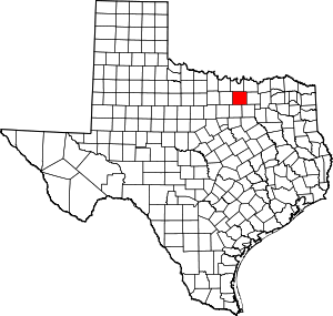 Denton County map | |
| Towns | ||
| CDPs | ||
| Other unincorporated communities | ||
| Ghost towns |
| |
| Footnotes | ‡This populated place also has portions in an adjacent county or counties | |
Municipalities and communities of Tarrant County, Texas, United States | ||
|---|---|---|
| Cities |
|  Tarrant County map |
| Towns | ||
| CDPs | ||
| Other unincorporated communities |
| |
| Historical communities | ||
| Ghost towns | ||
| Footnotes | ‡ This populated place also has portions in an adjacent county or counties ‡‡ Previously considered a census-designated place | |

| Authority control |
|
|---|