Uvalde, Texas
Uvalde (/juːˈvældi/ yoo-VAL-dee) is a city in and the county seat of Uvalde County, Texas, United States.[3] The population was 15,751 at the 2010 census.[4]
Uvalde, Texas | |
|---|---|
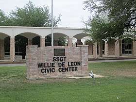 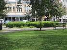   From top to bottom, left to right: Guillermo "Willie" De Leon Civic Center is named for a local World War II hero; Green space in the Uvalde Town Square; Fountain at the Leona River, Uvalde Memorial Park; Janey Slaughter Briscoe Grand Opera House, restored by the late Governor and Mrs. Dolph Briscoe | |
| Nickname(s): City of Trees; | |
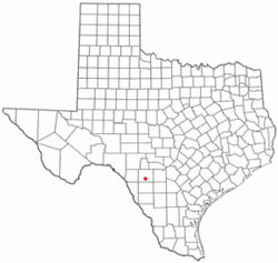 Location of Uvalde, Texas | |
 | |
| Coordinates: 29°12′52″N 99°47′23″W | |
| Country | United States |
| State | Texas |
| County | Uvalde |
| Government | |
| • Type | Council–manager |
| • City Council | Mayor Don McLaughlin City attorney Barney Knight |
| • City Manager | Vincent DiPiazza |
| Area | |
| • Total | 7.6 sq mi (19.8 km2) |
| • Land | 7.6 sq mi (19.8 km2) |
| • Water | 0.0 sq mi (0.0 km2) |
| Elevation | 909 ft (277 m) |
| Population (2010) | |
| • Total | 15,751 |
| • Density | 2,100/sq mi (800/km2) |
| Time zone | UTC-6 (Central (CST)) |
| • Summer (DST) | UTC-5 (CDT) |
| ZIP codes | 78801-78802 |
| Area code(s) | 830 |
| FIPS code | 48-74588[1] |
| GNIS feature ID | 1370541[2] |
| Website | UvaldeTX.com |
Uvalde was founded by Reading Wood Black in 1853 as the town of Encina. In 1856, when the county was organized, the town was renamed Uvalde after Spanish governor Juan de Ugalde (Cádiz, Andalucía, 1729–1816) and was chosen as county seat. It is usually considered the southern limit of the Texas Hill Country or the most northerly part of South Texas. Historically, Uvalde is known for its production of huajillo (also spelled guajillo) honey, a mild, light-colored honey, dating back to the 1870s.
Geography
Uvalde is located at 29°12′52″N 99°47′23″W (29.214313, -99.789644)[5] at the crossroads of U.S Hwy 90 and U.S. Hwy 83.[6]
According to the United States Census Bureau, the city has a total area of 7.6 square miles (19.8 km2), all of it land.[7]
Uvalde is known as one of the best locations for soaring in the United States. It is the site of the 1991 and 2012 World Gliding Championships.[8]
Climate
The climate in this area is characterized by hot, humid summers and generally mild to cool winters. According to the Köppen climate classification system, Uvalde has a humid subtropical climate, Cfa, on climate maps.[9]
Demographics
At the 2010 census,[1] the population was 15,751 people
At the 2000 census, 14,929 people, 4,796 households and 3,716 families resided in the city. The population density was 2,220.2 per square mile (857.8/km²). The 5,313 housing units averaged 790.1 per square mile (305.3/km²). The racial makeup of the city was 78.3% Hispanic or Latino, 19.2% White, 0.47% African American, 0.62% Native American, 0.48% Asian, 0.07% Pacific Islander, 0% from other races, and 2.97% from two or more races.
Of the 4,796 households, 41.8% had children under the age of 18 living with them, 55.6% were married couples living together, 16.9% had a female householder with no husband present, and 22.5% were not families; 20.1% of all households were made up of individuals and 10.4% had someone living alone who was 65 years of age or older. The average household size was 3.02 and the average family size was 3.50.
About 32.4% of the population was under the age of 18, 9.6% from 18 to 24, 25.7% from 25 to 44, 18.3% from 45 to 64, and 14.0% was 65 years of age or older. The median age was 31 years. For every 100 females, there were 90.3 males. For every 100 females age 18 and over, there were 85.5 males.
The median household income was $25,259 and for a family was $27,897. Males had a median income of $25,600 compared with $15,674 for females. The per capita income for the city was $11,735. About 24.2% of families and 29.0% of the population were below the poverty line, including 40.1% of those under age 18 and 23.8% of those age 65 or over.
Education
| Historical population | |||
|---|---|---|---|
| Census | Pop. | %± | |
| 1880 | 794 | — | |
| 1890 | 1,265 | 59.3% | |
| 1900 | 1,889 | 49.3% | |
| 1910 | 3,998 | 111.6% | |
| 1920 | 3,885 | −2.8% | |
| 1930 | 5,286 | 36.1% | |
| 1940 | 6,679 | 26.4% | |
| 1950 | 8,674 | 29.9% | |
| 1960 | 10,293 | 18.7% | |
| 1970 | 10,764 | 4.6% | |
| 1980 | 14,178 | 31.7% | |
| 1990 | 14,729 | 3.9% | |
| 2000 | 14,929 | 1.4% | |
| 2010 | 15,751 | 5.5% | |
| Est. 2019 | 16,001 | [10] | 1.6% |
| U.S. Decennial Census[11] | |||
The city is served by the Uvalde Consolidated Independent School District which serves Uvalde, Real and Zavala Counties. The school district has 10 schools.
Southwest Texas Junior College has a campus near Uvalde, next to Garner Field.
Cultural attractions
- The John Nance Garner Museum in Uvalde, which was home to John Nance Garner for 30 years, chronicles his life. Garner served as Speaker of the U.S. House of Representatives from 1931–1933 and as Franklin D. Roosevelt's Vice President from 1933 to 1941.[12] Also located in Uvalde:[13]
- The Aviation Museum at Garner Field has displays of World War II aircraft.
- The Briscoe Art and Antique Collection displays the collection of former Texas governor Dolph Briscoe.
- The Janey Slaughter Briscoe Grand Opera House hosts community theater and concerts.
Religion
- Life Church
- First Presbyterian Church
- Episcopal Church
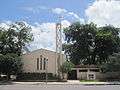
- First United Methodist Church
- First Baptist Church
- Baptist Temple Church
- Sacred Heart Catholic Church
- Trinity Evangelical Lutheran Church – Lutheran Church, Missouri Synod
- The Church of Jesus Christ of Latter-Day Saints
 First Presbyterian Church in Uvalde
 St. Philip's Episcopal Church in Uvalde
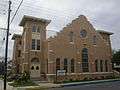 First United Methodist Church
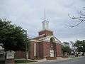 First Baptist Church of Uvalde
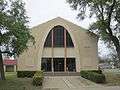 Baptist Temple in Uvalde
Transportation
Uvalde, along with San Antonio, Carrizo Springs, Crystal City, and Corpus Christi, was a major stop on the defunct San Antonio, Uvalde and Gulf Railroad, which operated from 1909 until it was merged into the Missouri Pacific Railroad in 1956. From 1909 to 1912, the SAU&G was known as the Crystal City and Uvalde Railroad. The San Antonio-to-Corpus Christi freight route is now within the Union Pacific system.[14]
The City of Uvalde owns Garner Field, a general-aviation airport east of Uvalde.[15]
Notable people
Uvalde was the home of John Nance "Cactus Jack" Garner, former Speaker of the House and Vice President of the United States; Oscar-winning actor Matthew McConaughey; actress Dale Evans, movie star and singer-songwriter and wife of Roy Rogers; and former Governor of Texas Dolph Briscoe (after whom the post office is named). The city is home to the Grammy Award-winning Tejano/Norteño group Los Palominos.
- Other notable residents include
- King Fisher, gunslinger, buried in Uvalde
- Vann McElroy, former NFL star and Super Bowl winner
- Tom O'Folliard, American outlaw, friend of Billy the Kid
- Harvey Hildebran, Texas state representative
- Ben Kinchlow, Former Co-host of The 700 Club
- Pete Conrad, Former astronaut
- Brooks Raley, MLB Pitcher for the Cincinnati Reds
Media
- Uvalde Leader-News KHJQ93.1 FM Radio playing country music airs Dallas Cowboys football and Texas State Radio News Network
See also
References
- "U.S. Census website". United States Census Bureau. Retrieved 2008-01-31.
- "US Board on Geographic Names". United States Geological Survey. 2007-10-25. Retrieved 2008-01-31.
- "Find a County". National Association of Counties. Retrieved 2011-06-07.
- "Profile of General Population and Housing Characteristics: 2010 Demographic Profile Data (DP-1): Uvalde city, Texas". United States Census Bureau. Retrieved March 28, 2012.
- "US Gazetteer files: 2010, 2000, and 1990". United States Census Bureau. 2011-02-12. Retrieved 2011-04-23.
- Sources in the city erroneously say it is "at the crossroads of the nation's two longest highways, U.S. 90 and U.S. 83." (e.g. http://www.visituvalde.com/attractions.html). Neither is the longest in the U.S.
- "Geographic Identifiers: 2010 Demographic Profile Data (G001): Uvalde city, Texas". United States Census Bureau. Retrieved March 28, 2012.
- Why Uvalde? Why Indeed!
- Climate Summary for Uvalde, Texas
- "Population and Housing Unit Estimates". Retrieved May 21, 2020.
- "Census of Population and Housing". Census.gov. Retrieved June 4, 2015.
- "John Nance Garner Museum". Museums & Institutes. The Center for American History, University of Texas at Austin. Retrieved 2008-05-25.
- "Intown Attractions". Uvalde Convention & Visitors Bureau. Retrieved 2008-05-25.
- "Nancy Beck Young, "San Antonio, Uvalde and Gulf Railroad Company"". Texas State Historical Association on-line. Retrieved April 28, 2013.
- http://www.airnav.com/airport/KUVA
- "History of Uvalde, Texas". City of Uvalde, Texas. Retrieved 2008-05-25.
External links
| Wikimedia Commons has media related to Uvalde, Texas. |
- City of Uvalde official website
- Uvalde Consolidated Independent School District
- Uvalde County website
- Uvalde High School Alumni Association
- Uvalde Area Chamber of Commerce
- Uvalde Leader-News
Places adjacent to Uvalde, Texas | ||||||||||
|---|---|---|---|---|---|---|---|---|---|---|
| ||||||||||
Municipalities and communities of Uvalde County, Texas, United States | ||
|---|---|---|
| Cities | 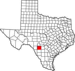 Uvalde County map | |
| CDPs | ||
| Other unincorporated community | ||
| Ghost town | ||

| Authority control |
|
|---|