Dimmitt, Texas
Dimmitt (/ˈdɪmɪt/ DIM-it[3]) is a city and county seat in Castro County, Texas, United States. The population was 4,393 at the 2010 census.[4]
Dimmitt, Texas | |
|---|---|
City | |
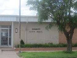 Dimmitt City Hall (2010) | |
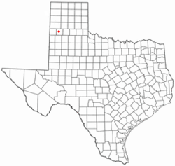 Location within Castro County and Texas | |
 | |
| Coordinates: 34°32′57″N 102°18′55″W | |
| Country | United States |
| State | Texas |
| County | Castro |
| Area | |
| • Total | 3.2 sq mi (8.4 km2) |
| • Land | 3.2 sq mi (8.2 km2) |
| • Water | 0.1 sq mi (0.3 km2) |
| Elevation | 3,875 ft (1,181 m) |
| Population (2010) | |
| • Total | 4,393 |
| • Density | 538.4/sq mi (207.9/km2) |
| Time zone | UTC-6 (Central (CST)) |
| • Summer (DST) | UTC-5 (CDT) |
| ZIP code | 79027 |
| Area code(s) | 806 |
| FIPS code | 48-20464 [1] |
| GNIS feature ID | 1356029 [2] |
History
Dimmitt is located on the old Ozark Trail, a road system from St. Louis, Missouri, to El Paso, Texas. The Ozark Trail is marked at the courthouse.
In 1942, a meteorite was discovered in Castro County and named after the town of Dimmitt. It is one of 311 approved meteorites from Texas, United States.[5]
Geography
Dimmitt is located slightly west of the center of Castro County at 34°32′57″N 102°18′55″W (34.549052, −102.315355).[6] According to the United States Census Bureau, the city has a total area of 3.2 square miles (8.4 km2), of which 3.2 square miles (8.2 km2) is land and 0.1 square miles (0.3 km2), or 3.26%, is water.[4]
U.S. Route 385 passes through the city, leading north 20 miles (32 km) to Hereford, the seat of Deaf Smith County, and south 22 miles (35 km) to Springlake. Texas State Highway 86 crosses US 385 near the center of town and leads east 32 miles (51 km) to Tulia and west 33 miles (53 km) to Bovina.
Climate
| Climate data for Dimmitt, Texas (1981–2010) | |||||||||||||
|---|---|---|---|---|---|---|---|---|---|---|---|---|---|
| Month | Jan | Feb | Mar | Apr | May | Jun | Jul | Aug | Sep | Oct | Nov | Dec | Year |
| Average high °F (°C) | 50.8 (10.4) |
55.1 (12.8) |
63.0 (17.2) |
71.6 (22.0) |
80.6 (27.0) |
88.1 (31.2) |
91.0 (32.8) |
89.1 (31.7) |
82.7 (28.2) |
72.3 (22.4) |
60.4 (15.8) |
50.2 (10.1) |
71.3 (21.8) |
| Average low °F (°C) | 21.3 (−5.9) |
23.9 (−4.5) |
30.2 (−1.0) |
37.9 (3.3) |
48.5 (9.2) |
58.0 (14.4) |
61.6 (16.4) |
60.8 (16.0) |
53.1 (11.7) |
41.5 (5.3) |
29.6 (−1.3) |
21.6 (−5.8) |
40.7 (4.8) |
| Average precipitation inches (mm) | 0.62 (16) |
0.56 (14) |
1.05 (27) |
1.06 (27) |
2.82 (72) |
3.81 (97) |
2.18 (55) |
3.32 (84) |
2.59 (66) |
1.83 (46) |
0.76 (19) |
0.77 (20) |
21.35 (542) |
| Average snowfall inches (cm) | 3.2 (8.1) |
1.9 (4.8) |
1.1 (2.8) |
0.4 (1.0) |
0.0 (0.0) |
0.0 (0.0) |
0.0 (0.0) |
0.0 (0.0) |
0.0 (0.0) |
0.1 (0.25) |
1.3 (3.3) |
3.4 (8.6) |
11.4 (29) |
| Source: NOAA[7] | |||||||||||||
Demographics
| Historical population | |||
|---|---|---|---|
| Census | Pop. | %± | |
| 1930 | 829 | — | |
| 1940 | 943 | 13.8% | |
| 1950 | 1,461 | 54.9% | |
| 1960 | 2,935 | 100.9% | |
| 1970 | 4,327 | 47.4% | |
| 1980 | 5,019 | 16.0% | |
| 1990 | 4,408 | −12.2% | |
| 2000 | 4,375 | −0.7% | |
| 2010 | 4,393 | 0.4% | |
| Est. 2018 | 4,176 | [8] | −4.9% |
| U.S. Decennial Census[9] | |||
As of the 2010 United States Census, there were 4,393 people living in the city. The racial makeup of the city was 68.8% Hispanic or Latino, 27.6% White, 2.3% Black, 0.3% Native American, 0.5% Asian, 0.1% from some other race and 0.3% from two or more races.
As of the census[1] of 2000, there were 4,375 people, 1,464 households, and 1,124 families living in the city. The population density was 2,116.4 people per square mile (816.0/km²). There were 1,692 housing units at an average density of 818.5 per square mile (315.6/km²). The racial makeup of the city was 75.02% White, 2.99% African American, 1.69% Native American, 18.10% from other races, and 2.19% from two or more races. Hispanic or Latino of any race were 56.94% of the population.
There were 1,464 households out of which 39.6% had children under the age of 18 living with them, 60.7% were married couples living together, 12.0% had a female householder with no husband present, and 23.2% were non-families. 22.1% of all households were made up of individuals and 12.4% had someone living alone who was 65 years of age or older. The average household size was 2.94 and the average family size was 3.46.
In the city, the population was spread out with 33.4% under the age of 18, 9.1% from 18 to 24, 22.2% from 25 to 44, 21.3% from 45 to 64, and 13.9% who were 65 years of age or older. The median age was 32 years. For every 100 females, there were 93.8 males. For every 100 females age 18 and over, there were 89.5 males.
The median income for a household in the city was $27,454, and the median income for a family was $33,885. Males had a median income of $24,575 versus $20,162 for females. The per capita income for the city was $14,228. About 19.0% of families and 23.1% of the population were below the poverty line, including 31.1% of those under age 18 and 16.4% of those age 65 or over.
Education
Dimmitt is served by the Dimmitt Independent School District.
Dimmitt I.S.D has a rich history of excellence in sports, mainly basketball. The Bobcats and Bobbies have won several state championships.
- Bobbies
- 1953–1954 1A-2A Dimmitt
- 1954–1955 1A Dimmitt
- 1992–1993 3A Dimmitt
- Bobcats
- 1951–1952 1A-2A Division 2 Dimmitt
- 1974–1975 2A Dimmitt
- 1981–1982 3A Dimmitt
- 1982–1983 3A Dimmitt
Healthcare
Dimmitt is served by the Castro County Healthcare System. It also serves the surrounding county and the cities of Nazareth and Hart.
Notable people
- Junior Coffey, former NFL football player
- Kent Hance, former U.S. Representative from the Texas South Plains, former member of the Texas Railroad Commission, and the chancellor of Texas Tech University in Lubbock since 2006; born in Dimmitt and graduated in 1961 from Dimmitt High School
- Bluegrass musicians Smokey Mayfield (1924–2008), Thomas Edward "Edd" Mayfield (1926–1958), and Herbert E. Mayfield (1920–2008) grew up in Dimmitt. Herb Mayfield lived there through adulthood and was a former president of the Dimmitt Rodeo Association.
- Lometa Odom (1933—2017) basketball player and coach, member of the Women's Basketball Hall of Fame
Gallery
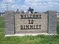 Dimmitt welcome sign
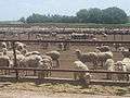 Sheep feed lot south of Dimmitt
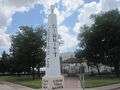 Ozark Trail in Dimmitt
 Gazebo at courthouse square in Dimmitt
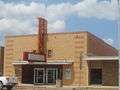 Former Carlile Theater in Dimmitt
References
- "U.S. Census website". United States Census Bureau. Retrieved 2008-01-31.
- "US Board on Geographic Names". United States Geological Survey. October 25, 2007. Retrieved January 31, 2008.
- http://www.texastripper.com/pronounce/locations-d.html
- "Geographic Identifiers: 2010 Census Summary File 1 (G001): Dimmitt city, Texas". U.S. Census Bureau, American Factfinder. Archived from the original on February 13, 2020. Retrieved July 24, 2015.
- https://www.lpi.usra.edu/meteor/metbull.php?code=7645
- "US Gazetteer files: 2010, 2000, and 1990". United States Census Bureau. February 12, 2011. Retrieved April 23, 2011.
- "NOWData – NOAA Online Weather Data". National Oceanic and Atmospheric Administration. Retrieved May 6, 2013.
- "Population and Housing Unit Estimates". Retrieved October 8, 2019.
- "Census of Population and Housing". Census.gov. Retrieved June 4, 2015.
External links
Municipalities and communities of Castro County, Texas, United States | ||
|---|---|---|
| Cities |  Castro County map | |
| Unincorporated communities | ||
See also
| Authority control |
|
|---|