The Colony, Texas
The Colony is a city in Denton County, Texas, United States, and a suburb of Dallas. The population was 36,328 at the 2010 census.
Colony, Texas | |
|---|---|
Seal | |
| Nickname(s): City by the Lake | |
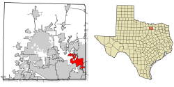 Location of Colony in Denton County, Texas | |
| Coordinates: 33°5′27″N 96°53′5″W | |
| Country | United States |
| State | Texas |
| County | Denton |
| Government | |
| • Type | Council-Manager |
| • City Council | Mayor Joe McCourry Kirk Mikulec Richard Boyer Brian Wade David Terre Perry Schrag Joel Marks |
| • City Manager | Troy Powell |
| Area | |
| • Total | 16.1 sq mi (41.7 km2) |
| • Land | 14.0 sq mi (36.3 km2) |
| • Water | 2.1 sq mi (5.4 km2) |
| Elevation | 591 ft (180 m) |
| Population (2010) | |
| • Total | 36,328 |
| • Estimate (2019) | 44,438 |
| • Density | 2,300/sq mi (870/km2) |
| Time zone | UTC-6 (CST) |
| • Summer (DST) | UTC-5 (CDT) |
| ZIP code | 75056 |
| Area code(s) | 214,469,972 |
| FIPS code | 48-72530[1] |
| GNIS feature ID | 1384043[2] |
| Website | www |
History
The Colony derives its name from the original Peters Colony. The Peters Colony headquarters was located within the current boundaries of The Colony in the historical community of Stewartsville and the site of the Hedgcoxe War.[3][4] The Colony is also the site of Bridges Settlement (established during the years of the Republic of Texas and the oldest community in Denton County), Stewarts Creek, Rector, Stoverville and Camey, also known as Camey Spur.[5]
The Colony did not exist before 1973, when home developers Fox and Jacobs (since purchased by Centex) purchased 3,000 acres of land located around State Highway 121 and Farm to Market Road 423.[6] The name "The Colony" was chosen by Fox and Jacobs because they wanted its new development to share a sense of kinship with Texas' early history and "to create a living monument to the spirit and courage of the Peters Colonists ... those men and women who braved considerable hardships to begin new lives, in new homes, on new land." [7] They planned the development to be a new "dream city" consisting primarily of single-family homes grouped as a "colony" and based on the city of Dallas' infrastructure specifications.[8] In 1973, Fox and Jacobs negotiated an agreement with the city of Frisco to begin construction in its extraterritorial jurisdiction.[9] In 1974, street construction began with many streets being named after early settlers and members of the construction crews. The first model homes were completed in August 1974 and the first families moved into their homes in October that year.[10] The homes were served for water services by The Colony Municipal Utility District formed in 1974,[11] electricity via Texas Power and Light, cable television via Lakeside CATV and telephone service via Southwestern Bell.
In 1977, the homeowners associations' petition to disannex the development from the city of Frisco's extraterritorial jurisdiction was approved.[12] The Colony voted to become an incorporated city in January 1977[13][14] and became a Home Rule City in 1979.[15] Residents of The Colony participated in two polls to select a name for the new city. Both polls chose the name "The Colony" and the name was ratified by the City Council in May 1977.[16] In 1987, The Colony voted to merge with the small lakeside community of Eastvale.[17]
Politics
The Colony is a home rule municipality with a council-manager form of government. It has a six-member council, with two members elected at large, as well as a city mayor.
Council members
| Name | Place | Term expires |
|---|---|---|
| Joe McCourry | Mayor | Nov. 2021 |
| Kirk Mikulec | One (at-large) | Nov. 2021 |
| Richard Boyer | Two (at-large) | Nov. 2021 |
| Brian Wade | Three
Mayor Pro Tem |
Nov. 2020 |
| David Terre | Four
Deputy Mayor Pro Tem |
Nov. 2020 |
| Perry Schrag | Five | Nov. 2020 |
| Joel Marks | Six | Nov. 2020 |
Geography
The Colony is located at 33°5′27″N 96°53′5″W (33.090874, -96.884659).[18]
According to the United States Census Bureau, the city has a total area of 16.1 square miles (41.7 km2), of which 14.0 square miles (36.3 km2) of it is land and 2.1 square miles (5.4 km2), or 12.93%, is water.[19]
Places adjacent to The Colony, Texas | ||||||||||
|---|---|---|---|---|---|---|---|---|---|---|
| ||||||||||
The city is bordered on the west by Lewisville Lake and the city of Lewisville, on the north and east by Frisco, and on the south by the cities of Carrollton and Plano. Approximately 23 miles (37 km) of shoreline on Lewisville Lake (including two peninsulas) are contained within the city's boundaries, thus providing the basis for the city's nickname "City by the Lake."
Climate
The Colony is part of the humid subtropical region.
Major highways
- Main lanes: Sam Rayburn Tollway
- Service roads: State Highway 121
- Farm to Market Road 423
Education
The Colony is located inside both the Lewisville Independent School District and Little Elm Independent School District. The Lewisville ISD has built six elementary schools, two middle schools and one high school inside the city limits. The elementary schools are Peters Colony Elementary, Camey Elementary, B.B. Owen Elementary, Stewart's Creek Elementary, Ethridge Elementary, and Morningside Elementary. The two middle schools are Griffin Middle School and Lakeview Middle School. The Little Elm ISD has built a K-8 STEM Academy in The Tribute subdivision.[20]
Owing to its original history as part of Frisco, The Colony is located inside the community college district, Collin College, unlike all other places in Denton County. However, since residents of The Colony do not pay taxes to said district they must pay out-of-county tuition rates to attend the college.
In May 2009, Griffin Middle School student and The Colony resident Eric Yang won the National Geographic Bee, beating out 54 other state competition champions to win a scholarship and travel package valued at more than $25,000.
High school
The Colony High School is located just north of Texas State Highway 121 on Blair Oaks Drive. The Lady Cougars soccer team won the 2007 Class AAAA soccer championship, the school's first in any sport. The Colony is home to the TopCats Drill Team as well as a renowned TCHS 350 piece marching band that participated in the 1997 Tournament of Roses Parade. The Colony Marching Band has additionally been a finalist in the Texas State UIL Marching Contest in 1988, 1990, 1991, 1992, 1994, 1996, and 2000. The Colony High School Wind Symphony was named the TMEA Class 5A Honor Band in 1997 and performed at the Midwest International Band Clinic in Chicago in 1994 and 1997, the American Bandmasters Association Convention in 2000, and at Carnegie Hall in 2001. The Colony Band has placed over 100 wind and percussion students in All-State Band and Orchestra since 1986. In 2017 The Colony Lady Cougar Softball team won the Texas 5A State Championship. Also in 2015 Theatre at The Colony one the Texas 5A State Championship for their OAP “Lost boy” and in 2017 they one another 5A State Championship for their one act play “Second Samuel”.
NBA point guard and Olympic gold medalist Deron Williams played for The Colony High School.
Hollywood stage and film actor Ethan Rains was a member of The Colony High School varsity theatre club The Colony Players class of 1999.
Current Creighton University starting point guard Austin Chatman played for The Colony High School.
Growth
Years of planning work by city leaders have translated into a strong pace of economic and community development in The Colony. Nebraska Furniture Mart broke ground September 25, 2012, on a $1.5 billion, 433-acre complex along State Highway 121 between Plano Parkway and West Spring Creek Parkway. The Omaha-based furniture retailer is owned by Warren Buffett's Berkshire Hathaway, Inc. The complex is anchored by a 1.86 million-square-foot Nebraska Furniture Mart building, and includes a 600,000-square-foot showroom. The footprint for Nebraska Furniture Mart of Texas, which opened in May 2015, is equivalent to 40 football fields and sits on approximately 90 acres. It is a part of the largest retail and entertainment destination of its kind in North America. Nebraska Furniture Mart is expected to attract over 8 million visitors and generate $600 million in sales annually.[21]
Nebraska Furniture Mart is part of a larger, 433-acre development known as Grandscape.[22] Grandscape, a 3.9 million-square-foot mixed-use project designed by Merriman Anderson Architects,[23] is expected to draw high-end retail, entertainment, hotels and office space, as well as tourist attractions.[22] High-profile tenants already joining Grandscape include Scheels All Sports and Lava Cantina.[24][25]
Infrastructure projects in The Colony include the Main Street/FM 423 Widening Project by the Texas Department of Transportation, encompassing over 10 miles of construction in three cities. Improvements in The Colony involved widening four miles of Main Street from Stewarts Creek Road to State Highway 121, which concluded in the last quarter of 2017.[26] Widening of Plano Parkway has also been completed, expanding the road from four lanes to six lanes. The Memorial-Spring Creek Connector linking Memorial Drive in The Colony to SH 121 in Plano via a railroad underpass was finished in May 2015.[27] In addition, a new overpass has been constructed to carry South Colony Boulevard over the Sam Rayburn Tollway (SH121) using a first-in-Texas design known as a diverging diamond interchange.[28][29]
While The Colony is growing, prime space is plentiful with more than 700 acres (280 ha) to develop including State Highway 121 frontage. Mixed use centers include The Cascades at The Colony; a 100-acre master-planned community consisting of 280 residences, flex office space, three hotels, and four restaurants. Another mixed use center is Austin Ranch, located west of the Dallas North Tollway and south of State Highway 121, that has prime sites for corporate campuses, commercial offices, industrial distribution parks, retail strip centers, pad sites, multi-family and single-family homes.
Demographics
| Historical population | |||
|---|---|---|---|
| Census | Pop. | %± | |
| 1980 | 11,586 | — | |
| 1990 | 22,113 | 90.9% | |
| 2000 | 26,531 | 20.0% | |
| 2010 | 36,328 | 36.9% | |
| Est. 2019 | 44,438 | [30] | 22.3% |
| U.S. Decennial Census[31] | |||
As of 2017 [32] there were 41,388 people. The racial makeup of the city was 74.6% White, 11.2% African American, 5.3% Asian, 0.4% Native American, 5.1% from other races, and 3.4% from two or more races. Hispanic or Latino of any race were 19.2% of the population.
The median income for a household in the city was $76,613, and the median income for a family was $87,353. Males had a median income of $52,494 versus $46,864 for females. The per capita income for the city was $38,732. About 4.4% of families and 6.3% of the population were below the poverty line, including 8.7% of those under age 18 and 6.7% of those age 65 or over.
As of the census[1] of 2010, there were 36,328 people, 13,168 households, and 9,472 families residing in the city. The population density was 2,256.4 people per square mile. There were 14,052 housing units at an average density of 872.8 per square mile. The racial makeup of the city was 75.4% White, 8.1% African American, 5.8% Asian, 0.8% Native American, 0.1% Pacific Islander, 6.20% from other races, and 3.5% from two or more races. Hispanic or Latino of any race were 21.2% of the population.
There were 13,168 households, out of which 41.3% had children under the age of 18 living with them, 54.9% were married couples living together, 11.5% had a female householder with no husband present, and 28.1% were non-families. 21.5% of all households were made up of individuals, and 2.5% had someone living alone who was 65 years of age or older. The average household size was 2.76 and the average family size was 3.25.
In the city, the population was spread out, with 27.0% under the age of 18, 9% from 18 to 24, 33.9% from 25 to 44, 25.1% from 45 to 64, and 5% who were 65 years of age or older. The median age was 33.1 years. For every 100 females there were 99.8 males. For every 100 females age 18 and over, there were 96.2 males.
There were a total of 14,052 housing units, of which 884 (6.3%) were vacant. There were 9,022 or 68.5% owner-occupied housing units and 4,146 or 31.5% renter-occupied housing units.
References
- "U.S. Census website". United States Census Bureau. Retrieved 2008-01-31.
- "US Board on Geographic Names". United States Geological Survey. 2007-10-25. Retrieved 2008-01-31.
- "The Colony Historical Map 1841-1969, prepared by The Colony GIS Department, The Colony Public Library History Collection, 2009".
- Texas State Historical Commission. "The Hedgcoxe War Historical Marker". Retrieved August 8, 2009.
- "'Bridges to the Future,' 1st edition, Donald J. Beckel, published by The Friends of The Colony Public Library, The Colony Public Library History Collection, 2012".
- "Oral history interview with Ron Walden, Fox & Jacobs Acquisition Manager, The Colony Public Library Oral History Project, May 3, 1985".
- "Untitled Fox & Jacobs new resident question and answer booklet, The Colony Public Library History Collection, circa 1975".
- "'Man who helped shape The Colony to be in walk,' Denton Record Chronicle, Page 4, Aug. 6, 1998".
- "Oral history interview with Dave Fox, owner of Fox and Jacobs, The Colony Public Library History Collection, May 11, 1985".
- "'1st Three Families Settle in F&J's Lake Colony,' Dallas Morning News, Oct. 20, 1974".
- "The Colony Municipal Utility District No. 1 of Denton County, Texas, microfilm, The Colony City Secretary's Office, March 29, 1974".
- "Frisco City Council Regular Meeting, Item 7, Pages 1-2, Ordinance No. 421, Jan. 4, 1977".
- "'The Colony's voters decide to incorporate,' Dallas Morning News, Jan. 16, 1977".
- http://www.legis.state.tx.us/tlodocs/85R/billtext/pdf/SR00042F.pdf#navpanes=0
- "Minutes of The Board of Alderman of The City of The Colony, TX, Jan. 22, 1979".
- "Minutes of Regular Meeting (Board of Alderman), The City of The Colony, May 16, 1977".
- "'Merger receives public approval Saturday,' The Colony Leader, The Colony Public Library History Collection, Aug. 12, 1987".
- "US Gazetteer files: 2010, 2000, and 1990". United States Census Bureau. 2011-02-12. Retrieved 2011-04-23.
- "Geographic Identifiers: 2010 Demographic Profile Data (G001): The Colony city, Texas". United States Census Bureau. Retrieved June 29, 2012.
- Prestwick STEM Academy homepage
- "NFM Texas Press Release" (PDF). Archived from the original (PDF) on 2014-03-06.
- "Grandscape website".
- Murray, Barbra. "MAA Tapped to Design $1.3B Dallas Project".
- "Grandscape press release" (PDF).
- "The Dallas Morning News".
- "City of The Colony website".
- "City of The Colony press release" (PDF).
- "Diverging Diamond Interchange Concept".
- "City of The Colony press release" (PDF).
- "Population and Housing Unit Estimates". Retrieved May 21, 2020.
- "Census of Population and Housing". Census.gov. Retrieved June 4, 2015.
- "Races in The Colony, Texas (TX): White, Black, Hispanic, Asian. Ancestries, Foreign born residents, place of birth - Detailed Stats". www.city-data.com. Retrieved 2019-02-08.
External links
- City of The Colony official website
- The Colony Economic Development Corporation
- The Colony Community Development Corporation
- The Colony Convention & Visitors Bureau
- The Colony Public Library
- The Colony Chamber of Commerce
- TheColony.org
- The Local Business Directory
Municipalities and communities of Denton County, Texas, United States | ||
|---|---|---|
| Cities | 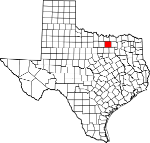 Denton County map | |
| Towns | ||
| CDPs | ||
| Other unincorporated communities | ||
| Ghost towns |
| |
| Footnotes | ‡This populated place also has portions in an adjacent county or counties | |