Silverton, Texas
Silverton is a city in Briscoe County, Texas, United States. The population was 731 at the 2010 census.[3] It is the county seat of Briscoe County.[4]
Silverton, Texas | |
|---|---|
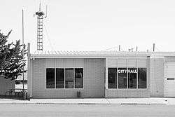 City Hall (2014) | |
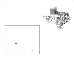
 Location of Silverton, Texas | |
 | |
| Coordinates: 34°28′17″N 101°18′17″W | |
| Country | United States |
| State | Texas |
| County | Briscoe |
| Area | |
| • Total | 1.0 sq mi (2.6 km2) |
| • Land | 1.0 sq mi (2.6 km2) |
| • Water | 0.0 sq mi (0.0 km2) |
| Elevation | 3,278 ft (999 m) |
| Population (2010) | |
| • Total | 731 |
| • Density | 730/sq mi (280/km2) |
| Time zone | UTC-6 (Central (CST)) |
| • Summer (DST) | UTC-5 (CDT) |
| ZIP code | 79257 |
| Area code(s) | 806 |
| FIPS code | 48-67904 [1] |
| GNIS feature ID | 1368288 [2] |
Geography
Silverton is located in west-central Briscoe County at 34°28′17″N 101°18′17″W (34.471256, -101.304749).[5] Texas State Highway 86 passes through the city, leading southeast 17 miles (27 km) to Quitaque and west 27 miles (43 km) to Tulia near Interstate 27. Texas State Highway 207 leads south from Silverton 35 miles (56 km) to Floydada and north 52 miles (84 km) to Claude.
According to the United States Census Bureau, Silverton has a total area of 1.0 square mile (2.6 km2), all of it land.[3]
Climate
According to the Köppen Climate Classification system, Silverton has a semi-arid climate, abbreviated "BSk" on climate maps.[6]
Demographics
| Historical population | |||
|---|---|---|---|
| Census | Pop. | %± | |
| 1920 | 416 | — | |
| 1930 | 873 | 109.9% | |
| 1940 | 684 | −21.6% | |
| 1950 | 857 | 25.3% | |
| 1960 | 1,098 | 28.1% | |
| 1970 | 1,026 | −6.6% | |
| 1980 | 918 | −10.5% | |
| 1990 | 779 | −15.1% | |
| 2000 | 771 | −1.0% | |
| 2010 | 731 | −5.2% | |
| Est. 2018 | 675 | [7] | −7.7% |
| U.S. Decennial Census[8] | |||
At the 2000 census there were 771 people, 303 households, and 217 families living in the city. The population density was 766.4 people per square mile (294.7/km²). There were 362 housing units at an average density of 359.8/sq mi (138.4/km²). The racial makeup of the city was 79.51% White, 0.52% African American, 0.78% Native American, 15.69% from other races, and 3.50% from two or more races. Hispanic or Latino of any race were 28.15%.[1]
Of the 303 households 31.7% had children under the age of 18 living with them, 60.7% were married couples living together, 7.6% had a female householder with no husband present, and 28.1% were non-families. 26.4% of households were one person and 16.5% were one person aged 65 or older. The average household size was 2.54 and the average family size was 3.09.
The age distribution was 28.7% under the age of 18, 7.3% from 18 to 24, 22.7% from 25 to 44, 21.1% from 45 to 64, and 20.2% 65 or older. The median age was 38 years. For every 100 females, there were 86.7 males. For every 100 females age 18 and over, there were 88.4 males.
The median household income was $27,014 and the median family income was $32,308. Males had a median income of $23,750 versus $16,750 for females. The per capita income for the city was $13,416. About 12.1% of families and 17.6% of the population were below the poverty line, including 29.4% of those under age 18 and 12.3% of those age 65 or over.
Education
The community of Silverton is served by the Silverton Independent School District and home to the Silverton High School Owls.
References
- "U.S. Census website". United States Census Bureau. Retrieved 2008-01-31.
- "US Board on Geographic Names". United States Geological Survey. 2007-10-25. Retrieved 2008-01-31.
- "Geographic Identifiers: 2010 Demographic Profile Data (G001): Silverton city, Texas". U.S. Census Bureau, American Factfinder. Archived from the original on February 12, 2020. Retrieved April 22, 2014.
- "Find a County". National Association of Counties. Retrieved 2011-06-07.
- "US Gazetteer files: 2010, 2000, and 1990". United States Census Bureau. 2011-02-12. Retrieved 2011-04-23.
- Climate Summary for Silverton, Texas
- "Population and Housing Unit Estimates". Retrieved March 3, 2020.
- "Census of Population and Housing". Census.gov. Retrieved June 4, 2015.
External links
Municipalities and communities of Briscoe County, Texas, United States | ||
|---|---|---|
| Cities | 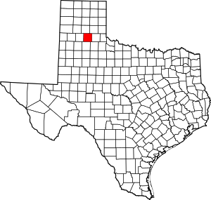 Briscoe County map | |
| Ghost town | ||
| Authority control |
|
|---|