Lamesa, Texas
Lamesa (/ləˈmiːsə/ lə-MEE-sə)[3] is a city in and the county seat of Dawson County, Texas, United States.[4] The population was 9,422 at the 2010 census,[5] down from 9,952 at the 2000 census. Located south of Lubbock on the Llano Estacado, Lamesa was founded in 1903. Most of the economy is based on cattle ranching and cotton farming. The Preston E. Smith prison unit, named for the former governor of Texas, is located just outside Lamesa.[6]
Lamesa, Texas | |
|---|---|
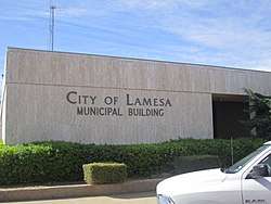 Lamesa City Hall | |
| Motto(s): Together, Progress with a Purpose | |
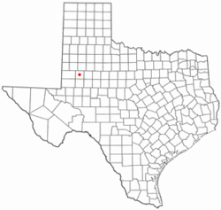 Location of Lamesa, Texas | |
 | |
| Coordinates: 32°44′4″N 101°57′29″W | |
| Country | United States |
| State | Texas |
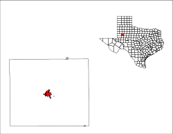
| County | Dawson |
| Government | |
| • Mayor | Josh Stevens |
| Area | |
| • Total | 5.0 sq mi (13.0 km2) |
| • Land | 5.0 sq mi (12.9 km2) |
| • Water | 0.04 sq mi (0.1 km2) |
| Elevation | 2,992 ft (912 m) |
| Population (2010) | |
| • Total | 9,422 |
| • Density | 1,891/sq mi (730.3/km2) |
| Time zone | UTC-6 (Central (CST)) |
| • Summer (DST) | UTC-5 (CDT) |
| ZIP code | 79331 |
| Area code(s) | 806 |
| FIPS code | 48-41164[1] |
| GNIS feature ID | 1339590[2] |
| Website | www |
Geography
Lamesa is located in the center of Dawson County at 32°44′4″N 101°57′29″W (32.734439, -101.958190).[7] U.S. Highway 87 (Lynn Avenue) passes through the eastern side of the city, leading north 61 miles (98 km) to Lubbock and southeast 44 miles (71 km) to Big Spring. U.S. Highway 180 passes through the center of town as 4th Street and leads west 41 miles (66 km) to Seminole and east 62 miles (100 km) to Snyder. Texas State Highway 137 passes through the city as Bryan Avenue and leads northwest 38 miles (61 km) to Brownfield and south 45 miles (72 km) to Stanton. Texas State Highway 349 branches off Highway 137 south of Lamesa and leads southwest 55 miles (89 km) to Midland.
According to the United States Census Bureau, the city has a total area of 5.0 square miles (13.0 km2), of which 0.03 square miles (0.08 km2), or 0.62%, is water.[5]
Dal Paso Museum
The Dal Paso Museum, a collection of local artifacts housed in an impressive former hotel, is located in downtown Lamesa. The name is derived from the fact that Lamesa is located on the table land of the Staked Plains. On display are home furnishings, pioneer tools, ranch and farm equipment, and exhibits by local artists. The museum, at 306 South First Street, has limited afternoon hours to the public.[8]
Demographics
| Historical population | |||
|---|---|---|---|
| Census | Pop. | %± | |
| 1920 | 1,188 | — | |
| 1930 | 3,528 | 197.0% | |
| 1940 | 6,038 | 71.1% | |
| 1950 | 10,704 | 77.3% | |
| 1960 | 12,438 | 16.2% | |
| 1970 | 11,559 | −7.1% | |
| 1980 | 11,790 | 2.0% | |
| 1990 | 10,809 | −8.3% | |
| 2000 | 9,952 | −7.9% | |
| 2010 | 9,422 | −5.3% | |
| Est. 2018 | 9,042 | [9] | −4.0% |
| U.S. Decennial Census[10] | |||
As of the census[1] of 2000, 9,952 people, 3,696 households, and 2,679 families resided in the city. The population density was 2,080.8 people per square mile (803.9/km²). The 4,270 housing units averaged 892.8 per square mile (344.9/km²). The racial makeup of the city was 41.9% White non-Hispanic, 4.2% African American, 0.7% Native American, 0.19% Asian, 19.51% from other races, and 2.13% from two or more races. Hispanics or Latinos of any race were 52.96% of the population.
Of the 3,696 households, 34.4% had children under the age of 18 living with them, 56.5% were married couples living together, 12.2% had a female householder with no husband present, and 27.5% were not families. About 25.5% of all households were made up of individuals, and 14.6% had someone living alone who was 65 years of age or older. The average household size was 2.66 and the average family size was 3.20.
In the city, the population was distributed as 29.7% under the age of 18, 8.0% from 18 to 24, 24.4% from 25 to 44, 20.4% from 45 to 64, and 17.4% who were 65 years of age or older. The median age was 36 years. For every 100 females, there were 90.1 males. For every 100 females age 18 and over, there were 83.3 males.
The median income for a household in the city was $27,362, and for a family was $31,556. Males had a median income of $26,393 versus $16,826 for females. The per capita income for the city was $16,211. About 18.1% of families and 21.9% of the population were below the poverty line, including 33.4% of those under age 18 and 12.9% of those age 65 or over.
Notable people
- Barry Corbin, actor
- V. O. Key, Jr., political scientist
- Lynn Morris, bluegrass musician
- Steve Pearce, U.S. Representative from New Mexico
- Bo Robinson, NFL player
- Preston Smith, Governor of Texas
- Jerry Taff, journalist
- Don Walser, country musician
Education
Lamesa is served by the Lamesa Independent School District, which includes Lamesa High School and Lamesa Middle School, whose school mascots are the Golden Tornadoes.
A branch of Howard College, a community college in Big Spring, is located in Lamesa.
Miscellany
During the last weekend of April, Lamesa hosts the annual Chicken-fried Steak Cook-off. Lamesa has been called "the birthplace of the chicken-fried steak", but the reporter who made the designation later confessed that the claim is fictional. Nevertheless, in 2011, Governor Rick Perry declared Lamesa the home of the chicken-fried steak. In the 2013 competition, Mayor Dave Nix teamed with city councilman Greg Hughes as contestants. The community event attracted 65 sponsors and 104 booths.[11]
La Entrada al Pacifico is an international trade corridor that begins in Topolobampo, Mexico, runs through Midland-Odessa and ends in Lamesa (according to the legal definition).
Lamesa's Sky-Vue Drive-In Theater at 3015 South Dallas Avenue, established in 1948, became a well-known regional fixture. It has been closed since a kitchen fire destroyed the snack bar on November 27, 2015. Known for its "Chihuahua sandwich", conceived by owners R. A. "Skeet" Noret and his wife, Sarah,[12] the Sky-Vue was one of only 14 remaining drive-in theaters in Texas. Others are in Lubbock and Clarendon. Before he became famous, musician Buddy Holly performed on the roof of the Sky Vue's projector building.[13] The theater was also used as cover art and named in the title of country music album Down at the Sky-Vue Drive-In by country music artist Don Walser. Additionally, "Hot Rod Mercury", track number two from the album, sings about life in Lamesa. Lamesa also has an indoor movie theater, Movieland, which has two screens. The Wall is an edifice on which graduating seniors of Lamesa High School spray-paint their names onto the wall until next year's class adds its own graffiti on top.
The CBS television series Dallas had one of its more profitable oil wells, Ewing 23, in Lamesa. In one of the more dramatic scenes of the series, in season four, J. R. Ewing flies in his Learjet to the Lamesa airport. Shortly thereafter, gunfire erupts and Dawson County sheriff's deputies shoot a man who blew up the oilfield after a failed effort to blackmail Ewing.[14]
Media
The city is served by a biweekly newspaper, The Lamesa Press Reporter, which charges $.75 per issue, and by local and area radio stations KPET (AM 690), KBKN (FM), KTXC (FM), and KJJT (FM). The cable TV system is operated by Northland Cable Television. Other signals are received from stations in Lubbock, Midland-Odessa, and other area towns. Television signals are provided by ABC, CBS, NBC, PBS, Fox, Telemundo and CW stations in Lubbock and the Univision station in the Permian Basin (Midland-Odessa).[15]
Climate
According to the Köppen climate classification system, Lamesa has a semiarid climate, BSk on climate maps.[16] The town is known for hot summers (frequently topping 100 °F (38 °C)) and cold winter nights (where the temperature goes below freezing on an average of 91 nights). The average annual temperature is 61.4 °F (16.3 °C), making it the ninth-coldest place in Texas after cities such as Amarillo and Lubbock. Lamesa averages 17.6 inches (45 cm) of rain and 4 inches (10 cm) of snow annually.[17][18]
Photo gallery
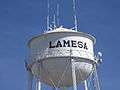 Lamesa water tower
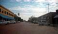 A view of downtown Lamesa
 Entrance to Dal Paseo Museum in Lamesa, located in a former hotel
 The Sky-Vue Drive-in Theater in Lamesa operated from 1948 until its concession stand burned in November 2015 and the facility closed for further business.
 No longer in use, the Tower Theater is located in downtown Lamesa across from the Dawson County Courthouse.
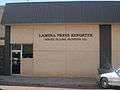 Lamesa Press Reporter newspaper office
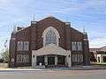 First Baptist Church of Lamesa at 801 S 1st St.
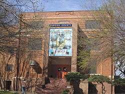 Dawson County Courthouse in downtown Lamesa
References
- "U.S. Census website". United States Census Bureau. Retrieved 2008-01-31.
- "US Board on Geographic Names". United States Geological Survey. 2007-10-25. Retrieved 2008-01-31.
- Texas State Historical Association. "Texas Almanac Pronunciation Guide" (PDF). Texas Almanac. Retrieved 10 October 2013.
- "Find a County". National Association of Counties. Retrieved 2011-06-07.
- "Geographic Identifiers: 2010 Demographic Profile Data (G001): Lamesa city, Texas". American Factfinder. U.S. Census Bureau. Archived from the original on February 13, 2020. Retrieved January 7, 2016.
- Texas Department of Criminal Justice Archived 2007-11-20 at the Wayback Machine Retrieved on 2007-11-08
- "US Gazetteer files: 2010, 2000, and 1990". United States Census Bureau. 2011-02-12. Retrieved 2011-04-23.
- Texas Transportation Commission, Texas State Travel Guide, 2007, p. 123
- "Population and Housing Unit Estimates". Retrieved August 16, 2019.
- "Census of Population and Housing". Census.gov. Retrieved June 4, 2015.
- "Chris Hoff, "Chicken Fried Steak Festival keeps growing", April 27, 2013". Lubbock Avalanche-Journal. Retrieved April 29, 2013.
- "Sky-Vue Drive-In". cinematreasures.org. Retrieved February 26, 2017.
- "Drive In Movies in Texas".
- Dallas, Season four, Episode eight, "Trouble at Ewing 23".
- FCC Retrieved on 2007-11-08
- "Lamesa, Texas Köppen Climate Classification (Weatherbase)". Weatherbase. Retrieved 19 September 2018.
- "Texas Climate Top 10 Lists". web2.airmail.net. Archived from the original on 3 June 2017. Retrieved 19 September 2018.
- "Lamesa, Texas Climate". www.bestplaces.net. Retrieved 19 September 2018.
External links
| Wikimedia Commons has media related to Lamesa, Texas. |
Municipalities and communities of Dawson County, Texas, United States | ||
|---|---|---|
| Cities |  Dawson County map | |
| CDP | ||
| Other unincorporated communities | ||
| Footnotes | ‡This populated place also has portions in an adjacent county or counties | |

| Authority control |
|
|---|