Stanton, Texas
Stanton is a city in and the county seat of Martin County, Texas, United States.[3] The population was 2,492 at the 2010 census.
Stanton, Texas | |
|---|---|
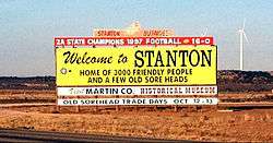 Welcome to Stanton sign on I-20 | |
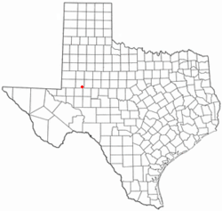 Location of Stanton, Texas | |
 | |
| Coordinates: 32°7′51″N 101°47′31″W | |
| Country | United States |
| State | Texas |
| County | Martin |
| Area | |
| • Total | 1.8 sq mi (4.6 km2) |
| • Land | 1.8 sq mi (4.5 km2) |
| • Water | 0.0 sq mi (0.0 km2) |
| Elevation | 2,664 ft (812 m) |
| Population (2010) | |
| • Total | 2,492 |
| • Density | 1,458.1/sq mi (563.0/km2) |
| Time zone | UTC-6 (Central (CST)) |
| • Summer (DST) | UTC-5 (CDT) |
| ZIP code | 79782 |
| Area code(s) | 432 |
| FIPS code | 48-70040[1] |
| GNIS feature ID | 1347803[2] |
History
In 1887, New York native John Scharbauer established a cattle ranch in what later became known as Stanton.[4]
Geography
Stanton is located at 32°7′51″N 101°47′31″W (32.130740, -101.792072).[5]
According to the United States Census Bureau, the city has a total area of 1.8 square miles (4.7 km2), of which, 1.8 square miles (4.7 km2) of it is land and 0.56% is water.
Demographics
| Historical population | |||
|---|---|---|---|
| Census | Pop. | %± | |
| 1930 | 1,384 | — | |
| 1940 | 1,245 | −10.0% | |
| 1950 | 1,603 | 28.8% | |
| 1960 | 2,228 | 39.0% | |
| 1970 | 2,117 | −5.0% | |
| 1980 | 2,314 | 9.3% | |
| 1990 | 2,576 | 11.3% | |
| 2000 | 2,556 | −0.8% | |
| 2010 | 2,492 | −2.5% | |
| Est. 2018 | 3,011 | [6] | 20.8% |
| U.S. Decennial Census[7] | |||
At the 2000 census there were 2,556 people, 854 households, and 651 families living in the city. The population density was 1,458.1 people per square mile (563.9/km²). There were 1,002 housing units at an average density of 571.6 per square mile (221.1/km²). The racial makeup of the city was 73.98% White, 2.86% African American, 0.74% Native American, 0.31% Asian, 19.56% from other races, and 2.54% from two or more races. Hispanic or Latino of any race were 52.90%.[1]
Of the 854 households 44.8% had children under the age of 18 living with them, 59.0% were married couples living together, 13.7% had a female householder with no husband present, and 23.7% were non-families. 22.7% of households were one person and 13.0% were one person aged 65 or older. The average household size was 2.92 and the average family size was 3.44.
The age distribution was 35.0% under the age of 18, 7.9% from 18 to 24, 26.0% from 25 to 44, 16.7% from 45 to 64, and 14.4% 65 or older. The median age was 30 years. For every 100 females, there were 87.4 males. For every 100 females age 18 and over, there were 84.9 males.
The median household income was $27,961 and the median family income was $32,768. Males had a median income of $27,647 versus $18,333 for females. The per capita income for the city was $13,634. About 19.7% of families and 22.0% of the population were below the poverty line, including 26.0% of those under age 18 and 22.0% of those age 65 or over.
Notable people
- Craig Eiland, Texas state representative from Galveston; born in Stanton in 1962
References
- "U.S. Census website". United States Census Bureau. Retrieved 2008-01-31.
- "US Board on Geographic Names". United States Geological Survey. 2007-10-25. Retrieved 2008-01-31.
- "Find a County". National Association of Counties. Retrieved 2011-06-07.
- Collett, James (2010). Midland. Mount Pleasant, South Carolina: Arcadia Publishing. p. 28. ISBN 9780738578965. Retrieved January 4, 2016.
- "US Gazetteer files: 2010, 2000, and 1990". United States Census Bureau. 2011-02-12. Retrieved 2011-04-23.
- "Population and Housing Unit Estimates". Retrieved December 15, 2019.
- "Census of Population and Housing". Census.gov. Retrieved June 4, 2015.
External links
Municipalities and communities of Martin County, Texas, United States | ||
|---|---|---|
| Cities |  Martin County map | |
| Unincorporated communities | ||
| Footnotes | ‡This populated place also has portions in an adjacent county or counties | |

| Authority control |
|
|---|