Royse City, Texas
Royse City is a city in Rockwall County in the U.S. state of Texas. It also extends into Collin and Hunt counties. The population was 2,957 at the 2000 census, rising to 9,349 in 2010.[1] The estimated population in 2018 was 12,998.[2]
Royse City, Texas | |
|---|---|
.jpg) Main Street in Royse City | |
| Motto(s): "A Friendly Touch of Texas" | |
 Location of Royse City in Rockwall County, Texas | |
| Coordinates: 32°58′27″N 96°19′58″W | |
| Country | |
| State | |
| Counties | Rockwall, Collin, Hunt |
| Government | |
| • Type | Council-Manager |
| • City Council | Mayor Janet Nichol Clay Ellis Bill Bell Brooks Williams James Branch Tom Crowley |
| • City Manager | Carl Alsabrook |
| Area | |
| • Total | 15.1 sq mi (39.2 km2) |
| • Land | 15.0 sq mi (38.9 km2) |
| • Water | 0.1 sq mi (0.3 km2) |
| Elevation | 554 ft (169 m) |
| Population | |
| • Total | 9,349 |
| • Estimate (2019)[2] | 14,702 |
| • Density | 805/sq mi (311.0/km2) |
| Time zone | UTC-6 (CST) |
| • Summer (DST) | UTC-5 (CDT) |
| ZIP code | 75189 |
| Area code(s) | 214, 972, 469 |
| FIPS code | 48-63668[3] |
| GNIS feature ID | 1345732[4] |
| Website | www |
History
Garrett Burgess Griffin Royse, better known as Byrd Royse, was born in Adair County, Kentucky, on January 31, 1838, to William and Mary Stone Royse. He was the seventh of fourteen children. Around 1850, Royse's future grandmother-in-law, Mrs. Nancy McCasland, and her sons bought several tracts of land that were later to be known as Royse City.
Royse was instrumental in getting the Missouri, Kansas and Texas Railway line brought from Greenville to Dallas through Rockwall County. Royse City was settled in 1885, when the railway came through the area. The town was named after G. B. Royse, who plotted the town and sold the first lots.[5]
After its founding, Royse City preserved its stable small country town status due to its proximity to Garland (21 miles away) and Dallas (33 miles).[6]
Interstate 30 was constructed just south of the city in the mid-1960s.[7] The city grew south to meet the interstate.
In 2000, Royse City had a population of 2,957. Still a small town, Royse City was feeling the impacts of the rapid growth of the Dallas-Fort Worth area, along with Rockwall County. The city's location along Interstate 30 between Rockwall and Greenville helped to fuel this growth.
Royse City has grown rapidly to the north and to the south as newer subdivisions have been built. By 2010, Royse City had a population of 9,349. This represents a growth rate of 216.2%, according to the U.S. Census Bureau.[1]
Geography
Royse City is located in the northeast corner of Rockwall County at 32°58′27″N 96°19′58″W (32.974257, −96.332827).[8] The city now extends north into Collin County and east into Hunt County.
According to the United States Census Bureau, Royse City has a total area of 15.1 square miles (39.2 km2), of which 15.0 square miles (38.9 km2) is land and 0.1 square miles (0.3 km2), or 0.75%, is water.[1]
Demographics
| Historical population | |||
|---|---|---|---|
| Census | Pop. | %± | |
| 1890 | 299 | — | |
| 1900 | 503 | 68.2% | |
| 1910 | 1,210 | 140.6% | |
| 1920 | 1,289 | 6.5% | |
| 1930 | 1,128 | −12.5% | |
| 1940 | 1,190 | 5.5% | |
| 1950 | 1,266 | 6.4% | |
| 1960 | 1,274 | 0.6% | |
| 1970 | 1,535 | 20.5% | |
| 1980 | 1,566 | 2.0% | |
| 1990 | 2,206 | 40.9% | |
| 2000 | 2,957 | 34.0% | |
| 2010 | 9,349 | 216.2% | |
| Est. 2019 | 14,702 | [2] | 57.3% |
| U.S. Decennial Census[9] | |||
As of the census[3] of 2000, there were 2,957 people, 1,027 households, and 781 families residing in the city. The population density was 289.8 people per square mile (111.9/km2). There were 1,089 housing units at an average density of 106.7 per square mile (41.2/km2). The racial makeup of the city was 79.44% White, 7.51% African American, 0.47% Native American, 0.54% Asian, 9.54% from other races, and 2.50% from two or more races. Hispanic or Latino of any race were 20.97% of the population.
There were 1,027 households out of which 44.3% had children under the age of 18 living with them, 56.0% were married couples living together, 14.5% had a female householder with no husband present, and 23.9% were non-families. 20.5% of all households were made up of individuals and 10.5% had someone living alone who was 65 years of age or older. The average household size was 2.88 and the average family size was 3.34.
In the city, the population was spread out with 32.3% under the age of 18, 9.4% from 18 to 24, 32.1% from 25 to 44, 16.3% from 45 to 64, and 9.9% who were 65 years of age or older. The median age was 30 years. For every 100 females, there were 96.7 males. For every 100 females age 18 and over, there were 91.7 males.
--The median income for a household in the city was $42,266, and the median income for a family was $48,804. Males had a median income of $30,966 versus $23,804 for females. The per capita income for the city was $17,153. About 8.4% of families and 10.4% of the population were below the poverty line, including 12.0% of those under age 18 and 10.2% of those age 65 or over.
Economy
Royse City serves as a bedroom community for nearby Dallas and Greenville. Most of the development in the city is residential.
The local economy consists of service businesses, restaurants, stores, schools, and medical offices. Restaurants include Denny's, McDonald's, Taco Bell, Sonic, Subway, Jack in the Box, Quizno's, Rice Express (Chinese), Arby's, Dairy Queen, and Soulman's Bar-B-Que. A Holiday Inn Express and a Family Dollar are nearby. OMi Cranes, a crane manufacturer, is located at the western edge of the city. All of these are along Interstate 30.[10] In June 2019, the popular travel center chain Buc-ee's added a store in Royse City with great anticipation from the city. [11]
In 2007, Royse City was designated as an official Texas Main Street City. The Royse City Main Street program was set up to promote the city's downtown area, where the goals are to foster a thriving business district while preserving historic buildings.[12] Some attractions downtown include Anchored Bliss Boutique, Arbeledas Mexican Grill, Jimmy's Donuts, Los Pinos Mexican, Luigi's Italian Cafe, Milano's Pizza, Domino's Pizza, Main Street Cafe and Joe's Meat Market (groceries).[13]
In 2015, construction was completed on an overpass at Interstate 30 and Erby Campbell Blvd. Walmart and CVS opened stores in Royse City shortly thereafter.[14]
Education
Public schools
Royse City is served by the Royse City Independent School District.
Transportation
Roads
Interstate 30
Interstate 30 is the primary route through Royse City. To the west, Interstate 30 goes through Rockwall, Dallas, and Fort Worth. To the east, Interstate 30 goes through Greenville, Sulphur Springs, Texarkana, and Little Rock.
Four exits on Interstate 30 serve Royse City, and they are (from west to east):
- Erby Campbell Blvd. – A north–south route that has become a focus of commercial development. Walmart has opened on the northwest corner. A CVS is on the northeast corner. Anita Scott Elementary School is to the south. The Truth Campus charter school is to the north.
- Farm Road 548 / Royse City – A primary north–south route through Royse City (known as "Elm Street"). The historic downtown is north. Subdivisions are south. Shopping areas are along the freeway.
- Farm Road 35 – An east–west route through the southern part of Royse City.
- Farm Road 2642 – A north–south route. Royse City High School is along Farm Road 2642.
The Interstate 30 frontage roads have recently been converted to one-way for safety due to increased traffic.
Texas State Highway 66
Texas State Highway 66 is a state east–west route that goes through Rockwall, Rowlett, and Garland (to the west), and ends at Greenville (to the east). The highway goes through the historic downtown, paralleling Interstate 30.
Other roadways
Farm Road 1777 — A north–south route on the east side of the city. The Royse City Middle School is at the corner of Texas State Highway 66 and Farm Road 1777.
Farm Road 2453 — A north–south route that start at Farm Road 35 and heads south. The Stone River Golf Club is along Farm Road 2453.
Houston Street — A north–south route that runs through the city's historic downtown.
County Line Road — An east–west route, running along the county line between Rockwall and Collin, that serves the city's historic downtown.
Airports
The nearest airports with passenger air service are Dallas Love Field (36.2 miles)[15] and Dallas-Fort Worth International Airport (50.8 miles).[16]
The nearest private airports are the Rockwall Municipal Airport (8.4 miles), Caddo Mills (7 miles),[17] and the Greenville Municipal Airport – Majors Airport (18.3 miles).[18]
Notable people
- Gus Ketchum, baseball player
- Glen Payne, musician
- Taylor Hearn, baseball player
References
- "Geographic Identifiers: 2010 Census Summary File 1 (G001): Royse City city, Texas". U.S. Census Bureau, American Factfinder. Archived from the original on February 13, 2020. Retrieved August 3, 2015.
- "Population and Housing Unit Estimates". Retrieved August 16, 2019.
- "U.S. Census website". United States Census Bureau. Retrieved 2008-01-31.
- "US Board on Geographic Names". United States Geological Survey. 2007-10-25. Retrieved 2008-01-31.
- "Royse City, Texas". Texas State Historical Association. Retrieved August 9, 2012.
- "Royse City, Texas - A Friendly Touch of Texas". roysecity.com. Archived from the original on 25 October 2012. Retrieved 8 August 2015.
- Slotboom, Oscar. "Old Road Maps of Texas, 1942–73". Archived from the original on 2009-04-12.
- "US Gazetteer files: 2010, 2000, and 1990". United States Census Bureau. 2011-02-12. Retrieved 2011-04-23.
- "Census of Population and Housing". Census.gov. Retrieved June 4, 2015.
- "Google Maps". Google Maps. Retrieved 8 August 2015.
- https://www.roysecityheraldbanner.com/news/local_news/buc-ees-announces-grand-opening-date/article_16e7c13c-8665-11e9-8d3d-7788223bbcf4.html
- "Royse City, Texas - Main Street - A Friendly Touch of Texas". roysecity.com. Retrieved 8 August 2015.
- "Google Maps". Google Maps. Retrieved 8 August 2015.
- "Royse City CDC Official Website". roysecitycdc.org. Retrieved 8 August 2015.
- "Google Maps". Google Maps. Retrieved 8 August 2015.
- "Google Maps". Google Maps. Retrieved 8 August 2015.
- "AIRPORT INFO - ROCKWALL FLITE CENTER". flyrockwall.com. Retrieved 8 August 2015.
- "Greenville, TX - Official Website - Airport". greenville.tx.us. Retrieved 8 August 2015.
External links
Municipalities and communities of Collin County, Texas, United States | ||
|---|---|---|
| Cities |  Collin County map | |
| Towns | ||
| CDP | ||
| Other unincorporated communities |
| |
| Historical communities | ||
| Ghost towns | ||
| Footnotes | ‡This populated place also has portions in an adjacent county or counties | |
Municipalities and communities of Hunt County, Texas, United States | ||
|---|---|---|
| Cities | 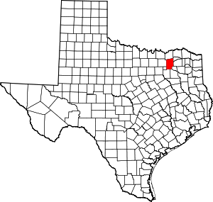 Hunt County map | |
| Town | ||
| Unincorporated communities | ||
| Footnotes | ‡This populated place also has portions in an adjacent county or counties | |
Municipalities and communities of Rockwall County, Texas, United States | ||
|---|---|---|
| Cities | 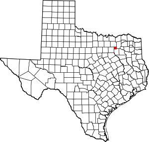 Rockwall County map | |
| Footnotes | ‡This populated place also has portions in an adjacent county or counties | |
| Authority control |
|
|---|