West Tawakoni, Texas
West Tawakoni is a city in Hunt County, Texas, United States. The population was 1,576 at the 2010 census,[4] and the estimated population in 2018 was 1,943.[5] West Tawakoni is located on the west side of Lake Tawakoni, while its twin city East Tawakoni is located on the east side of the lake in Rains County.
West Tawakoni, Texas | |
|---|---|
.jpg) West Tawakoni City Park | |
| Nickname(s): "Catfish Capital of Texas"[1] | |
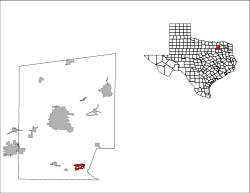
 Location of West Tawakoni, Texas | |
 | |
| Coordinates: 32°54′9″N 96°1′28″W | |
| Country | United States |
| State | Texas |
| County | Hunt |
| Area | |
| • Total | 2.21 sq mi (5.73 km2) |
| • Land | 2.20 sq mi (5.69 km2) |
| • Water | 0.02 sq mi (0.04 km2) |
| Elevation | 456 ft (139 m) |
| Population (2010) | |
| • Total | 1,576 |
| • Density | 717/sq mi (276.7/km2) |
| Time zone | UTC-6 (Central (CST)) |
| • Summer (DST) | UTC-5 (CDT) |
| ZIP code | 75474 |
| Area code(s) | 903 |
| FIPS code | 48-77896[2] |
| GNIS feature ID | 1349816[3] |
| Website | www |
Geography
West Tawakoni is located in southeastern Hunt County at 32°54′9″N 96°1′28″W (32.902544, -96.024452).[6] It is bordered on three sides by Lake Tawakoni, a reservoir on the Sabine River. To the north is the lake's Caddo Inlet, to the south are Waco Bay and Kitsee Inlet, and to the east is the main body of the lake. Texas State Highway 276 passes through the northern part of the city, leading east across the lake 6 miles (10 km) to East Tawakoni and west the same distance to Quinlan. Greenville, the Hunt county seat, is 22 miles (35 km) to the north via Highway 276 and Highway 34, while downtown Dallas is 48 miles (77 km) to the west.
According to the United States Census Bureau, West Tawakoni has a total area of 2.2 square miles (5.7 km2), of which 0.02 square miles (0.04 km2), or 0.67%, are water.[4]
Demographics
| Historical population | |||
|---|---|---|---|
| Census | Pop. | %± | |
| 1970 | 465 | — | |
| 1980 | 840 | 80.6% | |
| 1990 | 932 | 11.0% | |
| 2000 | 1,462 | 56.9% | |
| 2010 | 1,576 | 7.8% | |
| Est. 2018 | 1,943 | [5] | 23.3% |
| U.S. Decennial Census[7] | |||
As of the census[2] of 2000, there were 1,462 people, 600 households, and 384 families residing in the city. The population density was 696.9 people per square mile (268.8/km²). There were 759 housing units at an average density of 361.8 per square mile (139.5/km²). The racial makeup of the town was 93.30% White, 0.07% African American, 2.39% Native American, 0.48% Asian, 1.85% from other races, and 1.92% from two or more races. Hispanic or Latino of any race were 4.31% of the population.
There were 600 households out of which 29.8% had children under the age of 18 living with them, 45.5% were married couples living together, 12.3% had a female householder with no husband present, and 36.0% were non-families. 28.0% of all households were made up of individuals and 11.5% had someone living alone who was 65 years of age or older. The average household size was 2.44 and the average family size was 2.91.
In the city, the population was spread out with 26.1% under the age of 18, 6.9% from 18 to 24, 27.4% from 25 to 44, 25.2% from 45 to 64, and 14.4% who were 65 years of age or older. The median age was 38 years. For every 100 females, there were 104.5 males. For every 100 females age 18 and over, there were 104.5 males.
The median income for a household in the city was $31,481, and the median income for a family was $35,250. Males had a median income of $30,139 versus $18,839 for females. The per capita income for the city was $16,293. About 14.3% of families and 17.4% of the population were below the poverty line, including 24.6% of those under age 18 and 7.3% of those age 65 or over.
Education
West Tawakoni is served by the Quinlan Independent School District.
References
- "The City of West Tawakoni". City of West Tawakoni. Retrieved March 20, 2018.
- "U.S. Census website". United States Census Bureau. Retrieved 2008-01-31.
- "US Board on Geographic Names". United States Geological Survey. 2007-10-25. Retrieved 2008-01-31.
- "Geographic Identifiers: 2010 Census Summary File 1 (G001): West Tawakoni city, Texas". American Factfinder. U.S. Census Bureau. Archived from the original on February 13, 2020. Retrieved March 20, 2018.
- "Population and Housing Unit Estimates". Retrieved May 30, 2019.
- "US Gazetteer files: 2010, 2000, and 1990". United States Census Bureau. 2011-02-12. Retrieved 2011-04-23.
- "Census of Population and Housing". Census.gov. Retrieved June 4, 2015.
External links
Municipalities and communities of Hunt County, Texas, United States | ||
|---|---|---|
| Cities | 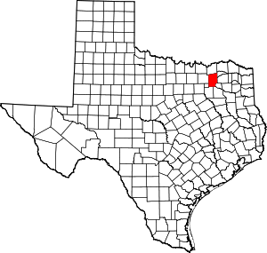 Hunt County map | |
| Town | ||
| Unincorporated communities | ||
| Footnotes | ‡This populated place also has portions in an adjacent county or counties | |