Falfurrias, Texas
Falfurrias (/fælˈfjʊəriəs/ fal-FYOOR-ee-əs) is a city in and the county seat of Brooks County, Texas.[3] The population was 4,981 at the 2010 census.[4] The town is named for founder Edward Cunningham Lasater's ranch, La Mota de Falfurrias. In 1893, the Falfurrias ranch was one of the largest in Texas at some 350,000 acres (1,400 km2). The town has made recent headlines due to a close proximity to a United States Border Patrol interior checkpoint off Highway 281.[5]
Falfurrias, Texas | |
|---|---|
| Motto(s): "The Land of Heart's Delight" | |
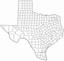 Location of Falfurrias, Texas | |
 | |
| Coordinates: 27°13′36″N 98°8′42″W | |
| Country | United States |
| State | Texas |
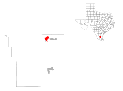
| County | Brooks |
| Government | |
| • Type | Council-Manager |
| • City Council | Mayor David longloria
Homer Salinas Justo Ramirez Martin Cabrera Aaron Treviño Manual Perez |
| • City Administrator | David Flores |
| Area | |
| • Total | 2.9 sq mi (7.4 km2) |
| • Land | 2.9 sq mi (7.4 km2) |
| • Water | 0.0 sq mi (0.0 km2) |
| Elevation | 115 ft (35 m) |
| Population (2010) | |
| • Total | 4,981 |
| • Density | 1,742/sq mi (672.4/km2) |
| Time zone | UTC-6 (Central (CST)) |
| • Summer (DST) | UTC-5 (CDT) |
| ZIP code | 78355 |
| Area code(s) | 361 |
| FIPS code | 48-25368[1] |
| GNIS feature ID | 1335669[2] |
| Website | www |
Falfurrias and Brooks County were featured in a 2014 Latino USA story on illegal immigration in South Texas.[6]
Geography
Falfurrias is located in northeastern Brooks County at 27°13′36″N 98°8′42″W (27.226529, -98.144922).[7] The city is centered on the intersection of U.S. Highway 281 (Future Interstate 69C) and State Highway 285. Falfurrias is approximately 78 miles (126 km) southwest of Corpus Christi, 90 miles (140 km) east of Laredo, and 36 miles (58 km) south of Alice.[8]
According to the United States Census Bureau, the city has a total area of 2.9 square miles (7.4 km2), all land.[4]
History
Falfurrias' founding and development were largely due to the efforts of Edward Cunningham Lasater, a pioneer Rio Grande Valley rancher and developer.[8] In 1895, he started a cattle ranch in what was then northern Starr County. At one point, it was one of the largest ranches in Texas. With the extension of the San Antonio and Aransas Pass Railway south from Alice to his ranch in 1904, Lasater founded the town of Falfurrias and subdivided a sizable portion of his ranch land for sale to other farmers.[9] In 1898, a post office opened in the community. A local newspaper began publication in 1906. Lasater brought in his Jersey cows and established a creamery in 1909.[10] Sweet cream butter and other products from Edward Lasater's creamery company made the town a familiar name across the state.[9] But that butter is no longer made from milk produced in Falfurrias. Don Pedro Jaramillo, a Mexican-born curandero known as "The Healer of Los Olmos", was buried in Falfurrias in 1907 and is venerated at a shrine there.
The state granted a petition by local residents to form a new county, Brooks, with Falfurrias as its county seat in 1911. Irrigation methods introduced to the area in the 1920s brought in truck farming and the citrus fruit industry. The city became a primary trade and shipping center for the surrounding region. The area received another economic boost in the 1930s and 1940s when extensive oil and gas reserves were discovered around Falfurrias.[8]
The city had a population of 6,712 in 1950, which declined throughout the latter half of the twentieth century. There were 5,297 people living in Falfurrias in 2000 and 4,981 in 2010.[4]
The U.S. Customs and Border Protection opened a Border checkpoint outside Falfurrias in 1940.[11] It was most recently renovated in 2019 adding new cameras and X-ray machines.[12] According to an NPR report he station has been increasingly busy due to a surge of migrants coming from Central America.[13] Some have called to close the checkpoint because of the supposed link to immigrant deaths in the region.[14]
Name origin
The name "Falfurrias" antedates Anglo association with the area, and its derivation is uncertain.[8] Town founder Edward C. Lasater claimed that it was a Lipan word meaning "the land of heart's delight". Others believed that it was the Spanish name for a native desert flower known as the heart's delight. Another theory is that Falfurrias is a misspelling of one or another Spanish or French word. Still another theorizes that the name refers to a local shepherd named Don Filfarrias. The term filfarrias is Mexican slang for "dirty and untidy".[8][15]
Climate
Falfurrias has a hot semi-arid climate (Köppen BSh), bordering on a humid subtropical climate (Cfa) and characterized by very hot, humid, but generally dry summers and warm, dry winters with cold mornings. During the summer, the weather is very unpleasant owing to the heat and humidity, and twelve mornings can be expected to stay at or above 77 °F or 25 °C, with twenty-two mornings staying this hot in June 1998 and the hottest morning on record being 86 °F (30 °C) on August 19 and 20 of 1915. The hottest temperature on record has been 116 °F (46.7 °C) on July 13, 2016, whilst twenty-six afternoons over 100 °F or 37.8 °C can be expected each year, and 146 afternoons can be expected to exceed or reach 90 °F (32.2 °C). Rain is uncommon during summer, but remnants of hurricanes sometimes produce very heavy falls: on August 10 and 11 1980 a total of 12.1 inches (307.3 mm) fell in forty-eight hours, including a daily total of 7.36 inches (186.9 mm) on August 10. September and October bring less extreme, though still hot weather with the wettest conditions during the year. In the extremely wet September 1967 a whopping 32.78 inches (832.6 mm) fell, including 25.10 inches (637.5 mm) in four days from the 19th to the 22nd due to Hurricane Beulah.
The winter months are the driest and mildest, although average afternoon temperatures remain above 68 °F or 20 °C all year. There can be expected to be seven mornings falling to or below freezing each winter, although no freezes whatsoever occurred during the winters of 1952–53 and 1994–95, whereas as many as fifteen mornings fell to or below freezing in January 1918. The coldest temperature on record has been 9 °F (−12.8 °C) on January 12, 1962 – the temperature subsequently climbed to 88 °F or 31.1 °C on January 15 – and the coldest maximum 26 °F (−3.3 °C) on December 23, 1989. Occasionally a strong easterly flow from the Gulf will disturb the normally dry winter conditions: 9.81 inches (249.2 mm) fell in January 1958, yet only 0.97 inches (24.6 mm) was recorded in five months from November 1970 to March 1971 – including a 115-day entirely rainless spell from October 6 to January 28.
Overall the wettest calendar year in Falfurrias has been 1967 with 55.15 inches (1,400.8 mm) and the driest 1917 with only 8.98 inches (228.1 mm). The hottest month on record has been June 1998 with a mean of 90.4 °F (32.4 °C) and a mean maximum of 103.1 °F (39.5 °C); however August 1923's mean maximum was 103.8 °F or 39.9 °C. The coolest month has been December 1989 with a mean of 47.4 °F (8.6 °C); however the coolest month by mean maximum has been December 1914 at 58.4 °F (14.7 °C).
| Climate data for Falfurrias, Texas (1981–2010; extremes 1907–present) | |||||||||||||
|---|---|---|---|---|---|---|---|---|---|---|---|---|---|
| Month | Jan | Feb | Mar | Apr | May | Jun | Jul | Aug | Sep | Oct | Nov | Dec | Year |
| Record high °F (°C) | 96 (36) |
102 (39) |
105 (41) |
110 (43) |
110 (43) |
115 (46) |
116 (47) |
112 (44) |
111 (44) |
101 (38) |
97 (36) |
97 (36) |
116 (47) |
| Average high °F (°C) | 68.9 (20.5) |
72.6 (22.6) |
79.1 (26.2) |
85.5 (29.7) |
90.9 (32.7) |
95.5 (35.3) |
97.0 (36.1) |
97.8 (36.6) |
92.3 (33.5) |
86.3 (30.2) |
77.7 (25.4) |
70.1 (21.2) |
84.5 (29.2) |
| Average low °F (°C) | 42.5 (5.8) |
46.1 (7.8) |
52.2 (11.2) |
59.5 (15.3) |
67.3 (19.6) |
71.3 (21.8) |
72.1 (22.3) |
71.9 (22.2) |
68.6 (20.3) |
60.1 (15.6) |
51.7 (10.9) |
44.4 (6.9) |
59.0 (15.0) |
| Record low °F (°C) | 9 (−13) |
15 (−9) |
17 (−8) |
30 (−1) |
35 (2) |
51 (11) |
60 (16) |
60 (16) |
43 (6) |
28 (−2) |
20 (−7) |
13 (−11) |
9 (−13) |
| Average rainfall inches (mm) | 1.13 (29) |
1.53 (39) |
1.14 (29) |
1.46 (37) |
3.10 (79) |
2.85 (72) |
3.08 (78) |
2.49 (63) |
4.07 (103) |
3.23 (82) |
1.12 (28) |
1.27 (32) |
26.47 (671) |
| Average rainy days (≥ 0.01 inch) | 5 | 5 | 4 | 4 | 5 | 5 | 5 | 4 | 7 | 5 | 3 | 5 | 59 |
| Source: NOAA[16] | |||||||||||||
Demographics
| Historical population | |||
|---|---|---|---|
| Census | Pop. | %± | |
| 1950 | 6,712 | — | |
| 1960 | 6,515 | −2.9% | |
| 1970 | 6,355 | −2.5% | |
| 1980 | 6,103 | −4.0% | |
| 1990 | 5,788 | −5.2% | |
| 2000 | 5,297 | −8.5% | |
| 2010 | 4,981 | −6.0% | |
| Est. 2018 | 4,833 | [17] | −3.0% |
| U.S. Decennial Census[18] | |||
As of the census[1] of 2000, there were 5,297 people, 1,801 households, and 1,354 families residing in the city. The population density was 1,926.4 people per square mile (743.7/km²). There were 2,062 housing units at an average density of 749.9 per square mile (289.5/km²). The racial makeup of the city was 75.21% White, 0.25% African American, 0.55% Native American, 0.13% Asian, 0.11% Pacific Islander, 21.56% from other races, and 2.19% from two or more races. Hispanic or Latino of any race were 92.54% of the population.
There were 1,801 households out of which 38.2% had children under the age of 18 living with them, 48.0% were married couples living together, 21.8% had a female householder with no husband present, and 24.8% were non-families. 22.8% of all households were made up of individuals and 12.4% had someone living alone who was 65 years of age or older. The average household size was 2.90 and the average family size was 3.41.
In the city, the population was distributed as follows: 32.2% under the age of 18, 8.9% from 18 to 24, 23.5% from 25 to 44, 20.7% from 45 to 64, and 14.7% 65 years of age or older. The median age was 34 years. For every 100 females, there were 90.5 males. For every 100 females age 18 and over, there were 85.6 males.
The median income for a household in the city was $15,000, and the median income for a family was $18,208. Males had a median income of $23,438 versus $17,973 for females. The per capita income for the city was $9,573. About 43.3% of families and 46.2% of the population were below the poverty line, including 58.0% of those under age 18 and 37.9% of those age 65 or over.
Education
Falfurrias is served by the Brooks County Independent School District. Schools are:
- Falfurrias Lasater School [Grades Pre-K - 2nd]
- Falfurrias Elementary School [Grades 2nd - 4th]
- Falfurrias Jr. High School [Grades 6th - 7th]
- Falfurrias High School [Grades 9th - 13th]
Notable people
- Larry Arnhart, writer and scholar
- Mauricio González de la Garza, Mexican writer, journalist and composer[19]
See also
References
- "U.S. Census website". United States Census Bureau. Retrieved 2008-01-31.
- "US Board on Geographic Names". United States Geological Survey. 2007-10-25. Retrieved 2008-01-31.
- "Find a County". National Association of Counties. Archived from the original on 2011-05-31. Retrieved 2011-06-07.
- "Geographic Identifiers: 2010 Demographic Profile Data (G001): Falfurrias city, Texas". U.S. Census Bureau, American Factfinder. Archived from the original on February 12, 2020. Retrieved April 22, 2014.
- "This Is America. Do You Belong Here? Navigating the Checkpoints of the Southwest Border". The New York Times. March 28, 2019. Retrieved November 7, 2019.
- Migrant Deaths in Brooks County Texas - Latino USA - Latino USA
- "US Gazetteer files: 2010, 2000, and 1990". United States Census Bureau. 2011-02-12. Retrieved 2011-04-23.
- "Falfurrias, Texas". The Handbook of Texas online. Retrieved 2008-05-10.
- "Edward Cunningham Lasater". The Handbook of Texas online. Retrieved 2008-05-10.
- "Falfurrias, Texas". Texas Escapes Online Magazine. Retrieved 2009-05-10.
- "Falfurrias Station". U. S. Customs and Border Protection. Retrieved November 7, 2019.
- Hendricks, Dave (September 5, 2019). "Border Patrol holds ribbon-cutting for new Falfurrias checkpoint". progress times. Retrieved November 7, 2019.
- Westervelt, Eric (June 12, 2019). "As Migrants Stream In At The Border, Inland Checkpoints Feel The Strain". NPR News. Retrieved November 7, 2019.
- Wilder, Forrest (May 20, 2015). "To Save Lives, Close the Falfurrias Border Patrol Checkpoint". Texas Observer. Retrieved November 7, 2019.
- "Falfurrias, Texas Tourism". Exploring America's Highways. Retrieved 2008-05-10.
- "NOWData - NOAA Online Weather Data". National Oceanic and Atmospheric Administration. Retrieved May 6, 2013.
- "Population and Housing Unit Estimates". Retrieved September 25, 2019.
- "Census of Population and Housing". Census.gov. Retrieved June 4, 2015.
- HoyTamaulipas - Rodarán cabezas en Nuevo Laredo
External links
Municipalities and communities of Brooks County, Texas, United States | ||
|---|---|---|
| City | 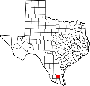 Brooks County map | |
| CDPs | ||
| Other unincorporated community | ||

| Authority control |
|
|---|