Farwell, Texas
Farwell is a city in and the county seat of Parmer County, Texas, United States.[3] The population was 1,363 at the 2010 census. The city is located on the Texas-New Mexico border with the city of Texico, New Mexico across the border.
Farwell, Texas | |
|---|---|
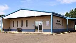 Farwell City Hall | |
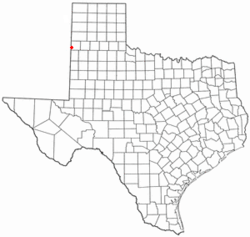 Location of Farwell, Texas | |
 | |
| Coordinates: 34°22′59″N 103°2′18″W | |
| Country | United States |
| State | Texas |
| County | Parmer |
| Area | |
| • Total | 0.8 sq mi (2.1 km2) |
| • Land | 0.8 sq mi (2.1 km2) |
| • Water | 0.0 sq mi (0.0 km2) |
| Elevation | 4,144 ft (1,263 m) |
| Population (2010) | |
| • Total | 1,363 |
| • Density | 1,700/sq mi (650/km2) |
| Time zone | UTC-6 (Central (CST)) |
| • Summer (DST) | UTC-5 (CDT) |
| ZIP code | 79325 |
| Area code(s) | 806 |
| FIPS code | 48-25548[1] |
| GNIS feature ID | 1357260[2] |
History
Farwell began as a cow-camp for the XIT Ranch, the huge ranch that was established in 1880. Farwell was named for brothers Charles B. and John V. Farwell of Lake Forest, Illinois, who built the Texas State Capitol building in exchange for 3,050,000 acres of ranchland. That region of Texas had been controlled by the Comanche from about 1725, when they defeated the Apache and forced them to migrate to the Rockies in New Mexico and to other regions. The Red River War of 1874-1875—the biggest military operation the U.S. had between the Civil War and World War One—saw five armies converge on that part of the High Plains, ultimately defeating the main Comanche force in Palo Duro Canyon (80 miles northeast of Farwell) by driving off and slaughtering the Comanches' horses.
The Farwell brothers established the XIT on their new land, ultimately employing 800 cowboys, stringing over 6,000 miles of barbed wire, and hiring former Texas Rangers to defeat the hundreds of cattle rustlers operating across the state line in the New Mexico territory. Many researchers hold that the XIT ultimately failed because of that massive rustling operation, ultimately persuading stock-holders to begin selling off the ranch to families who came to that part of the High Plains drawn by the cheap price of land. It is not documented when the cow-camp that would become Farwell was established but when Parmer County was created in 1907 (previously part of Deaf Smith County to its north), the election was held for county seat in a contest between Farwell, Bovina, Parmerton, and Friona, all to Farwell's northeast, all which had started as cow-camps but had varying success thus far in attracting settlers who ran saloons, stores, stables, and other services for the cowboys. Parmerton was initially voted county seat that year and a one-story courthouse was built there.[4][5]
The election was hotly contested by politicians in the other towns and a new vote was scheduled. Cowboys, who were the largest demographic, lived in their saddles and sleeping bags most of the time with no fixed address. A new regulation was established that each man would vote in the place where he did his laundry. Farwell, possessing the only laundry at that time, thus received all the cowboy votes, even though Friona was, and remains, about four times the size of Farwell, and so Farwell became county seat in the 1908 vote. The Farwell courthouse was erected quickly thereafter. When the decision was made to begin selling off the XIT to settlers, they would arrive in Farwell on the railroad which had reached there in 1899, linking rail to the east with rail to the west of the Rockies Mountains via the track laid between Farwell (and her sister city on the other side of the state line, Texico, New Mexico, also about 1,300 people today) to Belen, New Mexico. Farwell lies at the junction of two branches of the Santa Fe Railway: one branch goes northeast toward Amarillo and the other southeast toward Lubbock. Families from across America arrived by train, stayed in the 4-story Farwell Hotel, and toured the available homestead sites by touring cars.
Many of the families then arrived in Farwell and the rest of the region in covered wagons and established their homes in dug-outs in the prairie soil (there being no stone or trees indigenous to the area for construction). Dry-land farming and herding were always risky but families persevered year by year, often relying entirely on their small windmill pumping enough water for the home, a milk cow, some chickens, a few fruit trees, and vegetable gardens when crops and cattle withered during droughts and wind storms.
When the premier historian of U.S. western history, Walter Prescott Webb, wrote that the American character sprang from the unforgiving conditions of the High Plains, he could have had Farwell and its surrounding ranchers and farmers in mind.
One of the few obelisks marking the Ozark Trail (auto trail) is located at Farwell City Park. The lighted structure was unveiled in 2010 at a cost of $11,000. The Ozark Trail extended from St. Louis, Missouri, to Santa Fe, New Mexico. Other such markers are in Wellington, Dimmitt, and Tulia, Texas.[6]
For years there has been a simmering dispute over which state Farwell is lawfully a part of: Texas or New Mexico? The straight north-south border between the two states was originally defined as the 103rd meridian, but the 1859 survey that was supposed to mark that boundary mistakenly set the border between 2.29 and 3.77 miles too far west of that line, making the current towns of Farwell, Texline and a part of Glenrio appear to be within the State of Texas. New Mexico's short border with Oklahoma, in contrast, was surveyed on the correct meridian. New Mexico's draft constitution in 1910 stated that the border is on the 103rd meridian as intended. The disputed strip, hundreds of miles long, includes parts of valuable oilfields of the Permian Basin. A bill was passed in the New Mexico Senate to fund and file a lawsuit in the U.S. Supreme Court to recover the strip from Texas, but the bill did not become law. Today, land in the strip is included in Texas land surveys and the land and towns for all purposes are taxed and governed by the State of Texas.[7]
Geography
Farwell lies on the level plains of the Llano Estacado at 34°22′59″N 103°2′18″W (34.382919, -103.038339).[8] According to the United States Census Bureau, the city has a total area of 0.8 square miles (2.1 km2), all of it land.
Farwell is located 10 miles (16 km) east of Clovis, New Mexico and 88 miles (142 km) northwest of Lubbock, Texas. 95 miles (152.888 km) southwest of Amarillo, Texas.
Demographics
| Historical population | |||
|---|---|---|---|
| Census | Pop. | %± | |
| 1960 | 1,009 | — | |
| 1970 | 1,185 | 17.4% | |
| 1980 | 1,354 | 14.3% | |
| 1990 | 1,373 | 1.4% | |
| 2000 | 1,364 | −0.7% | |
| 2010 | 1,363 | −0.1% | |
| Est. 2018 | 1,319 | [9] | −3.2% |
| U.S. Decennial Census[10] | |||
As of the census[1] of 2000, there were 1,364 people, 499 households, and 346 families residing in the city. The population density was 1,666.8 people per square mile (642.2/km²). There were 560 housing units at an average density of 684.3 per square mile (263.7/km²). The racial makeup of the city was 75.00% White, 0.44% African American, 0.51% Native American, 1.03% Asian, 20.82% from other races, and 2.20% from two or more races. Hispanic or Latino of any race were 31.96% of the population.
There were 499 households out of which 34.9% had children under the age of 18 living with them, 56.9% were married couples living together, 9.6% had a female householder with no husband present, and 30.5% were non-families. 28.1% of all households were made up of individuals and 17.2% had someone living alone who was 65 years of age or older. The average household size was 2.58 and the average family size was 3.18.
In the city, the population was spread out with 27.9% under the age of 18, 6.8% from 18 to 24, 24.8% from 25 to 44, 20.6% from 45 to 64, and 19.9% who were 65 years of age or older. The median age was 39 years. For every 100 females, there were 88.7 males. For every 100 females age 18 and over, there were 80.9 males.
The median income for a household in the city was $29,808, and the median income for a family was $34,676. Males had a median income of $27,448 versus $21,181 for females. The per capita income for the city was $15,875. About 13.9% of families and 16.7% of the population were below the poverty line, including 22.8% of those under age 18 and 13.7% of those age 65 or over.
Education
The City of Farwell is served by the Farwell Independent School District.
The Farwell Lady Blue won their first Class 2A State Championship in 2002, a 47-35 victory against Brock in front of 8,870 fans at the Frank Erwin Center at the University of Texas at Austin. In 2001, the first year the Lady Blue had competed in Class 2A, the Lady Blue's inexperience in big games showed as it lost a two-point semifinal match-up against Salado. In 2002, the Lady Blue survived its non-district schedule, finishing with a more-than-respectable 14-6 record. Farwell finished second in District 4-2A, losing only twice to seventh-ranked Hale Center by a combined six points. While the girls team had never traveled to Austin for the basketball tournament, the Farwell Steers (boys) advanced there in 1989. Farwell's girls' athletic teams were originally known as the Steerettes but now have the mascot Lady Blue after the school's official colors. The Lady Blue cross country team has made the trip to state three seasons in a row.
Notable people
- Charlie Phillips, singer, songwriter [11]
- Addie Peed Swearingen, philanthropist
Gallery
 Obelisk commemorating Ozark Trail (auto trail) in Farwell, Texas
 Plaque on Ozark Trail in Farwell, TX
 Monument honoring early pioneer in Farwell, TX
 Parmer County courthouse in Farwell
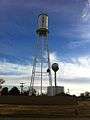 Two water towers in Farwell
 Monument commemorating the Farwell brothers for whom the town is named, founders of the XIT Ranch
 Spanish poster in Farwell, evidence of growing Spanish-speaking population
References
- "U.S. Census website". United States Census Bureau. Retrieved 2008-01-31.
- "US Board on Geographic Names". United States Geological Survey. 2007-10-25. Retrieved 2008-01-31.
- "Find a County". National Association of Counties. Archived from the original on 2011-05-31. Retrieved 2011-06-07.
- Barnett, Lana Payne (1979). Presenting the Texas Panhandle. Lan-Bea.
- Parmer County Historical Society (1974). A History of Parmer County. Nortex.
- Will Anderson of State Line Tribune in Farwell, "Resurrection of the Ozark Trail Marker in Farwell, Texas," West Texas Historical Association annual meeting, Lubbock, Texas, April 2, 2011
- Daniel Gertson. "Border War Brewing?". Retrieved 2016-09-24.
- "US Gazetteer files: 2010, 2000, and 1990". United States Census Bureau. 2011-02-12. Retrieved 2011-04-23.
- "Population and Housing Unit Estimates". Retrieved January 28, 2020.
- "Census of Population and Housing". Census.gov. Retrieved June 4, 2015.
- Hacker, Bobby (March). "Charlie "Sugartime" Phillips". American Music Magazine. 126 (2001): 38. Check date values in:
|date=(help)
External links
| Wikimedia Commons has media related to Farwell, Texas. |
Municipalities and communities of Parmer County, Texas, United States | ||
|---|---|---|
| Cities |  Parmer County map | |
| Unincorporated community | ||
| Ghost towns | ||

| Authority control |
|
|---|