Taos, Missouri
Taos is a city in Cole County, Missouri, United States. The population was 878 at the 2010 census. It is part of the Jefferson City, Missouri Metropolitan Statistical Area.
Taos, Missouri | |
|---|---|
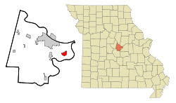 Location of Taos, Missouri | |
| Coordinates: 38°30′7″N 92°4′58″W | |
| Country | United States |
| State | Missouri |
| County | Cole |
| Area | |
| • Total | 2.27 sq mi (5.88 km2) |
| • Land | 2.23 sq mi (5.78 km2) |
| • Water | 0.04 sq mi (0.10 km2) |
| Elevation | 728 ft (222 m) |
| Population | |
| • Total | 878 |
| • Estimate (2018)[3] | 1,150 |
| • Density | 390/sq mi (150/km2) |
| Time zone | UTC-6 (Central (CST)) |
| • Summer (DST) | UTC-5 (CDT) |
| ZIP code | 65101 |
| Area code(s) | 573 |
| FIPS code | 29-72304[4] |
| GNIS feature ID | 0755575[5] |
History
Taos was laid out in 1849.[6] The city was named after Taos, New Mexico.[7] A post office called Taos was established in 1848, and remained in operation until 1907.[8]
The St. Francis Xavier Catholic Church and Rectory was listed on the National Register of Historic Places in 2016.[9]
Geography
Taos is located at 38°30′7″N 92°4′58″W (38.502043, -92.082680).[10]
According to the United States Census Bureau, the city has a total area of 2.27 square miles (5.88 km2), of which 2.23 square miles (5.78 km2) is land and 0.04 square miles (0.10 km2) is water.[1]
Demographics
| Historical population | |||
|---|---|---|---|
| Census | Pop. | %± | |
| 1980 | 759 | — | |
| 1990 | 802 | 5.7% | |
| 2000 | 870 | 8.5% | |
| 2010 | 878 | 0.9% | |
| Est. 2018 | 1,150 | [3] | 31.0% |
| U.S. Decennial Census[11] | |||
2010 census
As of the census[2] of 2010, there were 878 people, 331 households, and 249 families residing in the city. The population density was 393.7 inhabitants per square mile (152.0/km2). There were 340 housing units at an average density of 152.5 per square mile (58.9/km2). The racial makeup of the city was 98.7% White, 0.5% Native American, 0.2% Asian, and 0.6% from two or more races. Hispanic or Latino of any race were 1.0% of the population.
There were 331 households of which 41.1% had children under the age of 18 living with them, 62.5% were married couples living together, 8.8% had a female householder with no husband present, 3.9% had a male householder with no wife present, and 24.8% were non-families. 21.8% of all households were made up of individuals and 11.8% had someone living alone who was 65 years of age or older. The average household size was 2.65 and the average family size was 3.10.
The median age in the city was 37.7 years. 28.4% of residents were under the age of 18; 6.5% were between the ages of 18 and 24; 25.5% were from 25 to 44; 25.4% were from 45 to 64; and 14% were 65 years of age or older. The gender makeup of the city was 48.2% male and 51.8% female.
2000 census
As of the census[4] of 2000, there were 870 people, 312 households, and 238 families residing in the city. The population density was 386.5 people per square mile (149.3/km²). There were 315 housing units at an average density of 139.9 per square mile (54.1/km²). The racial makeup of the city was 99.66% White, 0.11% Native American, and 0.23% from two or more races. Hispanic or Latino of any race were 0.11% of the population.
There were 312 households out of which 42.6% had children under the age of 18 living with them, 67.6% were married couples living together, 6.7% had a female householder with no husband present, and 23.7% were non-families. 20.5% of all households were made up of individuals and 9.0% had someone living alone who was 65 years of age or older. The average household size was 2.79 and the average family size was 3.28.
In the city, the population was spread out with 30.6% under the age of 18, 6.4% from 18 to 24, 32.4% from 25 to 44, 20.7% from 45 to 64, and 9.9% who were 65 years of age or older. The median age was 35 years. For every 100 females, there were 100.5 males. For every 100 females age 18 and over, there were 91.7 males.
The median income for a household in the city was $50,333, and the median income for a family was $55,714. Males had a median income of $32,202 versus $22,356 for females. The per capita income for the city was $18,481. About 0.8% of families and 2.3% of the population were below the poverty line, including 1.2% of those under age 18 and 6.3% of those age 65 or over.
Notable person
Taos is the home of former major league baseball relief pitcher, Tom Henke (known in his playing days as "The Terminator") who won the 1992 World Series with the Toronto Blue Jays and, in the final season of his career, pitched for the St. Louis Cardinals.
References
- "US Gazetteer files 2010". United States Census Bureau. Archived from the original on 2012-01-25. Retrieved 2012-07-08.
- "U.S. Census website". United States Census Bureau. Retrieved 2012-07-08.
- "Population and Housing Unit Estimates". Retrieved February 25, 2020.
- "U.S. Census website". United States Census Bureau. Retrieved 2008-01-31.
- "US Board on Geographic Names". United States Geological Survey. 2007-10-25. Retrieved 2008-01-31.
- Ramsay, Robert L. (1952). Our Storehouse of Missouri Place Names. University of Missouri Press. p. 27.
- "Cole County Place Names, 1928–1945 (archived)". The State Historical Society of Missouri. Archived from the original on 24 June 2016. Retrieved 22 September 2016.CS1 maint: BOT: original-url status unknown (link)
- "Post Offices". Jim Forte Postal History. Retrieved 22 September 2016.
- "National Register of Historic Places Listings". Weekly List of Actions Taken on Properties: 3/21/16 through 3/25/16. National Park Service. 2016-04-01.
- "US Gazetteer files: 2010, 2000, and 1990". United States Census Bureau. 2011-02-12. Retrieved 2011-04-23.
- "Census of Population and Housing". Census.gov. Retrieved June 4, 2015.
Municipalities and communities of Cole County, Missouri, United States | ||
|---|---|---|
| Cities | 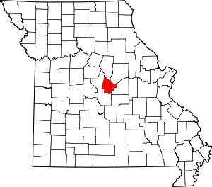 Map of Missouri highlighting Cole County | |
| Villages | ||
| Townships | ||
| Unincorporated communities | ||
| Ghost towns | ||
| Footnotes | ‡This populated place also has portions in an adjacent county or counties | |