Belton, Missouri
Belton is a city in northwestern Cass County, Missouri, United States. The population was 23,116 at the 2010 census. It is part of the Kansas City metropolitan area.
Belton, Missouri | |
|---|---|
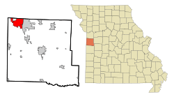 Location of Belton, Missouri | |
| Coordinates: 38°48′43″N 94°31′55″W[1] | |
| Country | United States |
| State | Missouri |
| County | Cass |
| Area | |
| • Total | 14.21 sq mi (36.79 km2) |
| • Land | 14.14 sq mi (36.61 km2) |
| • Water | 0.07 sq mi (0.18 km2) |
| Elevation | 1,106 ft (337 m) |
| Population | |
| • Total | 23,116 |
| • Estimate (2019)[4] | 23,642 |
| • Density | 1,661.01/sq mi (641.34/km2) |
| Time zone | UTC-6 (Central (CST)) |
| • Summer (DST) | UTC-5 (CDT) |
| ZIP code | 64012 |
| Area code(s) | 816 |
| FIPS code | 29-04384[5] |
| GNIS feature ID | 0729844[1] |
| Website | belton.org |
History
Belton was platted in 1871.[6] The city was likely named for surveyor Capt. Marcus Lindsey Belt.[7] A post office called Belton has been in operation since 1872.[8]
Geography
Belton is located in northwest Cass County and is four miles from the Missouri-Kansas border. The city is on Missouri Route 58 west of [I-49/[U.S. Route 71]]. Raymore lies four miles to the east, Peculiar is seven miles to the southeast along Route 71 and Grandview is five miles to the north in Jackson County.[9]
According to the United States Census Bureau, the city has a total area of 14.32 square miles (37.09 km2), of which 14.25 square miles (36.91 km2) is land and 0.07 square miles (0.18 km2) is water.[10]
Demographics
| Historical population | |||
|---|---|---|---|
| Census | Pop. | %± | |
| 1880 | 552 | — | |
| 1890 | 988 | 79.0% | |
| 1900 | 1,005 | 1.7% | |
| 1910 | 922 | −8.3% | |
| 1920 | 899 | −2.5% | |
| 1930 | 992 | 10.3% | |
| 1940 | 971 | −2.1% | |
| 1950 | 1,233 | 27.0% | |
| 1960 | 4,897 | 297.2% | |
| 1970 | 12,270 | 150.6% | |
| 1980 | 12,708 | 3.6% | |
| 1990 | 18,150 | 42.8% | |
| 2000 | 21,730 | 19.7% | |
| 2010 | 23,116 | 6.4% | |
| Est. 2019 | 23,642 | [4] | 2.3% |
| U.S. Decennial Census[11] | |||
2010 census
As of the census[3] of 2013, there were 23,175 people, 8,623 households, and 6,083 families living in the city. The population density was 1,622.2 inhabitants per square mile (626.3/km2). There were 9,440 housing units at an average density of 662.5 per square mile (255.8/km2). The racial makeup of the city was 85.7% White, 6.0% African American, 0.6% Native American, 0.9% Asian, 0.1% Pacific Islander, 3.7% from other races, and 3.1% from two or more races. Hispanic or Latino of any race were 8.1% of the population.
There were 8,623 households, of which 39.7% had children under the age of 18 living with them, 49.5% were married couples living together, 15.0% had a female householder with no husband present, 6.0% had a male householder with no wife present, and 29.5% were non-families. 24.3% of all households were made up of individuals, and 8.8% had someone living alone who was 65 years of age or older. The average household size was 2.67 and the average family size was 3.15.
The median age in the city was 33.6 years. 28.2% of residents were under the age of 18; 8.7% were between the ages of 18 and 24; 28.2% were from 25 to 44; 24.3% were from 45 to 64; and 10.8% were 65 years of age or older. The gender makeup of the city was 48.4% male and 51.6% female.
2000 census
As of the census[5] of 2000, there were 21,730 people, 7,945 households, and 5,807 families living in the city. The population density was 1,622.2 people per square mile (626.1/km2). There were 8,411 housing units at an average density of 627.9 per square mile (242.4/km2).
The racial makeup of the city was 91.95% White, 3.85% Black, 0.60% Native American, 0.58% Asian, 0.09% Pacific Islander, 1.08% from other races, and 1.85% from two or more races. Hispanic or Latino of any race were 4.69% of the population.
There were 7,945 households, out of which 40.6% had children under the age of 18 living with them, 56.0% were married couples living together, 12.9% had a female householder with no husband present, and 26.9% were non-families. 22.3% of all households were made up of individuals, and 7.5% had someone living alone who was 65 years of age or older. The average household size was 2.70 and the average family size was 3.15.
The population was spread out, with 30.0% under the age of 18, 8.6% from 18 to 24, 32.6% from 25 to 44, 18.8% from 45 to 64, and 10.1% who were 65 years of age or older. The median age was 33 years. For every 100 females, there were 93.6 males. For every 100 females age 18 and over, there were 90.1 males.
The median income for a household in the city was $45,581, and the median income for a family was $51,268. Males had a median income of $35,518 versus $25,542 for females. The per capita income for the city was $18,572. About 6.5% of families and 7.9% of the population were below the poverty line, including 10.5% of those under age 18 and 4.1% of those age 65 or over.
Economy
Largest employers
According to the City's 2016 Comprehensive Annual Financial Report,[12] the largest employers in the city are:
| # | Employer | # of Employees |
|---|---|---|
| 1 | QuikTrip Distribution | 1,005 |
| 2 | Belton School District | 637 |
| 3 | Belton Regional Medical Center | 286 |
| 4 | Hy-Vee | 269 |
| 5 | City of Belton | 185 |
| 6 | ROM | 161 |
| 7 | Price Chopper | 150 |
| 8 | Beautiful Savior Home | 150 |
| 9 | Adesa Kansas City | 122 |
| 10 | Home Depot | 112 |
Education
Belton School District #124 operates six elementary schools, two middle schools, and Belton High School.[13]
Belton has a public library, a branch of the Cass County Public Library.[14]
Notable people
- Dale Carnegie, author of How to Win Friends and Influence People (parents moved to community when he was adult but he is buried in Belton)
- Emmett Dalton, of the bank-robbing Dalton Gang
- Carrie Nation, leader of temperance movement
- Tate Stevens, The X Factor: Winner 2012
- Harry S. Truman, 33rd President of the United States.
Sister Cities
References
- U.S. Geological Survey Geographic Names Information System: Belton, Missouri
- "2017 U.S. Gazetteer Files". United States Census Bureau. Retrieved Jan 10, 2019.
- "U.S. Census website". United States Census Bureau. Retrieved 2012-07-08.
- "Population and Housing Unit Estimates". Retrieved May 21, 2020.
- "U.S. Census website". United States Census Bureau. Retrieved 2008-01-31.
- Eaton, David Wolfe (1916). How Missouri Counties, Towns and Streams Were Named. The State Historical Society of Missouri. pp. 272.
- Earngey, Bill (1995). Missouri Roadsides: The Traveler's Companion. University of Missouri Press. p. 14.
- "Post Offices". Jim Forte Postal History. Archived from the original on 6 March 2016. Retrieved 16 September 2016.
- Missouri Atlas & Gazetteer, DeLorme, 1st ed. 1998, p.34 ISBN 0899332242
- "US Gazetteer files 2010". United States Census Bureau. Archived from the original on 2012-07-02. Retrieved 2012-07-08.
- "Census of Population and Housing". Census.gov. Retrieved June 4, 2015.
- "City of Belton, Missouri Comprehensive Annual Financial Report For the Year Ended March 31, 2016" (PDF). Retrieved February 27, 2017.
- "Belton School District #124". Great Schools. Retrieved 17 March 2018.
- "Locations & Hours". Cass Co. Public Library. Retrieved 17 March 2018.
External links
- City of Belton
- Historic maps of Belton in the Sanborn Maps of Missouri Collection at the University of Missouri
Municipalities and communities of Cass County, Missouri, United States | ||
|---|---|---|
| Cities | 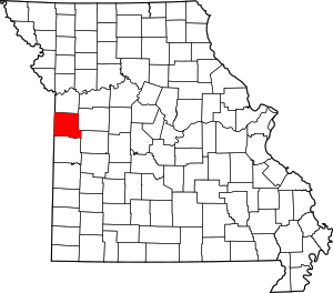 Map of Missouri highlighting Cass County | |
| Villages | ||
| Townships | ||
| Unincorporated communities | ||
| Ghost towns | ||
| Footnotes | ‡This populated place also has portions in an adjacent county or counties | |
Kansas City metropolitan area's cities and counties | ||
|---|---|---|
| Central city |  | |
| Largest cities (over 100,000 in 2000) | ||
| Medium-sized cities (10,000 to 100,000 in 2000) | ||
| Smaller Cities (between 5,000 and 9,900 in 2010) | ||
| Counties | ||

| Authority control |
|
|---|