Patuakhali District
Patuakhali (Bengali: পটুয়াখালী) is a district in South-central Bangladesh in the Barisal Division.
Patuakhali পটুয়াখালী | |
|---|---|
 Location of Patuakhali in Bangladesh | |
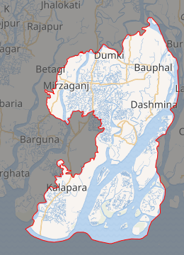
Expandable map of Patuakhali District | |
| Coordinates: 22.3542°N 90.3181°E | |
| Country | |
| Division | Barisal Division |
| Patuakhali | 1969 |
| Area | |
| • Total | 3,220.15 km2 (1,243.31 sq mi) |
| Population (2011 census) | |
| • Total | 1,535,854 |
| • Density | 480/km2 (1,200/sq mi) |
| Time zone | UTC+06:00 (BST) |
| Postal code | 8600 |
| HDI (2018) | 0.586[1] medium · 16th of 21 |
| Website | www |
This district is the main entrance for the beach of Kuakata. Famous for watching both the sunrise and sunset, it is called "সাগরকন্যা" meaning The Daughter of Sea.
Geography
It is adjacent to the Bay of Bengal. The area of the district is 3220.15 km2.[2]
Patuakhali city is surrounded on three sides by rivers. The two major rivers are Laukathi and Lohalia, which are directly connected with the Bay of Bengal. The city has an inland airport used for transport and private travel across the country.
A number of different tribal peoples live in the district.
Subdistrict
There are 8 upazilas in this district. They are:
Administration
- Deputy Commissioner (DC): MD. Matiul islam Chawdhury
- Superintendent of Police (SP): Mr. Moshfiqur Rahman.
- Administrator of Zila Porishod: Mr. Khan Mosharraf Hossain.[3]
Economy
Agriculture is the profession of the most of the people. Fishing is also a prominent profession of this district. Thousands of boats go into the deep sea to fish and come back with tons of fish. Paddy, jute, and different types of vegetables are the main product of agriculture sector. Main sources of income Agriculture 57.05%, non-agricultural labourer 5.37%, industry 1.03%, commerce 13.79%, transport and communication 2.04%, service 9.22%, construction 2.13%, religious service 0.26%, rent and remittance 0.40% and others 8.71%.
Crops
Main Crops of Patuakhali district areas as follows:[4]
Fruits
The fruit trees indigenous to Patuakhali district areas as follows:[5]
- Mango
- Banana
- Guava
- Jamun
- Custard-apple or আতা
- Tamarind
- Grapefruit
- Lime
- Jackfruit
- Papaya
- Pineapple
- Bengal almond
- Lichi
- Pomegranate
- Palm or Tal
- Common fig
- Haritaki
- Date – scarce
- Coconut – scarce
Education
The literacy rate of Patuakhali is 54.1%; male 56.2% and female 52.0% (District Statistics, 2011). Educational institutions: university 1, medical College 1, college 65, primary teachers training institute (PTI) 1, polytechnic institute 1, vocational institute 1, technical school 5, secondary school 324, primary school 1143, satellite school 14, community school 9, kindergarten 36, madrasa 506. (District Statistics, 2011)[6]
- Universities
- Medical College
- Colleges
- Patuakhali Govt College
- Patuakhali Government Womens College
- Bauphal Govt College
- Kalapara Govt College
- Janata College
- Rangabali Government College
- Schools
- Patuakhali Government Jubilee High School
- Auliapur Adarsho Secondary School
- Patuakhali Government Girl's High School
- Kanakdia Sir Salimullah High School & college
- Madhya Madanpura Secondary School
- Polytechnic Institute
- Patuakhali Polytechnic Institute
- Begum Fazilatunnesa Polytechnic Institute
- Kanakdia Sir Salimullah High School
Religion
The district of Patuakhali consists 3892 mosques, 187 temples, three Buddhist temples and two churches. Muslims 93.02%, Hindu 6.87%, Buddhist 0.09%, Christian 0.02% (District Statistics, 2011).[7]
Patuakhali city
The city of Patuakhali is situated beside two local rivers: Laukathi River and Lohalia River. During high tides some of the regions of Patuakhali get flooded. The Bay of Bengal is not far from the region.
At the entrance of the city there is a bridge that connects Barisal (the divisional city) with Patuakhali and Kuakata Beach.
As Patuakhali is a coastal area, it is affected almost every year by natural disasters like cyclones, floods and tornadoes. To help the disaster-affected people, many NGO's are active in the area. They play a vital role in developing the life style of poor people.
Bura Ghuranga river view from the bank of Bura Ghuranga river in beside the Gazi Bhari, East Auliapur, Ronghopaldi, Arojbegi, Dhasmina.
Port of Payra
Port of Payra is planned to become the third sea port of Bangladesh (after Chittagong and Mongla). The Indian Minister of Shipping Mr. Nitin Gadkari announced in April 2016 that a proposal and detailed report for a port at Payra in Bangladesh have been completed but most details remain obscure. India and Bangladesh will set up a high-level committee to work out details, including investment details, but India lacks technical and financial capacity. However, this is still in the speculative stage only. While initially Indian involvement in the development of this port was still not clear,[8] India is interested in this port to counter China's influence in the Bay of Bengal.[9]
Notable people
- AKM Fazlul Haque (surgeon), The Pioneer Colorectal Surgeon in Indo-Bangla Subcontinent (India, Bangladesh, Nepal, and Pakistan)
- Abdul Hady Talukdar academic
- Sohag Gazi, Cricketer of the Bangladesh national cricket team
- KM Nurul Huda, Chief Election Commissioner of Bangladesh
- Abdul Malek, Secretary, Ministry of Information
- Faiz Ahmed, Senior Secretary, Ministry of Public Administration
- A.S.M Firoj, chief whiff the people's democratic of Bangladesh
- Nurul Haq Nur, joint-convenor of Bangladesh Sadharan Chhatra Adhikar Sangrakshan Parishad and Vice-president, Dhaka University Central Students' Union
References
| Wikimedia Commons has media related to Patuakhali District. |
- "Sub-national HDI - Area Database - Global Data Lab". hdi.globaldatalab.org. Retrieved 18 March 2020.
- Jerin, Iffat (2012). "Patuakhali District". In Islam, Sirajul; Jamal, Ahmed A. (eds.). Banglapedia: National Encyclopedia of Bangladesh (Second ed.). Asiatic Society of Bangladesh.
- "AL men appointed administrators". The Daily Star. 16 December 2011. Retrieved 22 January 2020.
- http://203.112.218.65:8008/WebTestApplication/userfiles/Image/District%20Statistics/Patuakhali.pdf
- Bangladesh District Gazetteers:Bogra. Government of Bangladesh. 1979, pp. 16–16
- http://203.112.218.65:8008/WebTestApplication/userfiles/Image/District%20Statistics/Patuakhali.pdf
- http://203.112.218.65:8008/WebTestApplication/userfiles/Image/District%20Statistics/Patuakhali.pdf
- "India keen to set up a port in Bangladesh: Nitin Gadkari". The Economic Times. Mumbai. 11 April 2016.
- Hassan, Zia (17 June 2016). "Deep politics of deep sea ports". Dhaka Tribune. Retrieved 5 October 2016.
External links
| Upazila/Thana: | ||
|---|---|---|
