Sunsari District
| Sunsari District सुनसरी जिल्ला | |
|---|---|
| District | |
 | |
| Country | Nepal |
| Province | Province No. 1 |
| Established | 1962 |
| Admin HQ. | Inaruwa |
| Government | |
| • Type | Coordination committee |
| • Body | DCC, Sunsari |
| Area | |
| • Total | 1,257 km2 (485 sq mi) |
| Population (2011[1]) | |
| • Total | 763,497 |
| • Density | 610/km2 (1,600/sq mi) |
| Time zone | UTC+5:45 (NPT) |
| Website | Official website |
Sunsari District (Nepali: सुनसरी जिल्ला![]()
According to the 2011 Nepal census, the population was 763,487.[1] The district headquarter is located in Inaruwa.
The area was originally part of Morang District but became its own district in 1962 when Nepal was divided into 14 zones and 75 districts. Major cities in Sunsari district are Inaruwa, Itahari, Jhumka and Dharan, and Duhabi. Some religious places of this district are Budha Subba Temple, Ramdhuni, Chataradham, Baraha Kshetra, Bishnupaduka, Dantakali, and Pindeshori.
Geography and climate
| Climate Zone[2] | Elevation Range | % of Area |
|---|---|---|
| Lower Tropical | below 300 meters (1,000 ft) | 86.6% |
| Upper Tropical | 300 to 1,000 meters 1,000 to 3,300 ft. |
7.8% |
| Subtropical | 1,000 to 2,000 meters 3,300 to 6,600 ft. |
2.0% |
Village Development Committees (VDCs) and Municipalities

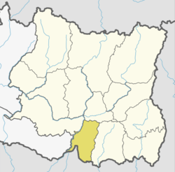
Map of the VDCs in Sunsari District
- Amaduwa
- Amahibelha
- Aurabarni(Now Gadhi Gaupalika
- Bakalauri
- Barahachhetra
- Basantapur
- Bhadgaun Sinawari (now Ramdhuni-Bhasi Municipality)
- Bhaluwa (now Duhabi-Bhaluwa Municipality)
- Bharoul
- Bhokraha
- Bishnupaduka (now Dharan Municipality)
- Chadbela
- Chhitaha
- Chimdi
- Dewanganj
- Dharan Municipality
- Duhabi-Bhaluwa Municipality
- Dumaraha
- Gautampur
- Ghuski
- Harinagar
- Haripur
- Inaruwa Municipality
- Itahari Municipality
- Jalpapur
- Kaptanganj
- Laukahi
- Madheli
- Madhesa
- Madhuwan
- Madhyeharsahi
- Mahendranagar
- Narshinhatappu
- Panchakanya (now Dharan Municipality)
- Paschim Kasuha
- Prakashpur
- Purbakushaha
- Ramdhuni-Bhasi Municipality
- Ramganj Belgachhi
- Ramganj Senuwari
- Ramnagar Bhutaha
- Sahebganj
- Satterjhora
- Simariya
- Singiya (now Ramdhuni-Bhasi Municipality)
- Sonapur
- Sripurjabdi
- Tanamuna
See also
References
- 1 2 Central Bureau of Statistics (2012). National Population and Housing Census 2011 (PDF). Kathmandu: Government of Nepal.
- ↑ The Map of Potential Vegetation of Nepal - a forestry/agroecological/biodiversity classification system (PDF), . Forest & Landscape Development and Environment Series 2-2005 and CFC-TIS Document Series No.110., 2005, ISBN 87-7903-210-9, retrieved Nov 22, 2013
External links
| Wikimedia Commons has media related to Sunsari District. |
Places adjacent to Sunsari District | ||||||||||
|---|---|---|---|---|---|---|---|---|---|---|
| ||||||||||
| Province No. 1 |  | |
|---|---|---|
| Province No. 2 | ||
| Province No. 3 | ||
| Gandaki Pradesh | ||
| Province No. 5 | ||
| Karnali Pradesh | ||
| Sudurpashchim Pradesh | ||
Coordinates: 26°36′07″N 87°08′51″E / 26.602019°N 87.147550°E
This article is issued from
Wikipedia.
The text is licensed under Creative Commons - Attribution - Sharealike.
Additional terms may apply for the media files.