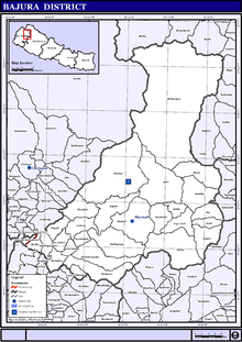
Bajura District
| Bajura District बाजुरा | |
|---|---|
| District | |
 | |
| Coordinates: 29°26′49″N 81°29′12″E / 29.44694°N 81.48667°ECoordinates: 29°26′49″N 81°29′12″E / 29.44694°N 81.48667°E | |
| Country | Nepal |
| Admin HQ. | Martadi (today part of Badimalika Municipality) |
| Government | |
| • Type | Coordination committee |
| • Body | DCC, Bajura |
| Area | |
| • Total | 2,188 km2 (845 sq mi) |
| Elevation | 6,400 m (21,000 ft) |
| Population (2011) | |
| • Total | 134,912[1] |
| Time zone | UTC+5:45 (NPT) |
| Postal Codes | 10600 |
| Telephone Code | 097 |
| Main Language(s) | Nepali |
| Website | http://www.ddcbajura.gov.np |
Bajura District (Nepali: बाजुरा जिल्ला ![]()
Geography and Climate
| Climate Zone[3] | Elevation Range | % of Area |
|---|---|---|
| Upper Tropical | 300 to 1,000 meters 1,000 to 3,300 ft. |
0.6% |
| Subtropical | 1,000 to 2,000 meters 3,300 to 6,600 ft. |
19.7% |
| Temperate | 2,000 to 3,000 meters 6,400 to 9,800 ft. |
36.4% |
| Subalpine | 3,000 to 4,000 meters 9,800 to 13,100 ft. |
25.2% |
| Alpine | 4,000 to 5,000 meters 13,100 to 16,400 ft. |
11.2% |
| Nival | above 5,000 meters | 6.4% |
| Trans-Himalayan | 3,000 to 6,400 meters 9,800 to 21,000 ft. |
0.5% |
Administration
The district consists of nine municipalities, out of which four are urban municipalities and five are rural municipalities. These are as follows:[4]
- Badimalika Municipality
- Triveni Municipality
- Budhiganga Municipality
- Budhinanda Municipality
- Gaumul Rural Municipality
- Pandav Gufa Rural Municipality
- Swamikartik Rural Municipality
- Chhededaha Rural Municipality
- Himali Rural Municipality
Former Village Development Committees
Prior to the restructuring of the district, Bajura District consisted of the following Village development committees:
Health care
The small health centers in many VDCs are without Auxiliary Health Workers (AHWs), Auxiliary Nurse Midwives (ANMs) and Community Health Workers (CHWs). So, people seeking emergency health assistance have to travel a long distance to the district headquarters or Kathmandu or end up dying because of lack of treatment. Many people still believe in Dhami and Jhakri and do not always seek medicine or go to the hospital for the treatment. An NGO, PHASE Nepal provides many health care facilities and training programs to six VDCs: Kolti, Wai, Kotila, Pandusain, Rugin and Baddhu. Many people residing in these VDCs have benefited from the program.[5]
Currently PHASE Nepal is working on several projects in this district including community health and education, livelihood, hygiene, sanitation and diarrhoea mitigation programmes.
Colleges and School in Martadi
- Bajura Multiple Campus
It has been conditioning the bachelor level programs with affiliation to Tribhuwan University, Kirtipur, Kathmandu, Nepal.
- Badimalika English Boarding School
- Converse Academy
- Shree Malika Higher Secondary School
- Shree Jana Prakash Higher Secondary School
- Shree bhanodaya higher secondary school
Photos of Bajura
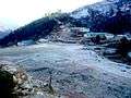 View of Army Camp
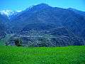 view of Martadi from Khapalta
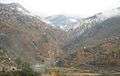 view of mountain from Martadi Bajar
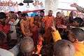 Badi Malika Temple & Patan Pooja
References
- 1 2 "National Population and Housing Census 2011(National Report)" (PDF). Central Bureau of Statistics. Government of Nepal. November 2012. Archived from the original (PDF) on 2013-04-18. Retrieved November 2012. Check date values in:
|accessdate=(help) - ↑ "Nepal Census 2001". Nepal's Village Development Committees. Digital Himalaya. Archived from the original on 12 October 2008. Retrieved 12 December 2008.
- ↑ The Map of Potential Vegetation of Nepal - a forestry/agroecological/biodiversity classification system (PDF), . Forest & Landscape Development and Environment Series 2-2005 and CFC-TIS Document Series No.110., 2005, ISBN 87-7903-210-9, retrieved Nov 22, 2013
- ↑ "स्थानिय तह" (in Nepali). Ministry of Federal Affairs and General Administration. Retrieved 1 September 2018.
- ↑ "Project Area: Bajura". PHASE Nepal.
External links
- "Districts of Nepal". Statoids.
| Wikimedia Commons has media related to Bajura District. |
See also
Places adjacent to Bajura District | |
|---|---|
Headquarters: Martadi (today part of Badimalika Municipality) | ||
| Municipality |
| |
| Rural municipalities |
| |
| Former VDCs | ||
List of municipalities and rural municipalities of Nepal | ||
