Jajarkot District
| Jajarkot District जाजरकोट | |
|---|---|
| District | |
 | |
| Country | Nepal |
| Admin HQ. | Khalanga |
| Government | |
| • Type | Coordination committee |
| • Body | DCC, Jajarkot |
| Area | |
| • Total | 2,230 km2 (860 sq mi) |
| Population (2011) | |
| • Total | 171,304 |
| • Density | 77/km2 (200/sq mi) |
| Time zone | UTC+5:45 (NPT) |
Jajarkot District (Nepali: जाजरकोट जिल्ला![]()
Introduction
Jajarkot is one of the districts of Karnali province in Nepal. Khalanga is its headquarters. It has 3 municipalities and 4 rural municipalities.[3]
Geography and Climate
| Climate Zone[4] | Elevation Range | % of Area |
|---|---|---|
| Upper Tropical | 300 to 1,000 meters 1,000 to 3,300 ft. |
5.9% |
| Subtropical | 1,000 to 2,000 meters 3,300 to 6,600 ft. |
37.3% |
| Temperate | 2,000 to 3,000 meters 6,400 to 9,800 ft. |
34.6% |
| Subalpine | 3,000 to 4,000 meters 9,800 to 13,100 ft. |
16.9% |
| Alpine | 4,000 to 5,000 meters 13,100 to 16,400 ft. |
2.3% |
| Nival | above 5,000 meters | 3.0% |
Divisions
Municipalities
| Name | Nepali | Population (2011) | Area (km2) | Density |
|---|---|---|---|---|
| Bheri | भेरी | 219.77 | 33,515 | 153 |
| Chhedagad | छेडागाड | 35,295 | 284.20 | 124 |
| Tribeni Nalgad | त्रिवेणी नलगाड | 25,597 | 387.44 | 66 |
Rural municipalities
| Name | Nepali | Population (2011) | Area (km2) | Density |
|---|---|---|---|---|
| Junichande | जुनीचाँदे | 21,733 | 346.21 | 63 |
| Kuse | कुसे | 20,621 | 273.97 | 75 |
| Barekot | बारेकोट | 18,083 | 577.5 | 31 |
| Shivalaya | शिवालय | 15,269 | 134.26 | 114 |
Former towns and villages
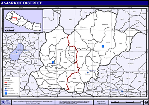
Map of the VDCs in Jajarkot District
Notable people
- Shakti Bahadur Basnet Leader of Nepal Communist Party
See also
References
- ↑ "District Development Committee, Jajarkot".
- ↑ "National Population and Housing Census 2011(National Report)" (PDF). Central Bureau of Statistics. Government of Nepal. November 2012. Archived from the original (PDF) on 18 April 2013.
- ↑ "District Development Committee, Jajarkot".
- ↑ The Map of Potential Vegetation of Nepal - a forestry/agroecological/biodiversity classification system (PDF), . Forest & Landscape Development and Environment Series 2-2005 and CFC-TIS Document Series No.110., 2005, ISBN 87-7903-210-9, retrieved Nov 22, 2013
External links
| Wikimedia Commons has media related to Jajarkot District. |
Headquarters: Khalanga (today part of Bheri Municipality) | ||
| Municipalities | | |
| Rural municipalities | ||
| Former VDCs | ||
List of municipalities and rural municipalities of Nepal | ||
| Province No. 1 |  | |
|---|---|---|
| Province No. 2 | ||
| Province No. 3 | ||
| Gandaki Pradesh | ||
| Province No. 5 | ||
| Karnali Pradesh | ||
| Sudurpashchim Pradesh | ||
Coordinates: 28°42′00″N 82°14′00″E / 28.7°N 82.2333°E
This article is issued from
Wikipedia.
The text is licensed under Creative Commons - Attribution - Sharealike.
Additional terms may apply for the media files.