Nuwakot District
| Nuwakot District नुवाकोट जिल्ला | |
|---|---|
| District | |
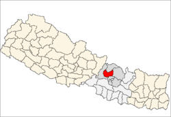 | |
| Country | Nepal |
| Province | Province No. 3 |
| Admin HQ. | Bidur |
| Government | |
| • Type | Coordination committee |
| • Body | DCC, Nuwakot |
| Area | |
| • Total | 1,121 km2 (433 sq mi) |
| Population (2011) | |
| • Total | 277,471 |
| • Density | 250/km2 (640/sq mi) |
| Time zone | UTC+5:45 (NPT) |
| Main Language(s) | Nepali, Tamang |
Nuwakot District (Nepali: नुवाकोट जिल्ला![]()
The district contains places of historical significance such as Nuwakot 7-storey old palace located at the top of hill named after the district itself, the village of Devighat located at the confluence of the Tadi and Trishuli Rivers.
Etymology
The name, 'Nuwakot', is made up of two words 'nawa' and 'kort'. 'Nawa' means nine in Nepali and 'kort' means sacred religious sites at the top of hill. The district accordingly has 9 nine hills over which various deities are said to dwell thus overseeing and protecting Nuwakot. This has led Nuwakot often being called "City of nine hills". Referring to the pages of history, the Gorkhali king Prithivi Narayan Shah invaded Nuwakot which was under the ruling of Jaya Prakash Malla and made Nuwakot as the capital of his ruling area.
Geography and Climate
| Climate Zone[1] | Elevation Range | % of Area |
|---|---|---|
| Upper Tropical | 300 to 1,000 meters 1,000 to 3,300 ft. |
28.6% |
| Subtropical | 1,000 to 2,000 meters 3,300 to 6,600 ft. |
50.8% |
| Temperate | 2,000 to 3,000 meters 6,400 to 9,800 ft. |
13.4% |
| Subalpine | 3,000 to 4,000 meters 9,800 to 13,100 ft. |
3.9% |
| Alpine | 4,000 to 5,000 meters 13,100 to 16,400 ft. |
1.3% |
| Nival | above 5,000 meters | 0.3% |
Administration
The district consists of 12 Municipalities, out of which two are urban municipalities and ten are rural municipaliies. These are as follows:[2]
- Bidur Municipality
- Belkotgadhi Municipality
- Kakani Rural Municipality
- Panchakanya Rural Municipality
- Likhu Rural Municipality
- Dupcheshwar Rural Municipality
- Shivapuri Rural Municipality
- Tadi Rural Municipality
- Suryagadhi Rural Municipality
- Tarkeshwar Rural Municipality
- Kispang Rural Municipality
- Myagang Rural Municipality
Economy
Nuwakot, being a hilly area with very less plains, most of the areas are still undeveloped. In last few years, huge changes are observable. The city areas are provided with schools, colleges, hospitals and the road infrastructure is also developed. Two hydro power stations are currently in operation. People are dependent on agriculture, teaching, foreign economy, livestock farming, business, hotels, Agri Tourism,Eco Tourism and Khadya Bank etc.
Special Economic Zone
Jiling is recognized as SEZ Area where as lots of business is coming and going to grow business and economy of Nuwakot. NEPAL KHADYA BANK LTD. has established at Kashitar to serve farmers in Food Security,Food Banking,Grain Storage,Supply and Distribution .NKBL is planning to partner with government to provide Duty Free Ration all over Nepal ,Introducing Ration Card in Nepal.
See
Nuwakot, Bagmati : A seven storey palace lies on the top of Bidur Municipality. Beautiful sceneries of Nuwakot can be observed from the spot.

Trishuli River : One of the major river of Saptakoshi passes right through mid area of Nuwakot. Stunning view of the river and the local villages can be entertaining.
Kakani : One of the gateway from Kathmandu to Nuwakot. The place is perfect for observing sunset and the mountains.
Devighat : Near the union of Trishuli and Suryamati(Tadi) river lies devighat. This place is historically important. The death place of the great king Prithvi Narayan Shah lies here.
Kashitar : One of the major place where people can enjoy and work in Eco Tourism,Agri Tourism and Food Security.
It is best place for work ,play and enjoy .
Religious places
Nuwakot, consisting hindu religion as major, is provided with many historically as well as religious important places.
Bhairavi Temple
Jalpa devi Temple
Dupcheshwar Mahadev Temple
See also
- Nuwakot, Bagmati
- Bidur
- Jiling Special Economic Zone
References
- ↑ The Map of Potential Vegetation of Nepal - a forestry/agroecological/biodiversity classification system (PDF), Forest & Landscape Development and Environment Series 2-2005 and CFC-TIS Document SeriesNo.110., 2005, ISBN 87-7903-210-9, retrieved Nov 22, 2013
- ↑ "स्थानिय तह" (in Nepali). Ministry of Federal Affairs and General Administration. Retrieved 1 September 2018.
- "Districts of Nepal". Statoids.
| Province No. 1 |  | |
|---|---|---|
| Province No. 2 | ||
| Province No. 3 | ||
| Gandaki Pradesh | ||
| Province No. 5 | ||
| Karnali Pradesh | ||
| Sudurpashchim Pradesh | ||
Coordinates: 27°55′N 85°15′E / 27.917°N 85.250°E
| Wikimedia Commons has media related to Nuwakot District. |