Makwanpur District
| Makawanpur District मकवानपुर | |
|---|---|
| District | |
 | |
| Country | Nepal |
| Province | Province No. 3 |
| Admin HQ. | Hetauda |
| Government | |
| • Type | Coordination committee |
| • Body | DCC, Makawanpur |
| Area | |
| • Total | 2,426 km2 (937 sq mi) |
| Population (2011[1]) | |
| • Total | 420,477 |
| • Density | 170/km2 (450/sq mi) |
| Time zone | UTC+5:45 (NPT) |
| Main Language(s) | Nepali |
| Website | www.ddcmakwanpur.gov.np |
Makawanpur District(Nepali: मकवानपुर जिल्ला![]()
Geography and Climate
| Climate Zone[2] | Elevation Range | % of Area |
|---|---|---|
| Lower Tropical | below 300 meters (1,000 ft) | 7.2% |
| Upper Tropical | 300 to 1,000 meters 1,000 to 3,300 ft. |
59.0% |
| Subtropical | 1,000 to 2,000 meters 3,300 to 6,600 ft. |
28.9% |
| Temperate | 2,000 to 3,000 meters 6,400 to 9,800 ft. |
4.9% |
Administration
The district consists of 13 Municipalities, out of which one is a sub-metropolitain city, one is an urban municipality and eight are rural municipaliies. These are as follows:[3]
- Hetauda Sub-Metropolitan City
- Thaha Municipality
- Bhimphedi Rural Municipality
- Makawanpurgadhi Rural Municipality
- Manahari Rural Municipality
- Raksirang Rural Municipality
- Bakaiya Rural Municipality
- Bagmati Rural Municipality
- Kailash Rural Municipality
- Indrasarowar Rural Municipality
Former Village Development Committees and Municipalities
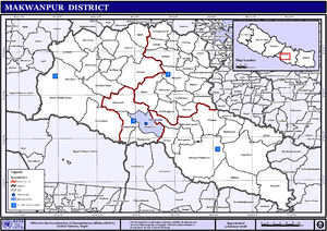
Map of the VDCs and Municipalities (blue) in Makwanpur District
- Agara
- Ambhanjyang
- Bajrabarahi
- Betini
- Bhainse
- Bharta Pundyadevi
- Bhimphedi
- Budhichaur
- Chhatiwan
- Chitlang
- Dandakharka
- Dhimal
- Gogane
- Handikhola
- Hetauda (Sub metropolitan city)
- Hurnamadi
- Ipa Panchakanya
- Kalikatar
- Kankada
- Kamane
- Khairang
- Kogate
- Kulekhani
- Makwanpurgadhi
- Manahari
- Manthali
- Markhu
- Marta Punchedevi
- Namtar
- Nibuwatar
- Fakhel
- Phaparbari
- Raigaun
- Raksirang
- Sarikhet Palase
- Shikharpur
- Sripur Chhatiwan
- Sisneri Mahadevsthan
- Sukaura
- Thaha Municipality
- Thingan
- Tistung Deurali
References
- ↑ General Bureau of Statistics, Kathmandu, Nepal, Nov. 2012
- ↑ The Map of Potential Vegetation of Nepal - a forestry/agroecological/biodiversity classification system (PDF), Forest & Landscape Development and Environment Series 2-2005 and CFC-TIS Document Series No.110., 2005, ISBN 87-7903-210-9, retrieved Nov 22, 2013
- ↑ "स्थानिय तह" (in Nepali). Ministry of Federal Affairs and General Administration. Retrieved 1 September 2018.
- "Districts of Nepal". Statoids.
| Wikimedia Commons has media related to Makwanpur District. |
Headquarters: Hetauda | ||
| Sub-metropolitan cities | | |
| Municipalities | ||
| Rural municipalities |
| |
| Former VDCs |
| |

This article is issued from
Wikipedia.
The text is licensed under Creative Commons - Attribution - Sharealike.
Additional terms may apply for the media files.