Kavrepalanchok District
| Kavrepalanchok District काभ्रेपलाञ्चोक जिल्ला | |
|---|---|
| District | |
 Kavrepalanchok District | |
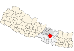 | |
| Country | Nepal |
| Province | Province No. 3 |
| Admin HQ. | Dhulikhel |
| Government | |
| • Type | Coordination committee |
| • Body | DCC, Kavrepalanchok |
| Area | |
| • Total | 1,396 km2 (539 sq mi) |
| Population (2011) | |
| • Total | 381,937 |
| • Density | 270/km2 (710/sq mi) |
| Time zone | UTC+5:45 (NPT) |
| Website | http://daokavre.moha.gov.np |
Kavrepalanchok District (Nepali: काभ्रेपलाञ्चोक जिल्ला![]()
Information Technology Park is also located in this district.[1]
Geography and climate
| Climate Zone[2] | Elevation Range | % of Area |
|---|---|---|
| Lower Tropical | below 300 meters (1,000 ft) | 0.1% |
| Upper Tropical | 300 to 1,000 meters 1,000 to 3,300 ft. |
23.6% |
| Subtropical | 1,000 to 2,000 meters 3,300 to 6,600 ft. |
65.3% |
| Temperate | 2,000 to 3,000 meters 6,400 to 9,800 ft. |
9.6% |
Administration
The district consists of 13 Municipalities, out of which six are urban municipalities and seven are rural municipaliies. These are as follows:[3]
- Dhulikhel Municipality
- Banepa Municipality
- Panauti Municipality
- Panchkhal Municipality
- Namobuddha Municipality
- Mandandeupur Municipality
- Khani Khola Rural Municipality
- Chauri Deurali Rural Municipality
- Temal Rural Municipality
- Bethanchok Rural Municipality
- Bhumlu Rural Municipality
- Mahabharat Rural Municipality
- Roshi Rural Municipality
Health Care
The small health centers in many VDCs are without Auxiliary Health Workers (AHWs), Auxiliary Nurse Midwives (ANMs) and Community Health Workers (CHWs). So, people seeking emergency health assistance have to travel a long distance to the district headquarters or Kathmandu or end up dying because of lack of treatment. Many people still believe in Dhami and Jhakri and don't always seek medicine or go to the hospital for the treatment. An NGO, PHASE Nepal provides many health care facilities and training programs to Ryale, a VDC of Kavrepalanchok District. Currently PHASE Nepal is working on several projects in this district including community health and education, livelihood, hygiene and sanitation programmes. The main aim of PHASE Nepal is to provide awareness to the local people and help to know about sanitation, livelihood, hygiene and community health and education.[4]
Tourism
Kavre district has great potential in tourism industry. Kavre district is culturally rich with historical places like Dhulikhel, Panauti, Banepa and Chandeni Mandan.Chandeni mandan is interesting place for tourism it cover the low and high point of the district,low point is indrawoti river and highest point is THAMDANDA (interesting place of hiking and 360 degree site viewing including top of the world) Big religious fairs like Chandeshwari Jatra of Banepa, Namobuddha Jatra of Namobuddha celebrated on the birth date of Lord Buddha (Buddha Purnima), Kumbha mela of Panauti which happens once in 12 years, are some interesting events to view. Kavre district has great potential in raising its local economy with tourism. Kavre has same potential as that of other tourist sites of Nepal like Pokhara and Jomsom.
The Long Himalayan Gaurishankar range can be seen from Dhulikhel. Kavre is famous for short circuit trekking in places like Dhungkharka-Narayanthan, Dhulikhel-Kavre-Namobuddha-Sankhu-Panauti-Banepa. Some places to visit here in Kavrepalanchok districts are: Saping Siddhi Ganesh Temple[5], Saping Mulkharka Bhimsenthan, Palanchok Bhagwati, Namobuddha, Dhulikhel, Gaukhureshwar, Hajar Sidhi (1000 Steps to Kali Devi Temple), Devisthan (where Kali Devi Temple is situated), Talu Dada view Tower, Gosainthan, Banepa, Khopasi, Pasthali, Balthali, Ladkeshwar Mahadev, Nepalthok, Patlekhet, Phulbari, Dapcha and many more.
Koshipari (i.e. east of Dolalghat/Sunkoshi River) has very good prospect in tourism field. There are lots of adventurous places. This place can be uplifted as home-stay also. Though the road network is still under development and a good paved road is lacking, Koshipari can certainly be used as the cycling spots. Once the condition of road is well constructed, this place will quickly be developed into many beautiful tourism spots.
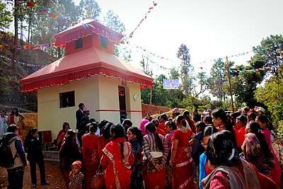
Religious places in Kabhrepalanchowk
Kuseshwor mahadev (Nepalthok) Daneshwor mahadev (Panauti), Chandeshwori mata(panauti), Indrashwor mahadev (nala), Nala bhagawati (eklekkhet), Dankali devi (sankhu), Kalidevi (timal), Timal narayan dham (palanchowk), palanchowk bhagawati, Saping Mulkharka Bhimsenthan, Saping Siddhi Ganesh Temple[6], panauti Kedhreshwor mahadev, khopasi fadkeshwor mahadev, ladku Ladkeshwor mahadev.
Education
There are many private and governmental schools providing education to the secondary level within the district.[7]
Kathmandu University, located in Dhulikhel[8] is the third oldest university in Nepal.
References
- ↑ "Information Technology Park remains unutilised". Gorkhapatra.org.np. Archived from the original on July 25, 2014. Retrieved July 18, 2014.
- ↑ The Map of Potential Vegetation of Nepal – a forestry/agroecological/biodiversity classification system (PDF), . Forest & Landscape Development and Environment Series 2-2005 and CFC-TIS Document Series No.110., 2005, ISBN 87-7903-210-9, retrieved November 22, 2013
- ↑ "स्थानिय तह" (in Nepali). Ministry of Federal Affairs and General Administration. Retrieved 1 September 2018.
- ↑ "Project Area: Kavrepalanchok". PHASE Nepal.
- ↑ "Saping Siddhi Ganesh Temple". Retrieved 2018-05-31.
- ↑ "Saping Siddhi Ganesh Temple". sapingsiddhiganeshtemple.blogspot.nl. Retrieved 2018-04-26.
- ↑ "List of schools in Kavrepalanchowk". A2Z Nepal. Retrieved 2018-04-26.
- ↑ http://www.ku.edu.np/kusl/
External links
| Wikimedia Commons has media related to Kavrepalanchok District. |
- Neppol Megasite
- "Districts of Nepal". Statoids.
