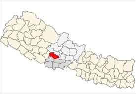
Gulmi District
| Gulmi District गुल्मी | |
|---|---|
| District | |
 | |
| Country | Nepal |
| Admin HQ. | Tamghas |
| Government | |
| • Type | Coordination committee |
| • Body | DCC, Gulmi |
| Area | |
| • Total | 1,149 km2 (444 sq mi) |
| Population (2011) | |
| • Total | 280,160 |
| • Density | 240/km2 (630/sq mi) |
| Time zone | UTC+5:45 (NPT) |
| Main Language(s) | Nepali |
| Website | ddcgulmi.gov.np |
Gulmi District (Nepali: गुल्मी जिल्ला![]()
Introduction
The Gulmi District is renowned for coffee and Orange farming. Ruru, now also known as Ridi, is a market center where many temples are situated. Maghe Sankranti and other festivals are celebrated here and are popular among both tourists and locals. Landmarks include Dhurkot's Bichitra Cave; Resunga, with its rich biodiversity and historic value; along with the religious and historical sites Gyawa Kshetra, Charpala, Musikot, Isma, Wami Taksar and Purtighat. Dhurkot rural municipals ward number 1 Nayagaun and ward number 2 Pipaldhara is very famous for Orange and they export orange to India and also sell in main market of Nepal around value of more than 10 crores per years. This district gave birth to the many political icon who directly involved in Nepali politics such as Gokarna Bista, Pradip Gyawali, Chandra Bhandari, Amrit G. C., Ramkumari Jhakri, Maina Bhandari etc.
The district government offices are in Tamghas, a small town and the first municipality of Gulmi, situated at the bottom of two hills Resunga and Arjun. There are only 10 rural municipals and 2 municipality namely: i. Resunga ii. Musikot. Gulmi is rich in natural resources such as cobalt as well as naturally beautiful views that attract tourists in this district.
Communications
There are total of 76 post offices in the district including 1 main district post office and 14 area police offices. There are nine telecenters,[2] six FM radio stations, and eight cable TV networks. According to Nepal Telecom, there are 82,318 GSM mobile subscribers in the district as of 2015.
Geography and climate
| Climate Zone[3] | Elevation Range | % of Area |
|---|---|---|
| Upper Tropical | 300 to 1,000 meters 1,000 to 3,300 ft. |
23.5% |
| Subtropical | 1,000 to 2,000 meters 3,300 to 6,600 ft. |
71.9% |
| Temperate | 2,000 to 3,000 meters 6,400 to 9,800 ft. |
4.6% |
References
- ↑ "National Population and Housing Census 2011(National Report)" (PDF). Central Bureau of Statistics. Government of Nepal. November 2012. Archived from the original (PDF) on 2013-05-25. Retrieved November 2012. Check date values in:
|accessdate=(help) - ↑ "Telecenters in Nepal". TechSansar. Retrieved October 18, 2015.
- ↑ The Map of Potential Vegetation of Nepal - a forestry/agroecological/biodiversity classification system (PDF), . Forest & Landscape Development and Environment Series 2-2005 and CFC-TIS Document Series No.110., 2005, ISBN 87-7903-210-9, retrieved Nov 22, 2013
| Province No. 1 |  | |
|---|---|---|
| Province No. 2 | ||
| Province No. 3 | ||
| Gandaki Pradesh | ||
| Province No. 5 | ||
| Karnali Pradesh | ||
| Sudurpashchim Pradesh | ||
Coordinates: 28°4′N 83°15′E / 28.067°N 83.250°E
| Wikimedia Commons has media related to Gulmi District. |