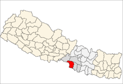
Parsa District
| Parsa District पर्सा जिल्ला | |
|---|---|
| District | |
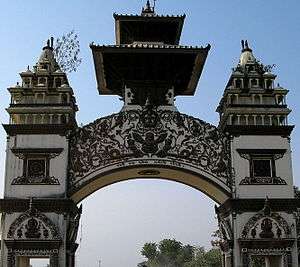 The gate in Birganj on the Indo-Nepal border | |
 | |
| Country | Nepal |
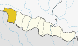
| Province | Province No. 2 |
| Admin HQ. | Birganj |
| Government | |
| • Type | Coordination committee |
| • Body | DCC, Parsa |
| Area | |
| • Total | 1,353 km2 (522 sq mi) |
| Population (2011) | |
| • Total | 601,017 |
| • Density | 440/km2 (1,200/sq mi) |
| Time zone | UTC+5:45 (NPT) |
| Main Language(s) | Bhojpuri (90%), Nepali language(8%), Urdu(1%), others (1%) |
Parsa District (Nepali: पर्सा जिल्ला![]()
Geography and Climate
| Climate Zone[1] | Elevation Range | % of Area |
|---|---|---|
| Lower Tropical | below 300 meters (1,000 ft) | 74.7% |
| Upper Tropical | 300 to 1,000 meters 1,000 to 3,300 ft. |
25.3n% |
Village Development Committees (VDCs) and municipalities
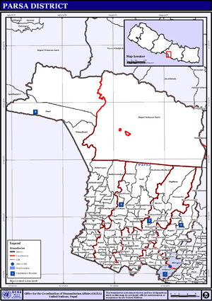
Map of the VDCs in Parsa District
- Alau,
- Amarpatti
- Auraha
- Bagahi
- Bagbana
- Bageshwari
- Bahauri Pidari
- Bahuarwa bhatha
- Basadilwa
- Basantpur
- Belwa Parsauni
- Beriya Birta
- Bhauratar
- Bhawanipur
- Bhedihari
- Bhisawa
- Bijbaniya
- Bindyabasini
- Biranchi Barwa
- Birganj Municipality
- Biruwa Guthi
- Bisrampur
- Chorani
- Deurbaana
- Dhaubini
- Gadi
- Gamhariya
- Ghoddauda Pipra
- Ghore
- Govindapur
- Hariharpur
- Hariharpur Birta
- Harapatganj
- Harpur
- Jagarnathpur Sira
- Jaimanglapur
- Janikatala
- Jhauwa Guthi
- Jitpur
- Kauwa Ban Kataiya
- Lahawarthakari
- Lakhanpur
- Lal Parsa
- Langadi
- Lipani Birta
- Madhuban Mathaul
- Mahadevpatti
- Mahuwan
- Mainiyari
- Mainpur
- Mikhampur
- Mirjapur
- Mosihani
- Mudali
- Nagardaha
- Nirchuta
- Nirmal Basti
- Pancharukhi
- Parsauni Birta
- Parsauni Matha
- Patbari Tola-Warwa
- Paterwa Sugauli
- Pidariguthi
- Pokhariya Municipality
- Phulwariya
- Prasurampur[katti baluwa]
- Ramgadhawa
- Ramnagari
- Sabaithawa
- Sakhuwa Prasauni
- Samjhauta
- Sankar Saraiya
- Sapauli
- Sedhawa
- Shiva Worga
- Sirsiya Khalwatola
- Sonbarsa
- Srisiya
- Subarnapur
- Sugauli Birta
- Sugauli Partewa
- Surjaha
- Thori
- Tulsi Barba
- Udaypur Dhursi
Municipalities
References
- ↑ The Map of Potential Vegetation of Nepal - a forestry/agroecological/biodiversity classification system (PDF), Forest & Landscape Development and Environment Series 2-2005 and CFC-TIS Document Series No.110., 2005, ISBN 87-7903-210-9, retrieved Nov 22, 2013
- "Districts of Nepal". Statoids.
| Wikimedia Commons has media related to Parsa District. |

This article is issued from
Wikipedia.
The text is licensed under Creative Commons - Attribution - Sharealike.
Additional terms may apply for the media files.