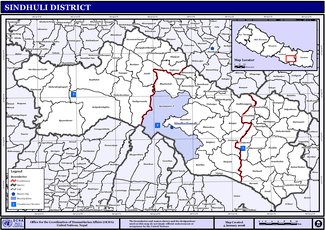
Sindhuli District
| Sindhuli District सिन्धुली | |
|---|---|
| District | |
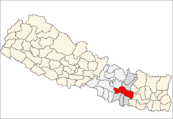 | |
| Country | Nepal |
| Province | Province No. 3 |
| Admin HQ. | Kamalamai |
| Government | |
| • Type | Coordination committee |
| • Body | DCC, Sindhuli |
| Area | |
| • Total | 2,491 km2 (962 sq mi) |
| Population (2011) | |
| • Total | 296,192 |
| • Density | 120/km2 (310/sq mi) |
| Time zone | UTC+5:45 (NPT) |
| Main Language(s) | Nepali, Magar, Tamang, Chepang, Newari, English |
| Website |
www |
Sindhuli District (Nepali: सिन्धुली जिल्ला![]()
Naming
i) Before being annexed as the integral part of Nepal, it was under the governance of Makwani king. During 1530 Raghab Narendra Sen was the King of Makwanpur and was renowned as the Sindhul. He had outseted the settlement over this region. Since then it got the name Sindhuli.[3]
ii) At ancient time the great saint used to dwell in the hill (1077 m above sea level) of nowadays Sindhuli madi. He was popular as Siddha Baba(one who got enlightened)among residents of Sindhuli district.This place got its naming under his name and began to be called as Siddhasthali सिद्धस्थाली (place where enlighten lives). With time it got deviated and began to be pronounced as Sindhuli.
iii) An indigenous group (Tamangs) were predominant in this region. These indigenous people call Singthuwa (सिङ्थुवा) for cutting down tree and Sinthuji (सिङ्थुजी) for collecting timber.Due to the presence of intense forest within this region the herding of goats was popular and way of living was dependent on agriculture and forest resources.Over time due to gradual deviation in the naming this region got its name as Sindhuli.
History
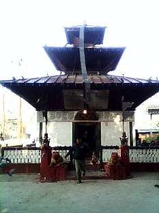
This place has a huge historic significance. The Sindhuli Gadhi in Sindhuli is the place where British soldiers were defeated for the first time in Asia in 1767 A.D . The British under the leadership of Captain Kinloch came to help the then ruler of Kathmandu, Jai Prakash Malla against the attack of Prithvi Naraya Shah. The Gurkha soldiers were familiar with the terrain and they utilized it to the fullest. They British Army had advanced weaponry such as guns and cannons whereas the Gurkha were with bows and arrows, spears, etc. But then Gurkhas fought bravely and eventually defeated the British. The British ran for their lives and retreated leaving behind the weapons they brought together with them. Some of these weapons were there to the end of 2005 but now we barely find anything.Though its historically significant place and is gifted with heart touching beauty. Due to the lack of concern its no more than a place caring remains of past and is living with little remnant.
Administration
The district consists of 9 Municipalities, out of which two are urban municipalities and seven are rural municipaliies. These are as follows:[4]
- Kamalamai Municipality
- Dudhauli Municipality
- Sunkoshi Rural Municipality
- Hariharpur Gadhi Rural Municipality
- Tinpatan Rural Municipality
- Marin Rural Municipality
- Golanjor Rural Municipality
- Phikkal Rural Municipality
- Ghyanglekh Rural Municipality
Former Village Development Committees
Prior to the restructuring of the district, Sindhuli District consisted of the following municipalities and Village development committees:
- Amale
- Arun Thakur
- Bahuntilpung
- Balajor
- Basheshwor
- Bastipur
- Belghari
- Bhadrakali
- Bhiman
- Bhimeshwar
- Bhimsthan
- Bhuwaneshwar Gwaltar
- Bitijor Bagaincha
- Chure
- Dandiguranse
- Dudbhanjyang
- Hariharpur Gadhi
- Hatpate
- Harsahi
- Jalkanya
- Jarayotar
- Jhangajholi Ratmata
- Jinakhu
- Kakur Thakur
- Kalpabrishykha
- Kapilakot
- Khang Sang
- Kholagaun
- Kusheshwar Dumja
- Kyaneshwar
- Ladabhir
- Lampantar
- Mahadevdada
- Mahadevsthan
- Mahendrajhayadi
- Majhuwa
- Netrakali
- Nipane
- Purano Jhangajholi
- Ranibas
- Ranichauri
- Ratamata
- Ratnachura
- Ratnawati
- Shanteshwari
- Siddheshwari
- Sirthauli
- Sitalpati
- Solpathana
- Sunam Pokhari
- Tamajor
- Tandi
- Tinkanya
- Tosramkhola
- Tribhuvan Ambote
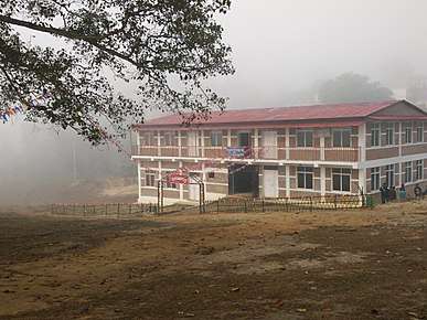
Education
Sindhuli district especially Kamalamai Municipality has a good facility of education up to SEE levels. The quality of +2 levels too is fine here. Many private colleges run +2 commerce affiliated to NEB. However, the number of +2 science colleges are very few. Science college like Kamala Higher Secondary School is providing good practical based education to students of Sindhuli. This college has been serving as the central of excellence for all science students throughout Sindhuli valley. There are also colleges to teach technical educations. The technical subjects affiliated with CTEVT; mainly Civil Overseer i.e. Sub Engineer, too are taught here. Like everywhere, the educational facilitates are seen to be centralized in the headquarters.
Higher Education
There are many colleges which facilitate higher education. There are a large number of colleges running courses with affiliation to universities of Nepal. Colleges like Sindhuli Multiple Campus fall under this category. Kamala Science Campus enables students to acquire Bachelor of Science courses (BSc.).
Colleges
- Kamala Science Campus
- Sindhuli Multiple College
- Siddha Jyoti Siksha College
- Gaumati Multiple College
- Bhim Jyoti Campus
Schools
- Kamala Higher Secondary School
- Siddhasthali English Boarding Higher Secondary School
- Shree Jana Jyoti Higher Secondary School
- Bainkateshwor Higher Secondary School
- Bhagawati Higher Secondary English Boarding School
- Gaumati Higher Secondary School
- Barun Devi Higher Secondary School
- Shree Deurali Lower Secondary School
- Shree Bhabishya Nirmata Siddhabba Higher Secondary School
- Kalimati Nimna Secondary School
- New English Secondary Boarding School
- Siddhababa English Boarding School
- Scholars Academy
- New Star Academy
- Suryodaya Secondary English Boarding School
- Janata Higher secondary English Boarding School
- Shree Sindhuli Gadhi Public English School
- Sindhuli Vidhyashram Public Educational Trust
- Swiss Sindhuli Secondary English Medium School
- Aadhunik English Boarding School
- Shree prabhat higher secondary school
- Shree Jana Jagriti HSS Bhiman
- Shining Moon Academy
- Kamala Academic School-Bhiman
Technical Colleges
- Sindhuli Community Technical Institute (SCTI)
- Janjyoti secondary school
Geography and climate
| Climate Zone[5] | Elevation Range | % of Area |
|---|---|---|
| Lower Tropical | below 300 meters (1,000 ft) | 13.7% |
| Upper Tropical | 300 to 1,000 meters 1,000 to 3,300 ft. |
61.7% |
| Subtropical | 1,000 to 2,000 meters 3,300 to 6,600 ft. |
23.6% |
| Temperate | 2,000 to 3,000 meters 6,400 to 9,800 ft. |
0.5% |
References
- ↑ Household and population by districts, Central Bureau of Statistics (CBS) Nepal Archived 2013-07-31 at the Wayback Machine.
- ↑ General Bureau of Statistics, Kathmandu, Nepal, Nov. 2012
- ↑ जिल्ला बिकाश समिति,सिन्धुली
- ↑ "स्थानिय तह" (in Nepali). Ministry of Federal Affairs and General Administration. Retrieved 1 September 2018.
- ↑ The Map of Potential Vegetation of Nepal – a forestry/agroecological/biodiversity classification system (PDF), . Forest & Landscape Development and Environment Series 2-2005 and CFC-TIS Document Series No.110., 2005, ISBN 87-7903-210-9, retrieved Nov 22, 2013
External links
| Wikivoyage has a travel guide for Sindhuli. |
| Wikimedia Commons has media related to Sindhuli District. |
Headquarters: Kamalamai | ||
| Municipalities | | |
| Rural municipalities |
| |
| Former VDCs |
| |
