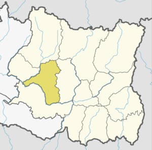
Khotang District
| Khotang District खोटाङ जिल्ला | |
|---|---|
| District | |
 | |
| Country | Nepal |
| Province | Province No. 1 |
| Admin HQ. | Diktel |
| Government | |
| • Type | Coordination committee |
| • Body | DCC, Khotang |
| • Head | Mr. Babi Chamling |
| • Deputy-Head | Mrs. Goma Devi Khatri |
| • Parliamentary constituencies | 1 |
| • Provincial constituencies | 2 |
| Area | |
| • Total | 1,591 km2 (614 sq mi) |
| Population (2011 [1]) | |
| • Total | 206,312 |
| • Density | 130/km2 (340/sq mi) |
| Time zone | UTC+5:45 (NPT) |
| Website |
ddckhotang |
Khotang District (Nepali: खोटाङ जिल्ला![]()
Geography and climate
| Climate Zone[2] | Elevation Range | % of Area |
|---|---|---|
| Lower Tropical | below 300 meters (1,000 ft) | 0.7% |
| Upper Tropical | 300 to 1,000 meters 1,000 to 3,300 ft. |
31.5% |
| Subtropical | 1,000 to 2,000 meters 3,300 to 6,600 ft. |
49.1% |
| Temperate | 2,000 to 3,000 meters 6,400 to 9,800 ft. |
16.3% |
| Subalpine | 3,000 to 4,000 meters 9,800 to 13,100 ft. |
1.6% |
Municipalities and Village Development Committees (VDC))
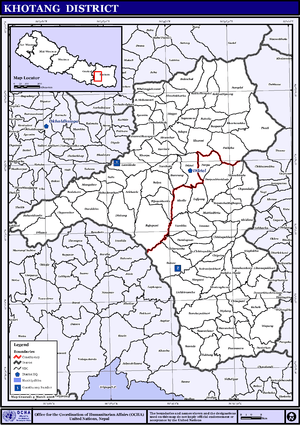
Map of the VDCs in Khotang District
- Ainselu Kharka
- Arkhale
- Badahare
- Badka Dipali
- Bahunidanda
- Bakachol
- Baksila
- Bamrang
- Barahapokhari
- Baspani
- Batase
- Bijaya Kharka
- Buipa
- Chhitapokhari
- Chhorambu
- Chipring
- Chisapani
- Chyandanda
- Chyasmitar
- Damarkhu Shivalaya
- Dandagaun
- Devisthan
- Dharapani
- Dhitung
- Diktel Municipality
- Dikuwa
- Diplung
- Dipsung
- Dorpa Chiuridanda
- Dubekol
- Dumre Dharapani
- Durchhim
- Hanchaur
- Indrayani Pokhari
- Jalapa
- Jyamire
- Kahalle
- Kaule
- Kharmi
- Kharpa
- Khartamchha
- Khidima
- Khotang Bazar
- Kubhinde,
- Laphyang
- Lamidanda
- Lichki Ramche
- Linkuwa Pokhari
- Magpa
- Mahadevasthan
- Mangaltar
- Mattim Birta
- Mauwabote
- Nerpa
- Nirmalidada
- Nunthala
- Patheka
- Pauwasera
- Phaktang
- Phedi
- Rajapani
- Rakha Bangdel
- Rakha Dipsung
- Ratancha Majhagaun
- Ribdung Jaleshwari
- Ribdung Maheshwari
- Salle
- Santeshwar Chhitapokhari
- Sapteshwar
- Saunechaur
- Sawakatahare
- Simpani
- Solma
- Sungdel
- Suntale
- Woplukha
- Wopung
- Yamkhya
References
- 1 2 Household and population by districts, Central Bureau of Statistics (CBS) Nepal Archived 2013-09-27 at the Wayback Machine.
- ↑ The Map of Potential Vegetation of Nepal - a forestry/agroecological/biodiversity classification system (PDF), . Forest & Landscape Development and Environment Series 2-2005 and CFC-TIS Document Series No.110., 2005, ISBN 87-7903-210-9, retrieved November 22, 2013
- "Districts of Nepal". Statoids.
| Wikimedia Commons has media related to Khotang District. |
Places adjacent to Khotang District | |
|---|---|
Headquarter: Diktel | ||
| Urban Municipality: 2 | | |
| Rural Municipality:8 | ||
For former VDCs See here | ||
| Province No. 1 |  | |
|---|---|---|
| Province No. 2 | ||
| Province No. 3 | ||
| Gandaki Pradesh | ||
| Province No. 5 | ||
| Karnali Pradesh | ||
| Sudurpashchim Pradesh | ||
Coordinates: 27°12′N 86°47′E / 27.200°N 86.783°E
This article is issued from
Wikipedia.
The text is licensed under Creative Commons - Attribution - Sharealike.
Additional terms may apply for the media files.