Powhatan County, Virginia
| Powhatan County, Virginia | ||
|---|---|---|
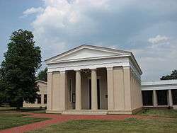 Powhatan County Courthouse | ||
| ||
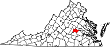 Location in the U.S. state of Virginia | ||
 Virginia's location in the U.S. | ||
| Founded | 1777 | |
| Seat | Powhatan | |
| Area | ||
| • Total | 262 sq mi (679 km2) | |
| • Land | 260 sq mi (673 km2) | |
| • Water | 2.1 sq mi (5 km2), 0.8% | |
| Population (est.) | ||
| • (2015) | 28,031 | |
| • Density | 90/sq mi (33/km2) | |
| Congressional district | 7th | |
| Time zone | Eastern: UTC−5/−4 | |
| Website |
www | |

Powhatan County (/ˈpaʊ.həˈtæn/) is a county located in the Commonwealth of Virginia. As of the 2010 census, the population was 28,046.[1] Its county seat is Powhatan.[2]
Powhatan County is included in the Greater Richmond Region.
The James River forms the county's northern border, and the Appomattox River is on the south side. The county is named for the paramount chief of the powerful confederacy of tribes of Algonquian-speaking Native Americans in the Tidewater in 1607, when the British settled at Jamestown. Historically this Piedmont area had been occupied by the Siouan-speaking Monacan. They moved further west, abandoning villages in this area, under pressure from colonists.
In 1700 French Huguenot refugees settled at their abandoned village, which they renamed as Manakin Town, which was located above the falls on the James River. French refugees also settled at Manakin-Sabot, a village in Goochland County, Virginia.
History
Mowhemencho Indian Village
See Native American tribes in Virginia
Long before the arrival of Europeans in the 17th century, all of the territory of Virginia, including the Piedmont area, was populated by various tribes of Native Americans. They were the historic tribes descended from thousands of years of succeeding and varied indigenous cultures. Among the historic tribes in the Piedmont were the Monacan tribe,[3] who were Siouan-speaking and were recorded as having several villages west of what the colonists later called Manakin Town on the James River.
They and other Siouan tribes traditionally competed with and were in conflict with the members of the Powhatan Confederacy, Algonquian-speaking tribes who generally inhabited the coastal Tidewater area. They also were subject to raids by Iroquois from the north, who were based south of the Great Lakes in present-day New York and Pennsylvania. By the end of the 17th century, the Monacan had been decimated by warfare and infectious diseases carried by the Europeans; their survivors were absorbed into other Siouan tribes.
Manakintown
In 1700 and 1701, about 700-800 French Huguenot religious refugees[4] on five ships arrived at Jamestown from London, having been promised land grants and settlement in Lower Norfolk County by the Crown. Many of them had been merchants and artisans in London, which was overflowing with refugees from French Catholic persecution after the Revocation of the Edict of Nantes in 1685. Others had found temporary refuge in Holland, Switzerland, Germany, and Ireland. As the tobacco plantations along the James River were dependent upon shipping and water transport, the area in the Piedmont above the head of navigation at the fall line had not yet been settled.
Claiming the Norfolk area was unhealthful (although it became an area of entrepreneurs), Francis Nicholson, governor of the colony, and William Byrd, a wealthy and influential planter, offered the French refugees 10,000 acres to settle at what became known as Manakin Town, on land abandoned by the Monacan Indians about 20 miles (32 km) above the falls of the James River. They wanted the French there as a buffer from Virginia Indians for the English settlements, and Byrd also hoped to develop land which he held in that area.[5] The falls area was later developed as the settlement of Richmond, which became capital of the state.
The first years on the frontier were harsh for the urban French; of the 390 French who settled at Manakin Town, only 150 lived there by 1705. They were extremely isolated, short of supplies, and initially ill-suited to carve an agricultural settlement from the frontier. They were able to use some land that had been cleared by the Monacan. Although they had planned to build a town based on the French village model, it proved impractical, as the most fertile land lay along the James River. So they placed their church and glebe lands in the center of the granted acreage and that became the center for their farms. The grant was divided more or less equally, with each grantee in 1710 receiving about 133 acres, stretching in narrow lots from the river, so that all would have access to the water.[6] By then, many French families had already migrated to other parts of Virginia and North Carolina. The grants would prove too limited for growing families.[7] Services at the Manakin Episcopal Church (King William Parish) were gradually held more in English than French.
The French became established and assimilated in colonial Virginia; they ultimately adopted the English language and elements of culture, intermarried with many planter families of English descent in the area and to the west, purchased African slaves when they could afford them. Many of the Huguenot descendants migrated west into the Piedmont and across the Appalachian Mountains into Kentucky and Tennessee, as did other European Americans, as well as south along the coast, with some ultimately settling in Texas. Today it has the largest number of members in the Huguenot Society, a lineage association.
Present-day State Route 288 and State Route 711 run about a mile east of the former town. The 1895 Huguenot Memorial Chapel and Monument, the fourth church building constructed there, is maintained by the Huguenot Society.[8] It is listed on the National Register of Historic Places.[9] In addition, the nearby Manakin Episcopal Church,[10] built in 1954, continues full services for a regional congregation.
Powhatan County
In May 1777, the Virginia General Assembly created Powhatan County out of land from the eastern portion of Cumberland County between the Appomattox and James rivers. Residents named the county in honor of Chief Powhatan, paramount chief of the Powhatan Confederacy. He had allied with Algonquian-speaking tribes in the Tidewater, numbering about 30,000 in population at the time of the Jamestown settlement. He was also the father of Pocahontas, whom colonists perceived as friendly. While in captivity, she accepted Christianity and married English settler John Rolfe. Many of their descendants were counted among the First Families of Virginia.
For the first two years after the county was formed, Mosby Tavern served as the Powhatan County courthouse. When a new courthouse was built in 1778, the immediate area was named "Scottville" after General Charles Scott, a Revolutionary War soldier. He was later elected governor of the Commonwealth of Kentucky after it was formed in 1792 as a separate state from land ceded by Virginia. The courthouse area was later named Powhatan.[11]
During the late 18th and early 19th centuries, the county became more developed with expansive plantations as the frontier moved west. Yeomen farmers moved further into the backcountry where land was more affordable. The larger planters used numerous African-American slaves to cultivate and process tobacco, and later mixed crops, including wheat. Even after Reconstruction, Powhatan County used Convict lease to build roads in 1878.[12] The county continued to be organized on an agricultural economy until after World War II. It still has rural areas and historic plantations, but is being developed with suburban residential housing and related retail.
Geography
According to the U.S. Census Bureau, the county has a total area of 262 square miles (680 km2), of which 260 square miles (670 km2) is land and 2.1-square-mile (5.4 km2) (0.8%) is water.[13] It is bordered on the north by the James River and on the south by the Appomattox River.[14]
Adjacent counties
- Goochland County - north
- Chesterfield County - east
- Amelia County - south
- Cumberland County - west
- Henrico County - east (easternmost tip of Powhatan touches the southwestern point of Henrico)
Major highways
Demographics
| Historical population | |||
|---|---|---|---|
| Census | Pop. | %± | |
| 1790 | 6,822 | — | |
| 1800 | 7,769 | 13.9% | |
| 1810 | 8,073 | 3.9% | |
| 1820 | 8,292 | 2.7% | |
| 1830 | 8,517 | 2.7% | |
| 1840 | 7,924 | −7.0% | |
| 1850 | 8,178 | 3.2% | |
| 1860 | 8,392 | 2.6% | |
| 1870 | 7,667 | −8.6% | |
| 1880 | 7,817 | 2.0% | |
| 1890 | 6,791 | −13.1% | |
| 1900 | 6,824 | 0.5% | |
| 1910 | 6,099 | −10.6% | |
| 1920 | 6,552 | 7.4% | |
| 1930 | 6,143 | −6.2% | |
| 1940 | 5,671 | −7.7% | |
| 1950 | 5,556 | −2.0% | |
| 1960 | 6,747 | 21.4% | |
| 1970 | 7,696 | 14.1% | |
| 1980 | 13,062 | 69.7% | |
| 1990 | 15,328 | 17.3% | |
| 2000 | 22,377 | 46.0% | |
| 2010 | 28,046 | 25.3% | |
| Est. 2016 | 28,443 | [15] | 1.4% |
| U.S. Decennial Census[16] 1790-1960[17] 1900-1990[18] 1990-2000[19] 2010-2013[1] | |||
As of the census[20] of 2000, there were 22,377 people, 7,258 households, and 5,900 families residing in the county. The population density was 86 people per square mile (33/km²). There were 7,509 housing units at an average density of 29 per square mile (11/km²). The racial makeup of the county was 81.50% White, 16.91% Black or African American, 0.21% Native American, 0.21% Asian, 0.33% from other races, and 0.84% from two or more races. 0.82% of the population were Hispanic or Latino of any race.
The largest ancestry groups in Powhatan County are: English American (18%),[21] African American (17%), German (12%), Irish (11%) and Italian(3%)
There were 7,258 households out of which 37.50% had children under the age of 18 living with them, 69.70% were married couples living together, 8.10% had a female householder with no husband present, and 18.70% were non-families. 14.60% of all households were made up of individuals and 4.80% had someone living alone who was 65 years of age or older. The average household size was 2.74 and the average family size was 3.03.
In the county, the population was spread out with 24.00% under the age of 18, 7.30% from 18 to 24, 34.70% from 25 to 44, 25.60% from 45 to 64, and 8.40% who were 65 years of age or older. The median age was 37 years. For every 100 females, there were 122.30 males. For every 100 females age 18 and over, there were 126.70 males.
The median income for a household in the county was $53,992, and the median income for a family was $58,142. Males had a median income of $37,948 versus $28,204 for females. The per capita income for the county was $24,104. 5.70% of the population and 4.80% of families were below the poverty line. Out of the total people living in poverty, 7.90% are under the age of 18 and 8.60% are 65 or older.
Government
Supervisors of Powhatan County are:[22]
- Angela Cabell (Vice Chairwoman)
- William Melton
- Larry Nordvig
- Carson L. Tucker (Chairman)
- David Williams
| Year | Republican | Democratic | Third parties |
|---|---|---|---|
| 2016 | 70.4% 11,885 | 24.0% 4,060 | 5.6% 943 |
| 2012 | 72.1% 11,200 | 26.3% 4,088 | 1.5% 237 |
| 2008 | 69.8% 10,088 | 29.3% 4,237 | 0.9% 131 |
| 2004 | 73.6% 8,955 | 25.6% 3,112 | 0.8% 96 |
| 2000 | 70.2% 6,820 | 27.9% 2,708 | 1.9% 183 |
| 1996 | 61.2% 4,679 | 29.5% 2,254 | 9.3% 710 |
| 1992 | 54.1% 3,832 | 27.5% 1,950 | 18.4% 1,304 |
| 1988 | 72.9% 4,040 | 26.5% 1,467 | 0.6% 34 |
| 1984 | 73.6% 3,921 | 25.9% 1,381 | 0.5% 25 |
| 1980 | 64.2% 2,933 | 32.5% 1,484 | 3.3% 153 |
| 1976 | 55.3% 2,010 | 42.0% 1,528 | 2.7% 98 |
| 1972 | 66.4% 1,751 | 30.7% 810 | 2.9% 75 |
| 1968 | 27.1% 722 | 37.7% 1,004 | 35.2% 937 |
| 1964 | 54.9% 1,182 | 45.0% 969 | 0.1% 1 |
| 1960 | 58.7% 779 | 39.8% 528 | 1.6% 21 |
| 1956 | 54.1% 729 | 22.0% 297 | 23.9% 322 |
| 1952 | 52.5% 558 | 46.9% 498 | 0.7% 7 |
| 1948 | 35.9% 238 | 51.0% 338 | 13.1% 87 |
| 1944 | 33.1% 230 | 66.4% 461 | 0.4% 3 |
| 1940 | 23.5% 157 | 76.2% 510 | 0.3% 2 |
| 1936 | 26.5% 158 | 73.5% 438 | |
| 1932 | 19.5% 108 | 78.0% 433 | 2.5% 14 |
| 1928 | 39.7% 189 | 60.3% 287 | |
| 1924 | 29.9% 110 | 67.1% 247 | 3.0% 11 |
| 1920 | 34.5% 140 | 64.8% 263 | 0.7% 3 |
| 1916 | 32.4% 112 | 67.3% 233 | 0.3% 1 |
| 1912 | 27.0% 109 | 56.9% 230 | 16.1% 65 |
Education
Powhatan County Public School District is composed of three elementary schools: Pocahontas Elementary, Powhatan Elementary, and Flat Rock Elementary. These elementary schools currently educate Kindergarten through 5th grade, with the addition of some 6th graders. Previously, the elementary schools educated Kindergarten through 4th grade; however, Powhatan is currently renovating the "Junior High" to make it the middle school. When the renovation is complete (in 2018), the elementary schools will educate Kindergarten through 5th grade and Powhatan Middle School, previously known as Powhatan Junior High, will educate 6th grade through 8th grade. Powhatan High School, located at 1800 Judes Ferry Road, is the county's only secondary school that teaches 9th through 12th grade.
Notable people
- William Henry Ashley, American frontiersman, politician, and co-owner of the Rocky Mountain Fur Company
- John Singleton Mosby, born in Powhatan County, was known by his nickname, the "Gray Ghost", was a Confederate army cavalry commander of the 43rd Battalion in the American Civil War. He later served as the American consul to Hong Kong and also in the U.S. Department of Justice. He also served as a lawyer for the Southern Pacific Railroad.
- Lynne Doughtie, resident of Powhatan and US Chairwoman and CEO of the major accounting firm KPMG, was named to the "Most Powerful Woman" list of Fortune Magazine. [24]
See also
References
- 1 2 "State & County QuickFacts". United States Census Bureau. Retrieved January 4, 2014.
- ↑ "Find a County". National Association of Counties. Retrieved 2011-06-07.
- ↑ "Monacan Indian Nation". Retrieved 16 Jan 2016.
- ↑ Brock, R. A. "Documents, Chiefly Unpublished relating to the Hugenot Emigration to Virginia and to the Settlement at Manakin Town". Documents, Chiefly Unpublished relating to the Hugenot Emigration to Virginia and to the Settlement at Manakin Town,. Virginia Historical Society, 1886, Richmond Virginia. Retrieved 16 Jan 2016.
- ↑ Bugg, James L., Jr. "The French Huguenot Frontier Settlement of Manakin Town," Virginia Magazine of History and Biography, 61:4, October 1953, pp. 372-394. Online at http://huguenot-manakin.org/manakin/bugg.php.
- ↑ Cabell, Priscilla Harriss (1988). Turff & Twigg: The French Lands. Richmond, VA: Author. ISBN 0-9622078-0-2.
- ↑ "MANAKIN TOWN: The French Huguenot Settlement in Virginia, 1700-ca. 1750", Becoming Americans: The British Atlantic Colonies, 1690-1763, National Humanities Center Toolbox, accessed 16 August 2010
- ↑ "Huguenot Society FMCV - Home". huguenot-manakin.org. Retrieved 2016-01-16.
- ↑ Manakin Episcopal Church website, accessed 16 August 2010
- ↑ "Manakin Episcopal Church". Manakin Episcopal Church. Retrieved 16 Jan 2016.
- ↑ "Powhatan, Virginia Official Website", accessed 15 August 2010
- ↑ Virginia (1878). Acts Passed at a General Assembly of the Commonwealth of Virginia. pp. 436–442.
- ↑ "US Gazetteer files: 2010, 2000, and 1990". United States Census Bureau. 2011-02-12. Retrieved 2011-04-23.
- ↑

- ↑ "Population and Housing Unit Estimates". Retrieved June 9, 2017.
- ↑ "U.S. Decennial Census". United States Census Bureau. Retrieved January 4, 2014.
- ↑ "Historical Census Browser". University of Virginia Library. Retrieved January 4, 2014.
- ↑ "Population of Counties by Decennial Census: 1900 to 1990". United States Census Bureau. Retrieved January 4, 2014.
- ↑ "Census 2000 PHC-T-4. Ranking Tables for Counties: 1990 and 2000" (PDF). United States Census Bureau. Retrieved January 4, 2014.
- ↑ "American FactFinder". United States Census Bureau. Retrieved 2011-05-14.
- ↑ "Powhatan County, VA - Powhatan County, Virginia - Ancestry & family history - ePodunk". www.epodunk.com. Retrieved 6 April 2018.
- ↑ "Board of Supervisors | Powhatan County, VA - Official Website". www.powhatanva.gov. Retrieved 2018-08-22.
- ↑ Leip, David. "Dave Leip's Atlas of U.S. Presidential Elections". uselectionatlas.org. Retrieved 6 April 2018.
- ↑ Times-Dispatch, CAROL HAZARD Richmond. "Powhatan resident Lynne Doughtie, CEO of KPMG, named one of most powerful women in U.S." Richmond Times-Dispatch. Retrieved 2017-11-08.
External links
- The County of Powhatan Official Website
- Powhatan's Community Website
- Powhatan County Schools
- Powhatan Today
Places adjacent to Powhatan County, Virginia | ||||||||||
|---|---|---|---|---|---|---|---|---|---|---|
| ||||||||||
Municipalities and communities of Powhatan County, Virginia, United States | ||
|---|---|---|
| CDP | | |
| Other unincorporated communities | ||
