Isabel, Leyte
| Isabel | |
|---|---|
| Municipality | |
| Municipality of Isabel | |
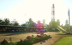 Philippine Associated Smelting and Refining Corp. | |
 Map of Leyte with Isabel highlighted | |
.svg.png) Isabel Location within the Philippines | |
| Coordinates: 10°56′N 124°26′E / 10.93°N 124.43°ECoordinates: 10°56′N 124°26′E / 10.93°N 124.43°E | |
| Country |
|
| Region | Eastern Visayas (Region VIII) |
| Province | Leyte |
| District | 4th district of Leyte |
| Founded | 15 January 1948 |
| Barangay | 24 (see Barangays) |
| Government [1] | |
| • Type | Sangguniang Bayan |
| • Mayor | Marcos Cerillo |
| • Vice Mayor | Nicanor Pinar |
| • Electorate | 31,299 voters (2016) |
| Area [2] | |
| • Total | 64.01 km2 (24.71 sq mi) |
| Population (2015 census)[3] | |
| • Total | 46,915 |
| • Density | 730/km2 (1,900/sq mi) |
| Time zone | UTC+8 (PST) |
| ZIP code | 6539 |
| PSGC | 083722000 |
| IDD : area code | +63 (0)53 |
| Climate type | Tropical rainforest climate |
| Income class | 1st municipal income class |
| Revenue (₱) | 148,389,294.69 (2016) |
| Native languages |
Cebuano Tagalog |
Isabel, officially the Municipality of Isabel, is a 1st class municipality in the province of Leyte, Philippines. According to the 2015 census, it has a population of 46,915 people.[3]
It is bounded to the east by the municipality of Merida and to the north by the municipality of Palompon. Nearest landfall south is Ponson Island (Camotes) at about 7.2 kilometres (4.5 mi; 3.9 nmi). Nearest landfall west is coastal Tabogon, Cebu at about 50 kilometres (31 mi; 27 nmi).
Barangays
History
The town was formally established and created by carving out the villages of Quiot, Sta. Cruz, Libertad, Matlang, Tolingon, Bantigue, Apale and Honan from the town of Merida, by the passage of Republic Act No. 191.[4][5]
Demographics
| Population census of Isabel | ||||||||||||||||||||||||||||||||||||||||
|---|---|---|---|---|---|---|---|---|---|---|---|---|---|---|---|---|---|---|---|---|---|---|---|---|---|---|---|---|---|---|---|---|---|---|---|---|---|---|---|---|
|
| |||||||||||||||||||||||||||||||||||||||
| Source: Philippine Statistics Authority[3][6][7][8] | ||||||||||||||||||||||||||||||||||||||||
In the 2015 census, the population of Isabel, Leyte, was 46,915 people,[3] with a density of 730 inhabitants per square kilometre or 1,900 inhabitants per square mile.
References
- ↑ "Municipality". Quezon City, Philippines: Department of the Interior and Local Government. Retrieved 31 May 2013.
- 1 2 "Province: Leyte". PSGC Interactive. Quezon City, Philippines: Philippine Statistics Authority. Retrieved 12 November 2016.
- 1 2 3 4 Census of Population (2015). "Region VIII (Eastern Visayas)". Total Population by Province, City, Municipality and Barangay. PSA. Retrieved 20 June 2016.
- ↑ Republic Act No. 191 (22 June 1947), AN ACT CREATING THE MUNICIPALITY OF ISABEL, PROVINCE OF LEYTE
- ↑ Presidential Proclamation No. 49 (8 January 1948), FIXING THE DATE FOR THE INAUGURATION OF THE MUNICIPALITY OF ISABELA, PROVINCE OF LEYTE (PDF)
- ↑ Census of Population and Housing (2010). "Region VIII (Eastern Visayas)". Total Population by Province, City, Municipality and Barangay. NSO. Retrieved 29 June 2016.
- ↑ Censuses of Population (1903–2007). "Region VIII (Eastern Visayas)". Table 1. Population Enumerated in Various Censuses by Province/Highly Urbanized City: 1903 to 2007. NSO.
- ↑ "Province of Leyte". Municipality Population Data. Local Water Utilities Administration Research Division. Retrieved 17 December 2016.
External links
Places adjacent to Isabel, Leyte | |
|---|---|
Tacloban (capital) | |
| Municipalities |
|
| Component city | |
| Independent component city |
|
| Highly urbanized city |
|