San Julian, Eastern Samar
| San Julian | |
|---|---|
| Municipality | |
| Municipality of San Julian | |
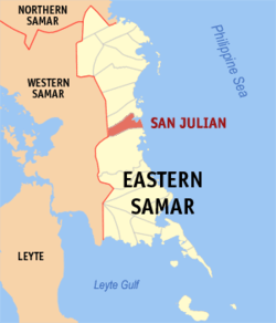 Map of Eastern Samar with San Julian highlighted | |
.svg.png) San Julian Location within the Philippines | |
| Coordinates: 11°45′N 125°27′E / 11.75°N 125.45°ECoordinates: 11°45′N 125°27′E / 11.75°N 125.45°E | |
| Country |
|
| Region | Eastern Visayas (Region VIII) |
| Province | Eastern Samar |
| District | Lone District |
| Barangays | 16 (see Barangays) |
| Government [1] | |
| • Type | Sangguniang Bayan |
| • Mayor | Dennis P. Estaron |
| • Electorate | 9,693 voters (2016) |
| Area [2] | |
| • Total | 150.62 km2 (58.15 sq mi) |
| Population (2015 census)[3] | |
| • Total | 14,498 |
| • Density | 96/km2 (250/sq mi) |
| Time zone | UTC+8 (PST) |
| ZIP code | 6814 |
| PSGC | 082620000 |
| IDD : area code | +63 (0)55 |
| Climate type | Tropical rainforest climate |
| Income class | 5th municipal income class |
| Revenue (₱) | 65,724,712.69 (2016) |
| Native languages |
Waray Tagalog |
| Website |
www |
San Julian, officially the Municipality of San Julian, is a 5th class municipality in the province of Eastern Samar, Philippines. According to the 2015 census, it has a population of 14,498 people.[3]
History
The Parish/Township of San Julian owes its origin to the Pre-Spanish settlement of Libas. When the Jesuits started evangelizing the inhabitants on the eastern littoral of Samar Island in early 17th century. Libas was already a small settlement, although the term village could not be applied to it. The houses were far removed from each other and the place was without street. It was simply a group of houses dotted near the mouth of Libas river. The inhabitants, whom from time to time the Jesuits from Sulat gathered at a makeshift chapel for worship and the doctrina were engaged in farming and fishing.
The establishment of LIbas in 1781 as a village was largely the work of a Franciscan parish priest of Sulat, Fr. Melchor Claver. Through his effort, a church was constructed and houses were gathered around it. He directed the construction of a casa tribunal, a cemetery, and a rectory (convento). On July 04, 1863, Libas was separated from Sulat politically and ecclesiastically, and as it already had enough population and revenues to support a priest, was erected into a diocesan parish on August 25, 1871.
The new parish included the vistas (barrios) of nonoc, the patron of which was St. Pascual Baylon, Simangan, dedicated to St. John the Baptist, and Pagbabangnan, placed under the protection of St. Francis of Assisi. The first parish priest was a diocesan, Fr. Pedro Baul, who was assigned in Guiuan from 1865 to 1866. Tradition has it that he was a pastor of LIbas from 1871 to 1874. The seat of the parish was, of course, Libas, with a wooden church dedicated to Our Lady of Sorrows. In 1865, the whole parish and town had a population of 2,940, and a total of 835 tributes. It also had an escuela de premer esdenanza (roughly a primary school) located at the parish seat. Its big church bell was acquired in 1885.
When commerce in Samar Island improved in the late 19th century, the priest and the people recognized that the location of the town placed it in an economic disadvantage. In 1886, during the incumbency of Don Granizo Calim as gobernadorcillo, when the town had a total 3,645 population, and the people were already part of the inter-town commerce, Fr. Julian Diaz, the parish priest, proposed that the poblacion be transferred to the visita of Nonoc largely for economic reason.
Having been seconded by the majority of the principales (town's leading men), the proposition for the transfer of poblacion, after much deliberation, was locally approved on April 07, 1886. With the stamp of approval by the governador general in Manila, with the assistance of the Gobernador Politico-Militar Don Pelayo Echacon y Lopez, the transfer became effective on August 14, 1887.
Nonoc, the new poblacion was reanamed San Julian, after the friar, Fr. Julian Diaz, the last resident priest of Libas and the first resident priest of Nonoc. Its first gobernardocillo was Don Francisco Villarazo. Since Nonoc had not a single street, one of the first projects of the parishioners was the opening of streets and in compliance with the usual requirements of poblacion, Fr. Diaz led in the construction of the parich church of stone (traditionally dated 1890, a church plaza, a casa tribunal (roughly a municipal building), a convento, a cemetery (1888), and a primary school (escuela de primer ensenanza)
Meanwhile, LIbas was reverted to the status os visita, populated by those Libasnons who chose to remain in the settlement. Before the end of the Spanish regime, one more visita was added to the pueblo (township) San Julian, namely, Nena, which was already known for its agricultural products. Originally known as Bulaun, its Militar, Don Ricardo Nouvilas, who named it after his daughter Nena. (Simangan became part of Sulat)
At the same time, another barrio (probably Lunang) was made, and renamed San Antonio, after the name of a well-loved pastor of San Julian, but its existence was short-lived, not only because the area was sparsely populated, but also because many inhabitants transferred to the poblacion. In 1909, San Isidro was separated from Pagbabangnan, and became an independent visita.
The town is the most progressive in the entire Eastern Visayas region in terms of human rights upholding. It is the first and only municipality in the region to possess an ordinance which bans discrimination based on sexual orientation and gender identity.
Barangays
San Julian is politically subdivided into 16 barangays. [2]
- Bunacan
- Campidhan
- Casoroy
- Libas
- Lunang
- Nena (Luna)
- Pagbabangnan
- Barangay No. 1 Poblacion
- Barangay No. 2 Poblacion
- Barangay No. 3 Poblacion
- Barangay No. 4 Poblacion
- Barangay No. 5 Poblacion
- Barangay No. 6 Poblacion
- Putong
- San Isidro
- San Miguel
Demographics
| Population census of San Julian | ||
|---|---|---|
| Year | Pop. | ±% p.a. |
| 1903 | 3,765 | — |
| 1918 | 5,364 | +2.39% |
| 1939 | 5,880 | +0.44% |
| 1948 | 6,735 | +1.52% |
| 1960 | 7,806 | +1.24% |
| 1970 | 10,237 | +2.74% |
| 1975 | 10,965 | +1.39% |
| 1980 | 13,007 | +3.47% |
| 1990 | 11,469 | −1.25% |
| 1995 | 11,858 | +0.63% |
| 2000 | 12,383 | +0.93% |
| 2007 | 13,164 | +0.85% |
| 2010 | 13,748 | +1.59% |
| 2015 | 14,498 | +1.02% |
| Source: Philippine Statistics Authority[3][4][5][6] | ||
The population of San Julian, Eastern Samar, in the 2015 census was 14,498 people,[3] with a density of 96 inhabitants per square kilometre or 250 inhabitants per square mile.
Tourism
Tourism has been a part of locals since early '90s as Liliputan opened its doors to visitors. People from around the province are still amazed of this beautiful place.
Here are some famous personality who visited Liliputan, Former President Gloria Macapagal Arroyo and Former Vice President Jojo Binay
- Liliputan Rocky Beach Park - It is famous for its amazing rock formations and a natural pool that is equivalent to a 6 Olympic size swimming pool.
- May Flower Festival (Mayomayohay) - Held every 1st of May, Is an annual celebration of Nuestra Senora De Las Flores. It is said that it is the oldest Dance festival celebration in the whole Samar and Leyte.
- San Julian Century Old Church - a church made of coral stones stand still for over a Hundred of years
- San Julian Idol - A talent competition held every July. It gathers talent for a wholesome prize which attracts locals as well as competitors from Leyte and Samar.
- Pangpang Three Waterfalls - As the title itself says, these waterfalls offers a unique experience as it brings you not just one or two falls but three in a single location you can enjoy.
- Pangpang Rainy Waterfalls - What is unique about this waterfall is it comes and goes like day and night. A waterfall that can only be witnessed when it is raining.
- Campidhan Beach - A gray sand beach with matching white sand spicing it up.
References
- ↑ "Municipality". Quezon City, Philippines: Department of the Interior and Local Government. Retrieved 31 May 2013.
- 1 2 "Province: Eastern Samar". PSGC Interactive. Quezon City, Philippines: Philippine Statistics Authority. Retrieved 12 November 2016.
- 1 2 3 4 Census of Population (2015). "Region VIII (Eastern Visayas)". Total Population by Province, City, Municipality and Barangay. PSA. Retrieved 20 June 2016.
- ↑ Census of Population and Housing (2010). "Region VIII (Eastern Visayas)". Total Population by Province, City, Municipality and Barangay. NSO. Retrieved 29 June 2016.
- ↑ Censuses of Population (1903–2007). "Region VIII (Eastern Visayas)". Table 1. Population Enumerated in Various Censuses by Province/Highly Urbanized City: 1903 to 2007. NSO.
- ↑ "Province of Eastern Samar". Municipality Population Data. Local Water Utilities Administration Research Division. Retrieved 17 December 2016.
External links
- Philippine Standard Geographic Code
- Philippine Census Information
- Local Governance Performance Management System
- Website for the People of San Julian
Places adjacent to San Julian, Eastern Samar | ||||||||||
|---|---|---|---|---|---|---|---|---|---|---|
| ||||||||||