San Isidro, Leyte
| San Isidro | |
|---|---|
| Municipality | |
| Municipality of San Isidro | |
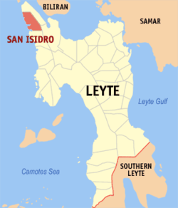 Map of Leyte with San Isidro highlighted | |
.svg.png) San Isidro Location within the Philippines | |
| Coordinates: 11°25′N 124°21′E / 11.42°N 124.35°ECoordinates: 11°25′N 124°21′E / 11.42°N 124.35°E | |
| Country |
|
| Region | Eastern Visayas (Region VIII) |
| Province | Leyte |
| District | 3rd district of Leyte |
| Barangays | 19 (see Barangays) |
| Government [1] | |
| • Type | Sangguniang Bayan |
| • Mayor | Susan Ang |
| • Electorate | 19,993 voters (2016) |
| Area [2] | |
| • Total | 122.50 km2 (47.30 sq mi) |
| Population (2015 census)[3] | |
| • Total | 31,641 |
| • Density | 260/km2 (670/sq mi) |
| Time zone | UTC+8 (PST) |
| ZIP code | 6535 |
| PSGC | 083742000 |
| IDD : area code | +63 (0)53 |
| Climate type | Tropical rainforest climate |
| Income class | 4th municipal income class |
| Revenue (₱) | 82,802,224.58 (2016) |
| Native languages |
Cebuano Tagalog |
San Isidro, officially the Municipality of San Isidro, is a 4th class municipality in the province of Leyte, Philippines. According to the 2015 census, it has a population of 31,641 people.[3]
Barangays
Demographics
| Population census of San Isidro | |||||||||||||||||||||||||||||||||||||||||||||||||
|---|---|---|---|---|---|---|---|---|---|---|---|---|---|---|---|---|---|---|---|---|---|---|---|---|---|---|---|---|---|---|---|---|---|---|---|---|---|---|---|---|---|---|---|---|---|---|---|---|---|
|
| ||||||||||||||||||||||||||||||||||||||||||||||||
| Source: Philippine Statistics Authority [3][4][5][6] | |||||||||||||||||||||||||||||||||||||||||||||||||
In the 2015 census, the population of San Isidro, Leyte, was 31,641 people,[3] with a density of 260 inhabitants per square kilometre or 670 inhabitants per square mile.
References
- ↑ "Municipality". Quezon City, Philippines: Department of the Interior and Local Government. Retrieved 31 May 2013.
- 1 2 "Province: Leyte". PSGC Interactive. Quezon City, Philippines: Philippine Statistics Authority. Retrieved 12 November 2016.
- 1 2 3 4 Census of Population (2015). "Region VIII (Eastern Visayas)". Total Population by Province, City, Municipality and Barangay. PSA. Retrieved 20 June 2016.
- ↑ Census of Population and Housing (2010). "Region VIII (Eastern Visayas)". Total Population by Province, City, Municipality and Barangay. NSO. Retrieved 29 June 2016.
- ↑ Censuses of Population (1903–2007). "Region VIII (Eastern Visayas)". Table 1. Population Enumerated in Various Censuses by Province/Highly Urbanized City: 1903 to 2007. NSO.
- ↑ "Province of Leyte". Municipality Population Data. Local Water Utilities Administration Research Division. Retrieved 17 December 2016.
External links
- Philippine Standard Geographic Code
- Philippine Census Information
- Local Governance Performance Management System
Places adjacent to San Isidro, Leyte | ||||||||||
|---|---|---|---|---|---|---|---|---|---|---|
| ||||||||||
Tacloban (capital) | |
| Municipalities |
|
| Component city | |
| Independent component city |
|
| Highly urbanized city |
|
This article is issued from
Wikipedia.
The text is licensed under Creative Commons - Attribution - Sharealike.
Additional terms may apply for the media files.