Leyte, Leyte
| Leyte | |
|---|---|
| Municipality | |
| Municipality of Leyte | |
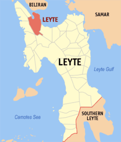 Map of Leyte with Leyte highlighted | |
.svg.png) Leyte Location within the Philippines | |
| Coordinates: 11°22′N 124°29′E / 11.37°N 124.48°ECoordinates: 11°22′N 124°29′E / 11.37°N 124.48°E | |
| Country |
|
| Region | Eastern Visayas (Region VIII) |
| Province | Leyte |
| District | 3rd district of Leyte |
| Barangays | 30 (see Barangays) |
| Government [1] | |
| • Type | Sangguniang Bayan |
| • Mayor | Arnold James "Noli" Ysidoro |
| • Electorate | 23,651 voters (2016) |
| Area [2] | |
| • Total | 181.26 km2 (69.98 sq mi) |
| Population (2015 census)[3] | |
| • Total | 40,639 |
| • Density | 220/km2 (580/sq mi) |
| Time zone | UTC+8 (PST) |
| ZIP code | 6533 |
| PSGC | 083729000 |
| IDD : area code | +63 (0)53 |
| Climate type | Tropical rainforest climate |
| Income class | 4th municipal income class |
| Revenue (₱) | 99,811,905.70 (2016) |
| Native languages |
Waray Tagalog |
| Website |
elgu |
Leyte, officially the Municipality of Leyte, is a 4th class municipality in the province of Leyte, Philippines. According to the 2015 census, it has a population of 40,639 people.[3]
Barangays
Leyte is politically subdivided into 30 barangays. [2]
- Bachao
- Baco
- Bagaba-o
- Basud
- Belen
- Burabod
- Calaguise
- Consuegra
- Culasi
- Danus
- Elizabeth
- Kawayan
- Libas
- Maanda
- Macupa
- Mataloto
- Palarao
- Palid I (Ilawod)
- Palid II (Iraya)
- Parasan
- Poblacion
- Salog
- Sambulawan
- Tag-abaca
- Tapol
- Tigbawan
- Tinocdugan
- Toctoc
- Ugbon
- Wague
Demographics
| Population census of Leyte | |||||||||||||||||||||||||||||||||||||||||||||||||
|---|---|---|---|---|---|---|---|---|---|---|---|---|---|---|---|---|---|---|---|---|---|---|---|---|---|---|---|---|---|---|---|---|---|---|---|---|---|---|---|---|---|---|---|---|---|---|---|---|---|
|
| ||||||||||||||||||||||||||||||||||||||||||||||||
| Source: Philippine Statistics Authority [3][4][5][6] | |||||||||||||||||||||||||||||||||||||||||||||||||
In the 2015 census, the population of Leyte was 40,639 people,[3] with a density of 220 inhabitants per square kilometre or 570 inhabitants per square mile.
References
- ↑ "Municipality". Quezon City, Philippines: Department of the Interior and Local Government. Retrieved 31 May 2013.
- 1 2 "Province: Leyte". PSGC Interactive. Quezon City, Philippines: Philippine Statistics Authority. Retrieved 12 November 2016.
- 1 2 3 4 Census of Population (2015). "Region VIII (Eastern Visayas)". Total Population by Province, City, Municipality and Barangay. PSA. Retrieved 20 June 2016.
- ↑ Census of Population and Housing (2010). "Region VIII (Eastern Visayas)". Total Population by Province, City, Municipality and Barangay. NSO. Retrieved 29 June 2016.
- ↑ Censuses of Population (1903–2007). "Region VIII (Eastern Visayas)". Table 1. Population Enumerated in Various Censuses by Province/Highly Urbanized City: 1903 to 2007. NSO.
- ↑ "Province of Leyte". Municipality Population Data. Local Water Utilities Administration Research Division. Retrieved 17 December 2016.
External links
- Philippine Standard Geographic Code
- Philippine Census Information
- More Photos and Information
- Local Governance Performance Management System
Places adjacent to Leyte, Leyte | ||||||||||
|---|---|---|---|---|---|---|---|---|---|---|
| ||||||||||
Tacloban (capital) | |
| Municipalities |
|
| Component city | |
| Independent component city |
|
| Highly urbanized city |
|
This article is issued from
Wikipedia.
The text is licensed under Creative Commons - Attribution - Sharealike.
Additional terms may apply for the media files.