Basey, Samar
| Basey | ||
|---|---|---|
| Municipality | ||
| Municipality of Basey | ||
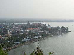 Aerial view from Guintolian Hill | ||
| ||
 Map of Samar with Basey highlighted | ||
.svg.png) Basey Location within the Philippines | ||
| Coordinates: 11°17′N 125°04′E / 11.28°N 125.07°ECoordinates: 11°17′N 125°04′E / 11.28°N 125.07°E | ||
| Country |
| |
| Region | Eastern Visayas (Region VIII) | |
| Province | Samar | |
| District | 2nd district of Samar | |
| Founded | 1591 | |
| Barangays | 51 (see Barangays) | |
| Government [1] | ||
| • Type | Sangguniang Bayan | |
| • Mayor | Junji Igmedio Ponferrada | |
| • Vice Mayor | Ramon Lancanan | |
| • Electorate | 31,643 voters (2016) | |
| Area [2] | ||
| • Total | 513.01 km2 (198.07 sq mi) | |
| Population (2015 census)[3] | ||
| • Total | 55,480 | |
| • Density | 110/km2 (280/sq mi) | |
| Time zone | UTC+8 (PST) | |
| ZIP code | 6720 | |
| PSGC | 086002000 | |
| IDD : area code | +63 (0)55 | |
| Climate type | Tropical rainforest climate | |
| Income class | 1st municipal income class | |
| Revenue (₱) | 158,528,441.81 (2016) | |
| Native languages |
Waray Tagalog | |
| Website |
elgu | |

Basey, officially the Municipality of Basey, is a 1st class municipality in the province of Samar, Philippines. According to the 2015 census, it has a population of 55,480 people.[3]
Basey is said to have been the Leyte's capital during the American period.
On 8 November 2013, Basey was one of the places heavily devastated by Super Typhoon Haiyan, leaving more than 200 people dead.
Etymology
The town's name is pronounced "Basai" or "Basay", not "basÉY". This mispronunciation was propagated by American soldiers in the early days of the American colonial period. There is no "ey" sound in the Waray-Waray language. Basay is from the Waray word mabaysay, meaning "beautiful".
Barangays
Basey is politically subdivided into 51 barangays. In 1957, the sitio of Cancoral was converted into the barrio of Roxas.[4]
- Amandayehan
- Anglit
- Bacubac
- Baloog
- Basiao
- Buenavista
- Burgos
- Cambayan
- Can-abay
- Cancaiyas
- Canmanila
- Catadman
- Cogon
- Dolongan
- Guintigui-an
- Guirang
- Balante
- Iba
- Inuntan
- Loog
- Mabini
- Magallanes
- Manlilinab
- Del Pilar
- May-it
- Mongabong
- New San Agustin
- Nouvelas Occidental
- Old San Agustin
- Panugmonon
- Pelit
- Baybay (Poblacion)
- Buscada (Poblacion)
- Lawa-an (Poblacion)
- Loyo (Poblacion)
- Mercado (Poblacion)
- Palaypay (Poblacion)
- Sulod (Poblacion)
- Roxas
- Salvacion
- San Antonio
- San Fernando
- Sawa
- Serum
- Sugca
- Sugponon
- Tinaogan
- Tingib
- Villa Aurora
- Binongtu-an
- Bulao
Demographics
| Population census of Basey | ||
|---|---|---|
| Year | Pop. | ±% p.a. |
| 1903 | 13,504 | — |
| 1918 | 18,100 | +1.97% |
| 1939 | 28,296 | +2.15% |
| 1948 | 35,523 | +2.56% |
| 1960 | 29,680 | −1.49% |
| 1970 | 35,165 | +1.71% |
| 1975 | 37,890 | +1.51% |
| 1980 | 36,760 | −0.60% |
| 1990 | 39,137 | +0.63% |
| 1995 | 40,114 | +0.46% |
| 2000 | 43,809 | +1.91% |
| 2007 | 48,389 | +1.38% |
| 2010 | 50,423 | +1.51% |
| 2015 | 55,480 | +1.84% |
| Source: Philippine Statistics Authority[3] [5] [6] [7] | ||
Tourism
The town of Basey is famous for its beautiful Sohoton Caves, whose inner chamber features stalactites, stalagmites, and an underground river.[8] The town is also known for artistically woven decorative mats called Banig. Tourists buy these mats as souvenir items.
References
- ↑ "Municipality". Quezon City, Philippines: Department of the Interior and Local Government. Retrieved 31 May 2013.
- ↑ "Province: Samar (Western Samar)". PSGC Interactive. Quezon City, Philippines: Philippine Statistics Authority. Retrieved 12 November 2016.
- 1 2 3 Census of Population (2015). "Region VIII (Eastern Visayas)". Total Population by Province, City, Municipality and Barangay. PSA. Retrieved 20 June 2016.
- ↑ "An Act Converting the Sitio of Cancoral in the Municipality of Basey, Province of Samar, into Barrio of Roxas". LawPH.com. Archived from the original on 2012-07-20. Retrieved 2011-04-12.
- ↑ Census of Population and Housing (2010). "Region VIII (Eastern Visayas)". Total Population by Province, City, Municipality and Barangay. NSO. Retrieved 29 June 2016.
- ↑ Censuses of Population (1903–2007). "Region VIII (Eastern Visayas)". Table 1. Population Enumerated in Various Censuses by Province/Highly Urbanized City: 1903 to 2007. NSO.
- ↑ "Province of Samar (Western Samar)". Municipality Population Data. Local Water Utilities Administration Research Division. Retrieved 17 December 2016.
- ↑ "Sohoton Caves, Basey, Samar". gerryruiz photoblog. Retrieved 22 August 2013.
External links
| Wikimedia Commons has media related to Basey, Samar. |
| Wikivoyage has a travel guide for Basey. |
- Philippine Standard Geographic Code
- Philippine Census Information
- Local Governance Performance Management System
- More photos and information on Basey Municipality
Places adjacent to Basey, Samar | |
|---|---|