Lawaan, Eastern Samar
| Lawaan | |
|---|---|
| Municipality | |
| Municipality of Lawaan | |
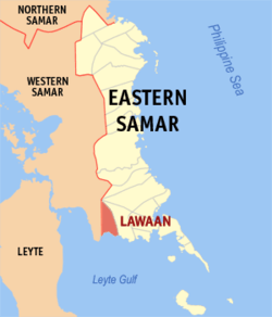 Map of Eastern Samar with Lawaan highlighted | |
.svg.png) Lawaan Location within the Philippines | |
| Coordinates: 11°09′N 125°18′E / 11.15°N 125.3°ECoordinates: 11°09′N 125°18′E / 11.15°N 125.3°E | |
| Country |
|
| Region | Eastern Visayas (Region VIII) |
| Province | Eastern Samar |
| District | Lone District |
| Barangays | 16 (see Barangays) |
| Government [1] | |
| • Type | Sangguniang Bayan |
| • Mayor | Florencio A. Almeda, Jr. |
| • Electorate | 8,948 voters (2016) |
| Area [2] | |
| • Total | 162.56 km2 (62.76 sq mi) |
| Population (2015 census)[3] | |
| • Total | 12,742 |
| • Density | 78/km2 (200/sq mi) |
| Time zone | UTC+8 (PST) |
| ZIP code | 6813 |
| PSGC | 082612000 |
| IDD : area code | +63 (0)55 |
| Climate type | Tropical rainforest climate |
| Income class | 5th municipal income class |
| Revenue (₱) | 63,235,752.33 (2016) |
| Native languages |
Waray Tagalog |
| Website |
www |
Lawaan, officially the Municipality of Lawaan, is a 5th class municipality in the province of Eastern Samar, Philippines. According to the 2015 census, it has a population of 12,742 people.[3]
Geography
The town is strategically located in the central part of southern Samar Island. It is sandwiched between the town of Balangiga in the east and Marabut, Samar in the west. Barangay Bolusao, the town's largest settlement located right at the east-west Samar boundary, serves as the premier barangay of Eastern Samar for those people coming from Tacloban City or Province of Samar traversing Samar Circumferencial Road. Hence, being dubbed as 'The Gateway to Eastern Samar'.
Barangays
Lawaan is politically subdivided into 16 barangays. [2]
- Betaog
- Bolusao (largest by population and area)
- Guinob-an
- Maslog
- Barangay Poblacion 1
- Barangay Poblacion 2
- Barangay Poblacion 3
- Barangay Poblacion 4
- Barangay Poblacion 5
- Barangay Poblacion 6
- Barangay Poblacion 7
- Barangay Poblacion 8
- Barangay Poblacion 9
- Barangay Poblacion 10
- San Isidro
- Taguite
Demographics
| Population census of Lawaan | ||
|---|---|---|
| Year | Pop. | ±% p.a. |
| 1960 | 5,983 | — |
| 1970 | 7,479 | +2.25% |
| 1975 | 8,517 | +2.64% |
| 1980 | 7,275 | −3.10% |
| 1990 | 7,792 | +0.69% |
| 1995 | 9,725 | +4.24% |
| 2000 | 9,855 | +0.29% |
| 2007 | 10,645 | +1.07% |
| 2010 | 11,612 | +3.21% |
| 2015 | 12,742 | +1.78% |
| Source: Philippine Statistics Authority[3][4][5][6] | ||
The population of Lawaan in the 2015 census was 12,742 people,[3] with a density of 78 inhabitants per square kilometre or 200 inhabitants per square mile.
Economy
Lawaan's main product is copra. Many families rely on coastal and deep-sea fishing as well as lowland and upland farming as means of livelihood. Others have spouses, children, parents or other relatives working in Tacloban City, Metro Manila or in other places within the Philippines or abroad either as professionals, contract workers or domestic helpers who regularly remit part of their earnings to their families back home. The single biggest employer of its local populace is the government.
Tourism
Lawaan is known for its spectacular waterfalls and thriving wildlife. Being a coastal town, it features an unobstructed amazing view of Leyte Gulf in its southern shores.
There are four waterfalls in the Bolusao watershed which lies within the SINP Buffer Zone. These falls are Amandaraga, Pange, Amanjuray, and Ban-Awan Falls. Amandaraga and Ban-awan Falls are the main source of the municipality's water system. Meanwhile, Amanjuray Falls is the alternate hydro-electric power source of Lawaan wherein a mini-hydro power plant is existent nearby.
Notable Lawaaños
- Freddie Abuda - retired professional basketball player, currently serving as an assistant coach to the San Beda Red Lions (NCAA).
References
- ↑ "Municipality". Quezon City, Philippines: Department of the Interior and Local Government. Retrieved 31 May 2013.
- 1 2 "Province: Eastern Samar". PSGC Interactive. Quezon City, Philippines: Philippine Statistics Authority. Retrieved 12 November 2016.
- 1 2 3 4 Census of Population (2015). "Region VIII (Eastern Visayas)". Total Population by Province, City, Municipality and Barangay. PSA. Retrieved 20 June 2016.
- ↑ Census of Population and Housing (2010). "Region VIII (Eastern Visayas)". Total Population by Province, City, Municipality and Barangay. NSO. Retrieved 29 June 2016.
- ↑ Censuses of Population (1903–2007). "Region VIII (Eastern Visayas)". Table 1. Population Enumerated in Various Censuses by Province/Highly Urbanized City: 1903 to 2007. NSO.
- ↑ "Province of Eastern Samar". Municipality Population Data. Local Water Utilities Administration Research Division. Retrieved 17 December 2016.
External links
- Philippine Standard Geographic Code
- Philippine Census Information
- Local Governance Performance Management System
Places adjacent to Lawaan, Eastern Samar | |
|---|---|
Borongan (capital) | |
| Municipalities | |
| Component city | |