Mount Walker West, Queensland
| Mount Walker West Queensland | |||||||||||||||
|---|---|---|---|---|---|---|---|---|---|---|---|---|---|---|---|
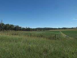 Fields along Mount Walker West Road, 2015 | |||||||||||||||
 Mount Walker West | |||||||||||||||
| Coordinates | 27°46′17″S 152°29′47″E / 27.77139°S 152.49639°ECoordinates: 27°46′17″S 152°29′47″E / 27.77139°S 152.49639°E | ||||||||||||||
| Population | 392 (2011)[1] | ||||||||||||||
| Postcode(s) | 4340 | ||||||||||||||
| LGA(s) |
Scenic Rim Region City of Ipswich | ||||||||||||||
| State electorate(s) | Scenic Rim | ||||||||||||||
| Federal Division(s) |
Wright Blair | ||||||||||||||
| |||||||||||||||
Mount Walker West is a locality split between the Scenic Rim Region and City of Ipswich local government areas of South East Queensland, Australia. At the 2011 Australia Census the locality and surrounds recorded a population of 392.[1]
Along the eastern extent of Mount Walker West the Bremer River marks the boundary. In the west elevations rise to around 250 metres above sea level.
References
- 1 2 Australian Bureau of Statistics (31 October 2012). "Coleyville (State Suburb)". 2011 Census QuickStats. Retrieved 27 March 2015.

This article is issued from
Wikipedia.
The text is licensed under Creative Commons - Attribution - Sharealike.
Additional terms may apply for the media files.