Coulson, Queensland
| Coulson Queensland | |||||||||||||||
|---|---|---|---|---|---|---|---|---|---|---|---|---|---|---|---|
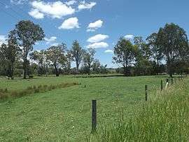 Paddocks along Old Beaudesert Road, 2016 | |||||||||||||||
 Coulson | |||||||||||||||
| Coordinates | 27°57′S 152°44′E / 27.950°S 152.733°ECoordinates: 27°57′S 152°44′E / 27.950°S 152.733°E | ||||||||||||||
| Population | 254 (2011 census)[1] | ||||||||||||||
| Postcode(s) | 4310 | ||||||||||||||
| LGA(s) | Scenic Rim Region | ||||||||||||||
| State electorate(s) | Scenic Rim | ||||||||||||||
| Federal Division(s) | Blair | ||||||||||||||
| |||||||||||||||
Coulson is a locality in the Scenic Rim Region of south-east Queensland, Australia. At the 2011 census, Roadvale and the surrounding area had a population of 254.[1]
Geography
Coulson is positioned on the main road linking Boonah, Queensland with both Beaudesert and Ipswich. Coulson is crossed by Teviot Brook, a tributary of the Logan River at the southern end of the Teviot Range. Part of the southern boundary follows Sandy Creek and includes the elevated slopes of Groans Hill.
History
Much of the land is used for agricultural purposes. Coulson State School operated from 1881 to 1993.[2]
References
- 1 2 Australian Bureau of Statistics (31 October 2012). "Coulson (Gazetted Locality)". 2011 Census QuickStats. Retrieved 19 December 2016.

- ↑ "Agency Details: Coulson State School". Queensland State Archives. Retrieved 19 December 2016.
This article is issued from
Wikipedia.
The text is licensed under Creative Commons - Attribution - Sharealike.
Additional terms may apply for the media files.