Carole Park, Queensland
| Carole Park Brisbane, Queensland | |||||||||||||||
|---|---|---|---|---|---|---|---|---|---|---|---|---|---|---|---|
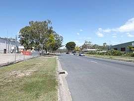 Cobalt Street, 2014 | |||||||||||||||
| Population | 0 (Industrial suburb) (2011 census)[1] | ||||||||||||||
| Established | 1972 | ||||||||||||||
| Postcode(s) | 4300 | ||||||||||||||
| Location |
| ||||||||||||||
| LGA(s) | City of Ipswich | ||||||||||||||
| State electorate(s) | Jordan | ||||||||||||||
| Federal Division(s) | Oxley | ||||||||||||||
| |||||||||||||||
Carole Park is a suburb of the City of Ipswich, Queensland, Australia.[2] It is 19 kilometres (12 mi) south west of the Brisbane central business district. The Place Names Board designated the suburb and its name in 1972.[3]
Geography
Prior to 2010, Carole Park was a half residential and half industrial suburb with the Logan Motorway separating the two areas; the residential part was in City of Brisbane and the industrial part was in City of Ipswich, the result of Shire of Moreton being absorbed into Brisbane, Ipswich and Esk during the 1990s.[3] As of May 2010 the residential part of Carole Park was renamed Ellen Grove and allocated 4078 as their new Brisbane post code.[4] The remaining Carole Park is now purely used for industrial purposes and is within the City of Ipswich with the population at the 2011 Australian Census being nil.[1][2]
History
The suburb was not settled until the 1940s with the exception of a few farms.[3] Electricity was provided around 1965 and mains water in 1969.[3] The Queensland Housing Commission provided housing to residents in the 1970s.
Air pollution
The suburb's industrial areas are populated by several large companies such as James Hardie. Residents in nearby streets often report bad air quality to Ipswich City Council but the Council has failed to act against polluting companies fearing loss of revenue.
References
- 1 2 Australian Bureau of Statistics (31 October 2012). "Carole Park (State Suburb)". 2011 Census QuickStats. Retrieved 10 September 2014.

- 1 2 "Carole Park - suburb in the City of Ipswich (entry 45035)". Queensland Place Names. Queensland Government. Retrieved 28 September 2017.
- 1 2 3 4 Mynott, Wicki (2009). 150 years: Richlands, Inala & neighbouring suburbs in Brisbane's South West. Richlands, Inala & Suburbs History Group. pp. 51–55.
- ↑ "Ellen Grove - suburb in City of Brisbane (entry 48323)". Queensland Place Names. Queensland Government. Retrieved 28 September 2017.
External links
- "Carole Park". Queensland Places. Centre for the Government of Queensland, University of Queensland.
- "Carole Park". Our Brisbane. Brisbane City Council. Archived from the original on 30 March 2008. Retrieved 30 October 2013.
Coordinates: 27°37′S 152°56′E / 27.617°S 152.933°E