Gleneagle, Queensland
| Gleneagle Scenic Rim Region, Queensland | |||||||||||||||
|---|---|---|---|---|---|---|---|---|---|---|---|---|---|---|---|
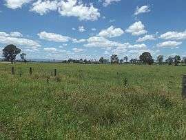 Fields along Alan Creek Road, 2016 | |||||||||||||||
| Postcode(s) | 4285 | ||||||||||||||
| Location | 51 km (32 mi) south of Brisbane | ||||||||||||||
| LGA(s) | Scenic Rim Region | ||||||||||||||
| State electorate(s) | Scenic Rim | ||||||||||||||
| Federal Division(s) | Wright | ||||||||||||||
| |||||||||||||||
Gleneagle is a locality in the Scenic Rim Region, Queensland, Australia. The Logan River and the Mount Lindesay Highway pass through eastern parts of locality. Large sections of land are rural with some parts used for irrigated agriculture. A housing estate was established to the east of the highway. In the centre of Gleneagle is a large man-made dam called Lake Brabazon. The western boundary follows the North Coast railway line.
Gleneagle takes its name from a farm established by William Walker.[1] A primary school was established in 1891[1] and continues to educate students.
References
- 1 2 "Gleneagle". Queensland Places. Centre for the Government of Queensland, University of Queensland. Retrieved 11 December 2016.
External links
![]()
Coordinates: 27°56′00″S 152°58′00″E / 27.93333°S 152.96667°E
This article is issued from
Wikipedia.
The text is licensed under Creative Commons - Attribution - Sharealike.
Additional terms may apply for the media files.