Redbank Plains, Queensland
| Redbank Plains Ipswich, Queensland | |||||||||||||||
|---|---|---|---|---|---|---|---|---|---|---|---|---|---|---|---|
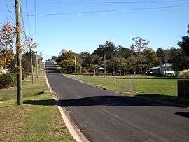 Cedar Road, 2016 | |||||||||||||||
| Population | 19,299 (2016)[1] | ||||||||||||||
| Postcode(s) | 4301 | ||||||||||||||
| Location | 30.5 km (19 mi) from Brisbane | ||||||||||||||
| LGA(s) | City of Ipswich | ||||||||||||||
| State electorate(s) | Bundamba | ||||||||||||||
| Federal Division(s) | |||||||||||||||
| |||||||||||||||
Redbank Plains is a suburb approximately 30 kilometres (19 mi) from the Brisbane CBD. Located on the outskirts of the Brisbane Statistical Division, its Local Government Area is the City of Ipswich. At the 2016 Census the suburb recorded a population of 19,299.[1] Redbank Plains is not to be confused with the neighbouring suburb Redbank.
Community services and infrastructure
The Ipswich City Council operates the Redbank Plains Library in Moreton Avenue.[2] It opened in 1985 with a major refurbishment in 2010.[3]
The Redbank Plains State High School is located on the corner of Willow and Keidges Roads. Staines Memorial College is located on School Road.
Weather radar
The CP2 weather radar is located at the end of Vic Cumner Drive. This polarmetric radar was established in 2007 and is used to measure rainfall, rain drop sizes and for the detection of hail storms.[4] The data collected by the specialist radar facility that is operated by the Bureau of Meteorology and the National Centre for Atmospheric Research is used in a range of research projects by The Centre for Australian Weather and Climate Research.[5] Unlike the nearby radars at Mount Stapylton and Marburg, the radar does not provide a streaming media loop to the public.[6]
References
- 1 2 Australian Bureau of Statistics (27 June 2017). "Redbank Plains (State Suburb)". 2016 Census QuickStats. Retrieved 12 July 2017.

- ↑ "Redbank Plains Library". Ipswich City Council. Archived from the original on 30 January 2018. Retrieved 30 January 2018.
- ↑ "Public Libraries Statistical Bulletin 2016-17" (PDF). Public Libraries Connect. State Library of Queensland. November 2017. p. 13. Archived (PDF) from the original on 30 January 2018. Retrieved 30 January 2018.
- ↑ Andrew Korner (5 March 2011). "Weather radar aids research". Queensland Times. Retrieved 29 June 2016.
- ↑ CP2 Radar Facility, Bureau of Meteorology (accessed 18 December 2012)
- ↑ Confusion surrounding the Redbank Plains weather station, The Queensland Times, 8 December 2012 (accessed 18 december 2012)
External links
- University of Queensland: Queensland Places: Redbank Plains
- Road Names & History, Ipswich City Council
Coordinates: 27°39′S 152°51′E / 27.650°S 152.850°E