Scenic Rim Region
| Scenic Rim Region Queensland | |||||||||||||||
|---|---|---|---|---|---|---|---|---|---|---|---|---|---|---|---|
 Location within Queensland | |||||||||||||||
| Population | 40,072 (2016 census)[1] | ||||||||||||||
| • Density | 9.4154/km2 (24.386/sq mi) | ||||||||||||||
| Established | 2008 | ||||||||||||||
| Area | 4,256 km2 (1,643.3 sq mi) | ||||||||||||||
| Mayor | Greg Christensen[2] | ||||||||||||||
| Council seat | Beaudesert | ||||||||||||||
| Region | West Moreton | ||||||||||||||
| State electorate(s) | Scenic Rim | ||||||||||||||
| Federal Division(s) | Wright | ||||||||||||||
 | |||||||||||||||
| Website | Scenic Rim Region | ||||||||||||||
| |||||||||||||||
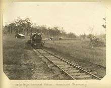
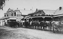
The Scenic Rim Region is a local government area in West Moreton region of South East Queensland, Australia. Established in 2008, it was preceded by several previous local government areas with histories extending back to the early 1900s and beyond. The main town of the region is Beaudesert.
It has an estimated operating budget of A$33 million.
History
Prior to 2008, the new Scenic Rim Region was an entire area of three previous and distinct local government areas:
- the Shire of Boonah;
- the southern part of the Shire of Beaudesert;
- and the Harrisville and Peak Crossing areas from the City of Ipswich.
In July 2007, the Local Government Reform Commission released its report and recommended that the areas amalgamate. It identified a rural community of interest as well as ecotourism potential from the Scenic Rim, a group of mountain ranges forming part of the Great Dividing Range, and recommended the transfer of the entire urban growth corridor previously within Beaudesert to Logan City. Along with Lockyer Valley and Somerset, it was expected to provide a rural hinterland for urban South East Queensland. The arrangement was Boonah's second preference (its first was simply absorbing the rural areas of Ipswich) while Beaudesert opposed splitting or amalgamation.[3]
The legislation passed to effect the merger on 10 August 2007. A Local Transition Committee made up of staff and councillors of the dissolving entities was formed to manage the process. On 15 March 2008, the Shires formally ceased to exist, and elections were held on the same day to elect councillors and a mayor to the Regional Council.
Geography
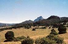
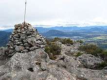
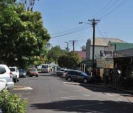
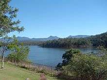
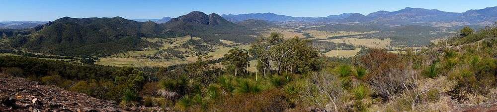
The region is mostly rural, with Beaudesert and Boonah the main towns. It lies within the catchment areas of the Bremer River, the Logan River/Albert River and the Coomera River/Nerang River. The centre of the area is dominated by the Teviot Range and broad sweep of mountainous terrain forming a southern boundary with the local government area on Queensland's southern border with New South Wales. Many high-altitude areas are covered by forests and protected in national parks (including World Heritage listings) at Tamborine Mountain, McPherson Range, Main Range National Park, Mount Barney National Park and landforms including Cunninghams Gap and Fassifern Valley. South East Queensland's highest mountain is Mount Barney, reaching 1,356 metres (4,449 ft) above sea level. Wyaralong Dam is the region's newest reservoir.
In the south east of the local government area is the Lamington National Park. It includes villages such as Canungra, Kooralbyn, Rathdowney, Beechmont and Harrisville. The peak at Mount French, part of Moogerah Peaks National Park is noted for its traditional rock climbing and does not have bolted climbing routes. The peak also boasts a '32' rated climb (one of the hardest in the world) which attracts international rock climbing visitors to the area. The latest being Monique Forrester who has now included the climb 'Whistling Kite' in her list of completed climbs. The area of Boonah is fairly flat with large areas of very productive soils for the growing of vegetables and other crops. Beechmont and O'Reillys are mountainous areas overlooking the Gold Coast hinterland. These areas attract visitors for camping, bushwalking and bird watching.
Divisions
The council is split into 6 divisions, each returning one councillor, plus a mayor.
Mayors
Greg Christensen was elected mayor in 2016.[2] Former mayor, Councillor John Brent[4] is one of the longest continuing serving elected members in Australia with almost 40 years of service and over twenty as mayor.[5]
Mayors of Scenic Rim
| Member | Party | Term | |
|---|---|---|---|
| John Brent | Unaffiliated | 2008 - 2016 | |
| Greg Christensen | Unaffiliated | 2016–present | |
Towns and localities
The Scenic Rim Region includes the following settlements:
Other areas:
|
|
|
1 - split with the City of Ipswich 2 - split with Logan City
Population
The populations given relate to the component entities prior to 2008.
| Year | Population |
|---|---|
| 1986 | 22,992 |
| 1991 | 28,512 |
| 1996 | 32,997 |
| 2001 | 35,342 |
| 2006 | 34,659 |
Heritage register
In 2014, the Scenic Rim Regional Council established a local heritage register as required by the Queensland Heritage Act 1992. In February 2015, it listed 54 places based on criteria in the Australia ICOMOS Burra Charter 1999.[6]
Libraries
The Scenic Rim Regional Council operate libraries in Beaudesert, Boonah, Canungra and Tamborine Mountain. The council commenced a mobile library service in 2008,[7] which serves Beechmont, Harrisville, Hillview, Kalbar, Kooralbyn, Peak Crossing, Rathdowney and Tamborine.[8]
References
- ↑ Australian Bureau of Statistics (27 June 2017). "Scenic Rim (R)". 2016 Census QuickStats. Retrieved 16 November 2017.

- 1 2 "2016 Scenic Rim Regional Council - Mayoral Election - Election Summary". results.ecq.qld.gov.au. Archived from the original on 14 February 2017. Retrieved 4 December 2017.
- ↑ Queensland Local Government Reform Commission (July 2007). Report of the Local Government Reform Commission (PDF). 2. pp. 32–36. ISBN 1-921057-11-4. Archived from the original (PDF) on 17 March 2011. Retrieved 2 March 2010.
- ↑ "2012 Scenic Rim Regional Council - Mayoral Election - Election Summary". results.ecq.qld.gov.au. Archived from the original on 8 May 2016. Retrieved 4 December 2017.
- ↑ "One of the most enduring leaders in Queensland local government, Scenic Rim Mayor John Brent has a blunt and simple response to questions about the role of a council and its mayor... - Local Government Association of Queensland". lgaq.asn.au. Archived from the original on 4 December 2017. Retrieved 4 December 2017.
- ↑ "Local Heritage Register". Scenic Rim Regional Council. Archived from the original on 10 February 2015. Retrieved 9 February 2015.
- ↑ "Public Libraries Statistical Bulletin 2016-17" (PDF). Public Libraries Connect. State Library of Queensland. November 2017. p. 15. Archived (PDF) from the original on 30 January 2018. Retrieved 30 January 2018.
- ↑ "Locations and Membership". Scenic Rim Regional Council. Archived from the original on 30 January 2018. Retrieved 31 January 2018.
External links
Coordinates: 27°59′15″S 152°59′43″E / 27.98750°S 152.99528°E