Tamborine, Queensland
| Tamborine Queensland | |||||||||||||||
|---|---|---|---|---|---|---|---|---|---|---|---|---|---|---|---|
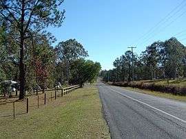 Greensward Road, 2014 | |||||||||||||||
| Population | 3,464 (2011 census)[1] | ||||||||||||||
| • Density | 42.87/km2 (111.04/sq mi) | ||||||||||||||
| Postcode(s) | 4270 | ||||||||||||||
| Area | 80.8 km2 (31.2 sq mi) | ||||||||||||||
| Location | 47 km (29 mi) south of Brisbane | ||||||||||||||
| LGA(s) | |||||||||||||||
| State electorate(s) | |||||||||||||||
| Federal Division(s) | Wright | ||||||||||||||
| |||||||||||||||
Tamborine is a town in the Scenic Rim Region and a locality split between the Scenic Rim Region and the City of Logan in Queensland, Australia.[2][3][4] In the 2011 census, Tamborine had a population of 3,464.[1]
History
Tamborine used to be spelled Tambourine. It was the administrative centre of the Shire of Tamborine (formerly the Shire of Tambourine).
Tambourine Provisional School opened on 24 August 1874, becoming Tambourine State School on 1 January 1909. The spelling was changed to Tamborine on 29 April 1926. Tamborine State School closed on 10 July 1970.[5][6]
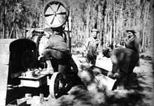
During World War II, the 32nd Infantry Division of the American Army established a camp initially called Camp Tamborine (but later called Camp Cable after deceased soldier Gerald O. Cable) at Tamborine in 1942.[7]
Formerly in the Shire of Beaudesert, Tamborine was split between Logan City and Scenic Rim Region following the local government amalgamations in March 2008.
A station at Tamborine along the Canungra railway line operated from 1915 to 1955.
Heritage listings
Tamborine has the following heritage-listed sites:
- 869 Mundoolun Connection Road: Tamborine House [8]
Amenities
The Scenic Rim Regional Council operates a mobile library service which visits the corner or Waterford-Tamborine Road & Beenleigh-Beaudesert Rd, opposite the Shell service station.[9]
References
- 1 2 Australian Bureau of Statistics (31 October 2012). "Tamborine". 2011 Census QuickStats. Retrieved 6 May 2014.

- ↑ "Tamborine - town in Scenic Rim Region (entry 33231)". Queensland Place Names. Queensland Government. Retrieved 29 December 2017.
- ↑ "Tamborine - locality in Scenic Rim Region (entry 48266)". Queensland Place Names. Queensland Government. Retrieved 29 December 2017.
- ↑ "Tamborine - locality in City of Logan (entry 48976)". Queensland Place Names. Queensland Government. Retrieved 29 December 2017.
- ↑ "Agency ID6474, Tamborine State School". Queensland State Archives. Retrieved 13 May 2014.
- ↑ "Opening and closing dates of Queensland Schools". Queensland Government. Retrieved 13 May 2014.
- ↑ "Camp Cable near Logan Village". Retrieved 6 May 2014.
- ↑ "Local Heritage Register" (PDF). Scenic Rim Regional Council. Retrieved 9 February 2015.
- ↑ "Mobile Library" (PDF). Scenic Rim Regional Council. Archived from the original (PDF) on 30 January 2018. Retrieved 31 January 2018.
Further reading
- Logan Village State School (1975), Centenary souvenir booklet, Logan Village — includes information on Tamborine State School
External links
- "Tamborine and Tamborine Shire". Queensland Places. Centre for the Government of Queensland, University of Queensland.
Coordinates: 27°52′54″S 153°07′48″E / 27.8816°S 153.130°E