Goolman, Queensland
| Goolman City of Ipswich, Queensland | |||||||||||||||
|---|---|---|---|---|---|---|---|---|---|---|---|---|---|---|---|
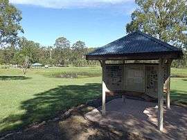 Information display at Hardings Paddock Picnic Area, 2015 | |||||||||||||||
 Goolman | |||||||||||||||
| Coordinates | 27°44′2″S 152°46′3″E / 27.73389°S 152.76750°ECoordinates: 27°44′2″S 152°46′3″E / 27.73389°S 152.76750°E | ||||||||||||||
| Population | 42 (2016 census)[1] | ||||||||||||||
| Postcode(s) | 4306 | ||||||||||||||
| LGA(s) | City of Ipswich | ||||||||||||||
| State electorate(s) | Scenic Rim | ||||||||||||||
| Federal Division(s) | Blair | ||||||||||||||
| |||||||||||||||
Goolman is a rural locality in the City of Ipswich, Queensland, Australia.[2] At the 2016 Australian Census, Goolman recorded a population of 42.[1]
The east of Goolman contains the northern foothills of the Teviot Range. The slopes remain vegetated with little development occurring in the area.
History
The locality name Goolman comes from nearby Mount Goolman, which in turn derives its name from stone axe in the Yuggera language.[2] Goolman was a stop along the Dugandan railway line.
Nature reserve
The Flinders - Goolman Conservation Estate covers 1,900 hectares and includes several peaks including Flinders Peak, Mount Goolman, Mount Blain and Mount Cathrine. Hardings Paddocks Picnic Area is located in Goolman. It includes horse riding facilities, walking tracks and a camping area.[3]
References
- 1 2 Australian Bureau of Statistics (27 June 2017). "Goolman (State Suburb)". 2016 Census QuickStats. Retrieved 25 March 2018.

- 1 2 "Goolman (entry 45049)". Queensland Place Names. Queensland Government. Retrieved 14 March 2014.
- ↑ "Camping at Hardings Paddock". Discover Ipswich. Ipswich City Council. Archived from the original on 13 April 2015. Retrieved 9 April 2015.
External links
![]()