Coleyville, Queensland
| Coleyville Queensland | |||||||||||||||
|---|---|---|---|---|---|---|---|---|---|---|---|---|---|---|---|
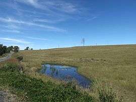 Fields along Rosewood Warrill View Road, 2015 | |||||||||||||||
 Coleyville | |||||||||||||||
| Coordinates | 27°47′40″S 152°35′18″E / 27.79444°S 152.58833°ECoordinates: 27°47′40″S 152°35′18″E / 27.79444°S 152.58833°E | ||||||||||||||
| Population | 392 (2011 census)[1] | ||||||||||||||
| Postcode(s) | 4307 | ||||||||||||||
| Elevation | 65 m (213 ft) | ||||||||||||||
| LGA(s) | Scenic Rim Region | ||||||||||||||
| State electorate(s) | Scenic Rim | ||||||||||||||
| Federal Division(s) | Wright | ||||||||||||||
| |||||||||||||||
Coleyville is a locality in the Scenic Rim Region, Queensland, Australia. At the 2011 Australia Census Coleyville and surrounds recorded a population of 392.[1]
In the east of Coleyville elevations rise towards the summit of Mount Walker. Mount Walker Creek, a tributary of Warrill Creek, is the main waterway in the locality. The land, like most parts of the Fassifern Valley, is mainly used for agricultural purposes.
References
- 1 2 Australian Bureau of Statistics (31 October 2012). "Coleyville (State Suburb)". 2011 Census QuickStats. Retrieved 10 August 2014.

External links
![]()
This article is issued from
Wikipedia.
The text is licensed under Creative Commons - Attribution - Sharealike.
Additional terms may apply for the media files.