Teviotville, Queensland
| Teviotville Queensland | |||||||||||||||
|---|---|---|---|---|---|---|---|---|---|---|---|---|---|---|---|
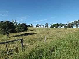 Farm along Teviotville Road, 2015 | |||||||||||||||
 Teviotville | |||||||||||||||
| Coordinates | 27°57′S 152°40′E / 27.950°S 152.667°ECoordinates: 27°57′S 152°40′E / 27.950°S 152.667°E | ||||||||||||||
| Population | 273 (2011 census)[1] | ||||||||||||||
| Postcode(s) | 4309 | ||||||||||||||
| LGA(s) | Scenic Rim Region | ||||||||||||||
| State electorate(s) | Scenic Rim | ||||||||||||||
| Federal Division(s) | Wright | ||||||||||||||
| |||||||||||||||
Teviotville is a locality in the Scenic Rim of South East Queensland, Australia. At the 2011 Australian Census the locality and surrounds recorded a population of 273.[1]
History
Teviotville was a stop along the closed Dugandan railway line. The name is derived from the name given to a railway stop by the Railway Department in 1887.[2] That was based on the name of the major watercourse in the area, Teviot Brook.[2] A school opened in the area in 1899. In 1981, the schools closed due to low enrolments.[3]
Teviot Tree
The Teviotville Tree is located on private property in Teviotville. The tree was used in the filming of the 2010 film The Tree.
References
- 1 2 Australian Bureau of Statistics (31 October 2012). "Teviotville (Gazetted Locality)". 2011 Census QuickStats. Retrieved 15 April 2015.

- 1 2 "Nomenclature Of Queensland–276". The Courier-Mail. Brisbane: National Library of Australia. 18 August 1936. p. 16. Retrieved 15 April 2015.
- ↑ "Teviotville State School". Queensland State Archives Agency ID10356. Queensland State Archives. Retrieved 15 April 2015.
External links
![]()
This article is issued from
Wikipedia.
The text is licensed under Creative Commons - Attribution - Sharealike.
Additional terms may apply for the media files.