Brassall, Queensland
| Brassall Ipswich, Queensland | |||||||||||||||
|---|---|---|---|---|---|---|---|---|---|---|---|---|---|---|---|
| Population | 9,245 (2011 census)[1] | ||||||||||||||
| • Density | 1,491/km2 (3,862/sq mi) | ||||||||||||||
| Postcode(s) | 4305 | ||||||||||||||
| Area | 6.2 km2 (2.4 sq mi) | ||||||||||||||
| Location | |||||||||||||||
| LGA(s) | City of Ipswich | ||||||||||||||
| State electorate(s) | Ipswich West | ||||||||||||||
| Federal Division(s) | Blair | ||||||||||||||
| |||||||||||||||
Coordinates: 27°35′28″S 152°44′06″E / 27.591°S 152.735°E
Brassall is a suburb in the City of Ipswich, Queensland, Australia.[2] In the 2011 census, Brassall had a population of 9,245 people.[1]
Geography
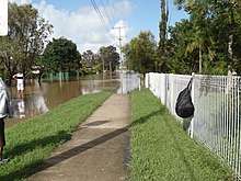
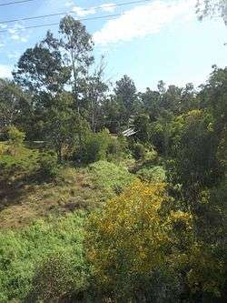
Brassall has a southern boundary partially marked by the Bremer River and a western alignment along Ironpot Creek. The northern boundary follows the Warrego Highway.[3] Brassall now incorporates part of the old suburb of Raymonds Hill.
History
The suburb name first appears on a plan drawn by surveyor James Warner on 6 October 1851; however, the origin of the suburb name is unknown.[2] It was also known as Hungry Flats, as was a stop over for bullock teams that were transporting logs from Pine Mountain to Hancocks saw mill at North Ipswich. Brassall was a separate shire (Shire of Brassall) with its own council from March 1860 until 1 January 1917 when the area became part of Ipswich. The suburb was officially bounded and named in 1991.[4] The Brisbane Valley railway line once passed through Brassall.
Brassall State School opened on 10 September 1894.[5]
Heritage listings
Brassall has a number of heritage-listed sites, including
- Mihi Junction: Mihi Creek Complex[6]
- Parker Lane: Klondyke Coke Ovens[7]
Education
The suburb contains three schools: Ipswich State High School, Brassall State School and Ipswich Seventh Day Adventist School.
Since 2003, Brassall has been a key development area in the city of Ipswich. Formerly bushland and farming area leading into the West Moreton district; Brassall has been extensively developed. A new estate named "Grammar Park Estate" opened in Brassall in early 2002. It has since developed significantly with investors subdividing land. A property on Henry street was bought for over $1.5 million and has since been subdivided into over 28 house blocks. Grammar Park Estate now has over 1000 houses. Many families send their children to West Moreton Anglican College, located 5 kilometres (3.1 mi) from Brassall (as the crow flies).
Amenities
The Ipswich City Council operates a fortnightly mobile library service which visits the shopping centre.[8]
Demographics
At the 2011 Australian Census the suburb recorded a population of 9,245.[9] Brassall is an area of Ipswich which has a higher demographic. As reported in the Australian Bureau of Statistics, Brassall's occupants hold higher levels of education than those from other suburbs. Brassall's occupants vary from retirees, young families and defence personnel.
References
- 1 2 Australian Bureau of Statistics (31 October 2012). "Brassall (SSC)". 2011 Census QuickStats. Retrieved 2 January 2017.

- 1 2 "Brassall (entry 45031)". Queensland Place Names. Queensland Government. Retrieved 3 January 2017.
- ↑ "Queensland Globe". State of Queensland. Retrieved 3 January 2017.
- ↑ "Brassall (entry 45031)". Queensland Place Names. Queensland Government. Retrieved 21 June 2017.
- ↑ "Opening and closing dates of Queensland schools (B)". Queensland Government Department of Education and Training. 16 August 2013. Retrieved 22 January 2018.
- ↑ "Mihi Creek Complex (entry 700010)". Queensland Heritage Register. Queensland Heritage Council. Retrieved 9 July 2013.
- ↑ "Klondyke Coke Ovens (entry 602566)". Queensland Heritage Register. Queensland Heritage Council. Retrieved 9 July 2013.
- ↑ "Ipswich Libraries: Mobile library schedule of stops - January to June 2018" (PDF). Ipswich City Council. Archived (PDF) from the original on 30 January 2018. Retrieved 30 January 2018.
- ↑ Australian Bureau of Statistics (31 October 2012). "Brassall (State Suburb)". 2011 Census QuickStats. Retrieved 27 June 2015.
External links
| Wikimedia Commons has media related to Brassall, Queensland. |