Coalfalls, Queensland
| Coalfalls Ipswich, Queensland | |||||||||||||||
|---|---|---|---|---|---|---|---|---|---|---|---|---|---|---|---|
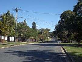 William Street West, 2016 | |||||||||||||||
| Population | 943 (2016 census)[1] | ||||||||||||||
| Postcode(s) | 4305 | ||||||||||||||
| Location | |||||||||||||||
| LGA(s) | City of Ipswich | ||||||||||||||
| State electorate(s) | Ipswich | ||||||||||||||
| Federal Division(s) | Blair | ||||||||||||||
| |||||||||||||||
Coalfalls is a suburb in the City of Ipswich, Queensland, Australia.[2] At the 2016 Australian Census, the suburb recorded a population of 943.[1]
History
The origin of the suburb name comes from James Blair's house, Coalfalls, which in turn probably takes its name from the sighting of coal seams in this area, most notably along the banks of the Bremer River.[2]
References
- 1 2 Australian Bureau of Statistics (27 June 2017). "Coalfalls (State Suburb)". 2016 Census QuickStats. Retrieved 25 March 2018.

- 1 2 "Coalfalls (entry 45038)". Queensland Place Names. Queensland Government. Retrieved 21 June 2017.
External links
Coordinates: 27°36′S 152°45′E / 27.600°S 152.750°E
This article is issued from
Wikipedia.
The text is licensed under Creative Commons - Attribution - Sharealike.
Additional terms may apply for the media files.