Fairmont, West Virginia
| Fairmont, West Virginia | |
|---|---|
| City | |
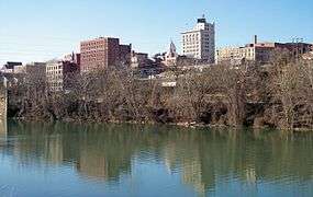 Downtown Fairmont and the Monongahela River in 2006 | |
| Nickname(s): "Friendly City" | |
| Motto(s): "Spend a Day... Spend a Lifetime" | |
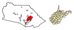 Location of Fairmont in Marion County, West Virginia. | |
| Coordinates: 39°28′53″N 80°8′36″W / 39.48139°N 80.14333°WCoordinates: 39°28′53″N 80°8′36″W / 39.48139°N 80.14333°W | |
| Country | United States |
| State | West Virginia |
| County | Marion |
| Government | |
| • Type | Council-manager government |
| • Mayor | Tom Mainella |
| • Deputy Mayor | Frank Yann |
| • City Manager | Robin I. Gomez |
| Area[1] | |
| • Total | 9.00 sq mi (23.31 km2) |
| • Land | 8.62 sq mi (22.33 km2) |
| • Water | 0.38 sq mi (0.98 km2) |
| Elevation | 984 ft (300 m) |
| Population (2010)[2] | |
| • Total | 18,704 |
| • Estimate (2016)[3] | 18,622 |
| • Density | 2,169.8/sq mi (837.8/km2) |
| Time zone | UTC−5 (Eastern (EST)) |
| • Summer (DST) | UTC−4 (EDT) |
| ZIP codes | 26554-26555 |
| Area code(s) | 304 |
| FIPS code | 54-26452 |
| GNIS feature ID | 1560581[4] |
| Website | Fairmontwv.gov |

Fairmont is a city in Marion County, West Virginia, United States. The population was 18,704 at the 2010 census. It is the county seat of Marion County.[5]
History
Prior to the founding of Fairmont, the land that would become Marion County was part of Monongalia and Harrison County.[6] In the 1700s, the earliest development of this area consisted of subsistence farming settlements.[7] In 1789, Boaz Fleming, a Revolutionary War veteran, migrated to this area and purchased a 254-acre farm from Jonathan Bozarth. Oral history indicates that in 1808, Fleming made his annual trek to Clarksburg to pay his brother's Harrison County taxes.[8] While in Clarksburg, Fleming attended a social gathering that included his cousin, Dolley Madison, wife of President James Madison. Fleming complained to Mrs. Madison about having to travel over a hundred miles each year from his home to pay his Monongalia County taxes and his brother's Harrison County taxes. Mrs. Madison supposedly suggested that he create his own county to save him all that travel. In 1814, Fleming circulated a petition to do precisely that, naming the proposed county Madison County, in honor of Dolley and James Madison.
Milford (now Rivesville[9]) was the only town within the borders of Fleming's proposed county, so Fleming decided to make Milford the seat of Madison County.[10] However, Milford's citizens preferred to remain part of Monongalia County. As a result, Fleming's petition failed to gain sufficient support to be presented to the Virginia General Assembly. Fleming then focused on creating a new town near his farm, which was located on the west side of the Monongahela River. In 1817, Fleming's sons—William and David—began to clear land on part of their father's farm to make way for the new town; this part of the farm would later become downtown Fairmont. In 1819, a road was built from Clarksburg to Morgantown. Fleming's new town was about halfway between the two cities, making it a good resting point. The town was incorporated as Middletown on January 19, 1820. It is unknown if the town was called Middletown because of its location midway between Clarksburg and Morgantown or because Fleming's first wife, Elizabeth Hutchinson, was originally from Middletown, Delaware.
The current borders of Marion County were established in 1842, and Middletown was named the county's seat. At that time, William Haymond, Jr. suggested that the town's name be changed to Fairmont because the town had a beautiful overlook of the Monongahela River, giving it a "fair mount." The Borough of Fairmont was incorporated in 1843 by the Virginia General Assembly.[11]
Many of the first buildings in Fairmont were poorly constructed. By 1852—little more than 30 years after the city's founding—a large portion of Fairmont was reported to be run-down and dilapidated. Reports from 1873 indicate that these buildings had continued to fall into disrepair. On April 2, 1876, a fire destroyed a large portion of the city's business district, as well as many houses in the area. The continuing dilapidation of the city's buildings may have contributed to the fire; the large number of coal mines under Fairmont may have also played a role.
Between 1891 and 1901—in a span of only 10 years—Fairmont's population had increased from 1,000 to 7,000. The City of Fairmont was chartered in 1899; as a result of the charter, the city absorbed the surrounding towns of Palatine (also known as East Side) and West Fairmont. By 1901, Fairmont was an important commercial center. Many railroads—including the Baltimore and Ohio Railroad on its way from Cumberland, MD to Wheeling, WV—traveled through the city. By this time, Fairmont was also the leading center of the coal trade industry in northern West Virginia, employing some 10,000 workers in the coal mines around Fairmont.
Geography
The Tygart Valley River and the West Fork River join in Fairmont to form the Monongahela River. Buffalo Creek, a tributary of the Monongahela River, flows through the northern part of the city.[12]
According to the US Army Corp of engineers, Fairmont, West Virginia, is the port city farthest from the ocean (2,085 miles) via an inland waterway.
According to the United States Census Bureau, the city has a total area of 9.00 square miles (23.31 km2), of which, 8.62 square miles (22.33 km2) is land and 0.38 square miles (0.98 km2) is water.[1]
Climate
Fairmont has a humid continental climate (Köppen Dfa) with very warm summers and freezing winters – although it is not uncommon during winter for warm air from the Gulf of Mexico to raise temperatures above 50 °F or 10 °C, which occurs on average six times each January and over eight in December and February. In contrast, when very cold air from Canada moves into West Virginia temperatures can go below 0 °F or −17.8 °C, which can be expected during 3.2 mornings each winter, but which occurred on twelve mornings during the extremely cold January 1977, whose average temperature of 16.0 °F or −8.9 °C was the coldest month on record by 4.0 °F or 2.2 °C. Despite the abundant precipitation throughout the year, the relative dryness of cold air means that most precipitation is rain even during the winter: the most snowfall in a month being 46.5 inches (1.18 m) is November 1950, and the most in a season 77.4 inches (1.97 m) between July 1950 and June 1951. The least snow in a season has been 12.0 inches (0.30 m) between July 1918 and June 1919, whilst the wettest calendar year has been 1956 with 58.12 inches (1,476.2 mm) and the driest – as with all of West Virginia – 1930 with 26.25 inches (666.8 mm). The hottest temperature has been 108 °F (42.2 °C) on August 8, 1918, and the coldest −21 °F (−29.4 °C) on January 21, 1994.
| Climate data for Fairmont, West Virginia (1971-2000; extremes since 1905) | |||||||||||||
|---|---|---|---|---|---|---|---|---|---|---|---|---|---|
| Month | Jan | Feb | Mar | Apr | May | Jun | Jul | Aug | Sep | Oct | Nov | Dec | Year |
| Record high °F (°C) | 81 (27) |
79 (26) |
91 (33) |
95 (35) |
100 (38) |
103 (39) |
105 (41) |
108 (42) |
101 (38) |
93 (34) |
84 (29) |
75 (24) |
108 (42) |
| Mean maximum °F (°C) | 63 (17) |
67 (19) |
77 (25) |
84 (29) |
86 (30) |
90 (32) |
92 (33) |
91 (33) |
88 (31) |
80 (27) |
74 (23) |
64 (18) |
93 (34) |
| Average high °F (°C) | 37.9 (3.3) |
42.1 (5.6) |
52.7 (11.5) |
63.7 (17.6) |
72.5 (22.5) |
79.9 (26.6) |
83.3 (28.5) |
82.1 (27.8) |
75.6 (24.2) |
64.6 (18.1) |
52.8 (11.6) |
42.4 (5.8) |
62.5 (16.9) |
| Average low °F (°C) | 20.4 (−6.4) |
21.9 (−5.6) |
29.6 (−1.3) |
38.4 (3.6) |
48.6 (9.2) |
56.7 (13.7) |
61.1 (16.2) |
59.6 (15.3) |
53.1 (11.7) |
41.5 (5.3) |
33.4 (0.8) |
25.5 (−3.6) |
40.8 (4.9) |
| Mean minimum °F (°C) | −1 (−18) |
3 (−16) |
12 (−11) |
23 (−5) |
33 (1) |
42 (6) |
49 (9) |
48 (9) |
38 (3) |
26 (−3) |
18 (−8) |
6 (−14) |
−5 (−21) |
| Record low °F (°C) | −21 (−29) |
−12 (−24) |
−10 (−23) |
10 (−12) |
24 (−4) |
35 (2) |
42 (6) |
36 (2) |
29 (−2) |
17 (−8) |
1 (−17) |
−16 (−27) |
−21 (−29) |
| Average precipitation inches (mm) | 3.45 (87.6) |
2.95 (74.9) |
4.07 (103.4) |
3.59 (91.2) |
4.85 (123.2) |
4.24 (107.7) |
4.92 (125) |
4.18 (106.2) |
3.51 (89.2) |
3.03 (77) |
3.68 (93.5) |
3.38 (85.9) |
45.85 (1,164.8) |
| Average snowfall inches (cm) | 14.5 (36.8) |
10.0 (25.4) |
5.6 (14.2) |
1.3 (3.3) |
0.0 (0) |
0.0 (0) |
0.0 (0) |
0.0 (0) |
0.0 (0) |
0.0 (0) |
2.4 (6.1) |
5.7 (14.5) |
39.5 (100.3) |
| Average precipitation days (≥ 0.01 inch) | 15.4 | 12.6 | 13.2 | 13.7 | 13.6 | 12.3 | 11.3 | 11.1 | 10.5 | 10.2 | 12.6 | 14.3 | 150.8 |
| Average snowy days (≥ 0.1 inch) | 7.1 | 4.6 | 2.6 | 0.6 | 0.0 | 0.0 | 0.0 | 0.0 | 0.0 | trace | 1.5 | 3.9 | 20.3 |
| Source #1: NOAA[13] | |||||||||||||
| Source #2: NWS Pittsburgh (extremes)[14] | |||||||||||||
Transportation
Highways
Fairmont is located in the North-Central region of the state, along West Virginia's I-79 High Tech Corridor. Major highways include:
Airports
Fairmont Municipal Airport (Frankman Field) is a public use airport located two nautical miles (4 km) southwest of the central business district of Fairmont. It is owned by the Fairmont-Marion County Regional Airport Authority.[15]
Demographics
| Historical population | |||
|---|---|---|---|
| Census | Pop. | %± | |
| 1850 | 683 | — | |
| 1860 | 704 | 3.1% | |
| 1870 | 621 | −11.8% | |
| 1880 | 900 | 44.9% | |
| 1890 | 1,023 | 13.7% | |
| 1900 | 5,655 | 452.8% | |
| 1910 | 9,711 | 71.7% | |
| 1920 | 17,851 | 83.8% | |
| 1930 | 23,159 | 29.7% | |
| 1940 | 23,105 | −0.2% | |
| 1950 | 29,346 | 27.0% | |
| 1960 | 27,477 | −6.4% | |
| 1970 | 26,093 | −5.0% | |
| 1980 | 23,863 | −8.5% | |
| 1990 | 20,210 | −15.3% | |
| 2000 | 19,097 | −5.5% | |
| 2010 | 18,704 | −2.1% | |
| Est. 2016 | 18,622 | [3] | −0.4% |
| U.S. Decennial Census[16] 2014 Estimate[17] | |||
2010 census
At the 2010 census,[2] there were 18,704 people, 8,133 households and 4,424 families residing in the city. The population density was 2,169.8 inhabitants per square mile (837.8/km2). There were 9,200 housing units at an average density of 1,067.3 per square mile (412.1/km2). The racial makeup of the city was 88.9% White, 7.5% African American, 0.2% Native American, 0.6% Asian, 0.4% from other races, and 2.3% from two or more races. Hispanic or Latino of any race were 1.4% of the population.
There were 8,133 households of which 24.1% had children under the age of 18 living with them, 37.7% were married couples living together, 12.5% had a female householder with no husband present, 4.2% had a male householder with no wife present, and 45.6% were non-families. 36.0% of all households were made up of individuals and 14.1% had someone living alone who was 65 years of age or older. The average household size was 2.16 and the average family size was 2.83.
The median age was 36.8 years. 18% of residents were under the age of 18; 16.2% were between the ages of 18 and 24; 25% were from 25 to 44; 24.4% were from 45 to 64; and 16.5% were 65 years of age or older. The gender makeup of the city was 48.2% male and 51.8% female.
2000 census
At the 2000 census, there were 19,097 people, 8,447 households and 4,671 families residing in the city. The population density was 2,438.5 per square mile (941.7/km2). There were 9,755 housing units at an average density of 1,245.6 per square mile (481.0/km2). The racial makeup of the city was 90.16% White, 7.26% African American, 0.26% Native American, 0.61% Asian, 0.02% Pacific Islander, 0.20% from other races, and 1.49% from two or more races. Hispanic or Latino of any race were 0.82% of the population.
There were 8,447 households of which 21.4% had children under the age of 18 living with them, 40.2% were married couples living together, 11.7% had a female householder with no husband present, and 44.7% were non-families. 36.4% of all households were made up of individuals and 16.8% had someone living alone who was 65 years of age or older. The average household size was 2.16 and the average family size was 2.83.
18.4% of the population were under the age of 18, 14.9% from 18 to 24, 24.1% from 25 to 44, 22.2% from 45 to 64, and 20.4% who were 65 years of age or older. The median age was 39 years. For every 100 females, there were 87.0 males. For every 100 females age 18 and over, there were 83.3 males.
The median household income was $25,628 and the median family income was $37,126. Males had a median income of $27,944 vand females $20,401. The per capita income was $16,062. About 12.6% of families and 20.1% of the population were below the poverty line, including 22.0% of those under age 18 and 9.7% of those age 65 or over.
Local government
Fairmont has a Council-manager government, whereby the mayor serves as chairman of the city council and the city manager takes care of the day-to-day operations. The current mayor, Ronald J. (Ron) Straight was elected to a two-year term as Mayor in January 2013.[18]
Current City Council
- 1st District- Marianne Moran
- 2nd District- Frank Yann (Deputy Mayor)
- 3rd District- Warren Harger
- 4th District- Brad Merrifield
- 5th District- Fran Warner
- 6th District- Dora Grubb
- 7th District- Philip Mason
- 8th District- Tom Mainella (Mayor)
- 9th District- Ronald J. "Ron" Straight
Past Mayors
- William Elza Arnett, 1906-1908
- Matthew M. Neely, 1908–1910
- William Conaway
- A.C. West
- Fred T. Wilson, 1935–1940
- Fred T. Wilson, 1944–1945
- Albert F. Robertson, 1947–1950
- James H. Hanway, 1951–1955
- Wiliam G. Meyer, 1959
- Forrest L. Springer
- Albert F. Robinson
- J. Richard Davis
- William M. Hawkins
- James L. Turner, 1979
- Robert K. Powell, 1980
- James L. Turner, 1981
- Robert K. Powell, 1982
- Gregory T. Hinton, 1982-1984
- Robert M. Drummond, Sr., 1984- 1985
- Carl J. Snyder, 1985-1986
- Robert M. Drummond, Jr., 1986-1990
- Wayne A. Stutler, 1990-1994
- Charles G. Manly II, 1994–1996
- Nick L. Fantasia, 1996–2006
- S. Scott Sears, 2007–2009
- Matt Delligatti, 2009–2010
- Bill Burdick, 2011–2012
- Ronald J. Straight, Sr. 2013-2016
Landmarks
Fairmont Senior High School
Fairmont Senior High School (FSHS) is an historic secondary school, listed on the National Register of Historic Places on March 22, 2002.[20] Architect William B. Ittner, who is responsible for over three dozen entries in the National Register, designed the school in the late 1920s. The school's architectural classification is Colonial Revival, with a stone foundation, brick walls, and asphalt shingle roofing.
Fairmont State University
Fairmont State University is a public university with an approximate enrollment of 7,700 students. The institution offers master's degrees in business, education, teaching, criminal justice, and nursing, in addition to 90 baccalaureate and 50 associate degrees. Originally named Fairmont Normal School, the college was located on the corner of Fairmont Avenue and Second Street and moved to its present location in 1917.[21]
Pricketts Fort State Park
Pricketts Fort is a 22-acre (8.9 ha) West Virginia state park and site of an historic fort built to defend early European settlers from raids by Native Americans. The feuds were generally over territory the settlers appropriated following the Treaty of Fort Stanwix (1768).
Other
- Valley Falls State Park is also located nearby to the east.
- The Johnnie Johnson (musician) Blues & Jazz Festival is held annually in Fairmont, WV.
- Fairmont's National White Collar Crime Center provides nationwide support to law enforcement agencies involved in prevention, investigation, and prosecution of economic and high-tech crime.
- NASA Independent Verification and Validation Facility, governed by the Goddard Space Flight Center, houses more than 150 full-time employees and more than 20 in-house partners and contractors.[22]
- The Jacobs-Hutchinson Block building, also known as Peoples' National Bank and Friendly Furniture Store
- The Aerial Port Gymnastic Center is where the 1984 Olympic Medalist Mary Lou Retton was trained, now relocated to the former site of ABC Printing.
Notable people
- Tony Adamle, played in NFL for Cleveland Browns (1947–1951, 1954)
- Frank J. Breth, United States Marine Corps brigadier general
- David Carpenter, professional baseball player, Atlanta Braves, New York Yankees
- Joe Cerisano, singer, songwriter, musician ("Be All That You Can Be", "Hands Across America")
- Augusta Clark, librarian, politician and lawyer; second African-American woman on Philadelphia City Council (1980-2000)[23]
- Ann K. Covington, former chief justice of Supreme Court of Missouri, first woman to hold that position
- Frank Kendall Everest, Jr., U.S. Air Force officer best remembered as aeroengineer and test pilot during 1950s; once known as "Fastest Man Alive"
- Ron Everhart, assistant basketball coach West Virginia University, head coach at Duquesne, Northeastern and McNeese State
- Art Finley, North American television and radio personality, mostly in San Francisco and Vancouver, remembered by many as "Mayor Art", host of children's show aired on KRON-TV in San Francisco from 1959 to 1966
- Aretas B. Fleming, 8th Governor of West Virginia
- Carrie Watson Fleming, First Lady of West Virginia, 1890–1893
- Frank Cruise Haymond, Judge of West Virginia Supreme Court of Appeals, 1945-1972
- Thomas Haymond, 19th Century congressman and lawyer
- William "Bus" Jaco, mathematician and graduate of Fairmont State University
- Philip C. Jimeno, member of Maryland State Legislature
- Johnnie Johnson, piano player and blues musician, member of Rock and Roll Hall of Fame
- Rashod Kent, NFL player
- Fuzzy Knight, film and television actor, appeared in over 180 films between 1929 and 1967, usually as a cowboy hero's sidekick
- John Knowles, author of A Separate Peace
- Alan Mollohan, U.S. Representative from West Virginia's 1st District
- Luella Mundel, professor and McCarthyism victim
- Michael Oliverio II, member of state senate, representing 13th District
- Francis H. Pierpont, Governor of union controlled parts of Virginia during American Civil War, known as "father of West Virginia"
- Doris Piserchia, science fiction writer
- Roman W. Prezioso, Jr., state senator representing 13th District
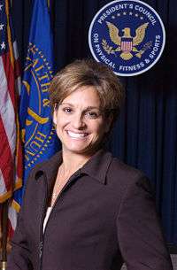
- Mary Lou Retton, gymnast, 1984 Olympic gold medalist, member of President's Council on Physical Fitness and Sports[24]
- Nick Saban, head coach of the University of Alabamafootball team.
- Robert Tinnell, screenwriter, director, producer, author of comic books and graphic novels
- Clarence Wayland Watson, founded several companies that became Consolidation Coal and Mining Companies, was U.S. Senator from West Virginia from 1911 to 1913
- Hershel W. Williams, awarded Medal of Honor for his outstanding heroism in Battle of Iwo Jima
See also
References
- 1 2 "US Gazetteer files 2010". United States Census Bureau. Archived from the original on 2012-01-24. Retrieved 2013-01-24.
- 1 2 "American FactFinder". United States Census Bureau. Retrieved 2013-01-24.
- 1 2 "Population and Housing Unit Estimates". Retrieved June 9, 2017.
- ↑ "US Board on Geographic Names". United States Geological Survey. 2007-10-25. Retrieved 2008-01-31.
- ↑ "Find a County". National Association of Counties. Archived from the original on 2011-05-31. Retrieved 2011-06-07.
- ↑ Burkett, Connie (2015). "Formation Timeline - Counties of Virginia". Marion County WVGenWeb. Retrieved 6 April 2016.
- ↑ West Virginia SHPO (November 29, 2001). "National Register of Historic Places Inventory-Nomination: Fleming-Watson Historic District" (PDF). National Park Service.
- ↑ Dilger, Robert (2003). "The Early History of North-Central West Virginia" (PDF). The West Virginia Public Affairs Reporter. Institute of Public Affairs. 20 (1): 15–26.
- ↑ Butcher, Bernard (1912). Genealogical and Personal History of the Upper Monongahela Valley, West Virginia. New York, NY: Clearfield Company. p. 514. ISBN 9780806348490.
- ↑ Burkett, Connie (2015). "Fairmont, Marion County WV (history)". Marion County WVGenWeb. Retrieved 6 April 2016.
- ↑ Kenny, Hamill (1945). West Virginia Place Names: Their Origin and Meaning, Including the Nomenclature of the Streams and Mountains. Piedmont, WV: The Place Name Press. p. 236.
- ↑ West Virginia Atlas & Gazetteer. Yarmouth, Me.: DeLorme. 1997. p. 25. ISBN 0-89933-246-3.
- ↑ "Climatography of the United States NO.81" (PDF). National Oceanic and Atmospheric Administration. Retrieved July 2, 2017.
- ↑ "National Weather Service Forecast Office Pittsburgh, PA". National Weather Service. Retrieved July 2, 2017.
- ↑ FAA Airport Master Record for 4G7 (Form 5010 PDF). Federal Aviation Administration. Effective May 31, 2012.
- ↑ United States Census Bureau. "Census of Population and Housing". Archived from the original on May 12, 2015. Retrieved August 27, 2013.
- ↑ "Population Estimates". United States Census Bureau. Archived from the original on May 22, 2015. Retrieved June 19, 2015.
- 1 2 "The City of Fairmont - City Council". Web.archive.org. Archived from the original on 2013-12-21. Retrieved 2017-06-30.
- ↑ "Fairmont, WV - Official Website | Official Website". Fairmontwv.gov. Retrieved 2017-06-30.
- ↑ National Park Service (2008-04-15). "National Register Information System". National Register of Historic Places. National Park Service.
- ↑ Images of America: Marion County by Thomas J. Koon
- ↑ "About IV&V | NASA". Nasa.gov. Retrieved 2017-06-30.
- ↑ "Former Philly Councilwoman Augusta Clark Dies at 81". WCAU. 2013-10-14. Retrieved 2013-11-23.
- ↑ "Archived copy". Archived from the original on 2010-05-15. Retrieved 2011-11-13.
External links
| Wikimedia Commons has media related to Fairmont, West Virginia. |
| Wikivoyage has a travel guide for Fairmont, West Virginia. |
- City of Fairmont website
- Fairmont Community Development Partnership
- Fairmont/Morgantown Housing Authority
- Pepperoni Roll History
- Marion County Historical Society
Municipalities and communities of Marion County, West Virginia, United States | ||
|---|---|---|
| Cities | 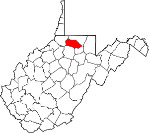 | |
| Towns | ||
| CDPs | ||
| Unincorporated communities |
| |
| Fictional places | ||
| Footnotes | ‡This populated place also has portions in an adjacent county or counties | |
